Back to cities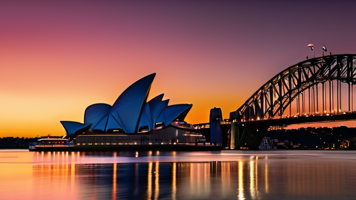
cities
Sydney Harbour National Park
Wikivoyage guide · 56 sections
▸Introduction373 chars
Sydney Harbour National Park is a national park scattered across Sydney Harbour, Australia. First gazetted in 1975, it's one of many national parks within metropolitan Sydney, renowned for its sheltered beaches, tranquil picnic spots, rich Aboriginal, colonial and military heritage, aquatic reserves and most importantly; harbour islands. Where history, meets the harbour.
▸Landforms140 chars
Sydney Harbour National Park is located on 12 different landforms. The name in brackets is the indigenous name, which you might come across:
▸History1,429 chars
Residential development has impacted a significant amount of the harbour foreshores over many years. Much of what remained was preserved partly due to the presence of military bases, and partly because of the work of conservationists. Early conservationists were responsible for stopping mining at Ashton Park in the 19th Century. Other places were saved because of people such as Niels Neilsen, who became the New South Wales Minister for Lands and a strong advocate of a public reserve around Sydney Harbour. Nielsen was ahead of his time when he used the phrase "national park" in regard to the harbour foreshores, but Sydney eventually caught up with him.
Unfortunately, it wasn't possible to revert all the damage done in past decades, however, there was still much that could be preserved. In the 1960s were a particularly active time in this regard. In 1965 the Government of New South Wales began buying land around the foreshores, and the National Trust suggested a national park in 1968. In the following year, the NSW Government announced a plan whereby it would buy Commonwealth land around the harbour. The Sydney Harbour National Park was finally gazetted in 1975, with Nielsen Park at Shark Bay being added in 1978. Extra land was transferred from Commonwealth to State Government control, and added to the national park in 1979; the historically important quarantine station at Manly; Q station was added in 1984.
▸Landscape383 chars
Most of the park is a coastal landscape with some hills, no higher than 30 m (98 ft) in altitude. At times, there may be moments where you might feel like "is this Sydney?" due to the large amount of greenery.
When it comes to the shore, there are some near perpendicular cliffs, and some in artistic shapes and forms; providing a perfect place to relax and read a book by the ocean.
▸Flora and fauna662 chars
Sydney Harbour National Park is one of the last homes of the endangered bandicoots. Most of these can only be found at North Head but they are occasionally spotted at other places too. Bandicoot spotting is at best around 8PM to 11PM at a stay in Q-station. Whale watching is popular during May-November, and it's pretty common to spot one if you're at the heads. Some unique types of plants that you might see is the Grass Tree, the blueberry ash, a flannel flower or a smooth barked apple. Additionally, along the North Head to Manly path, there are some information boards where you can have a look at each types of flora you see on the way. QR reader needed.
▸Climate577 chars
Most of the park's climate is very similar to the climate in Sydney. However, since the park is in multiple locations, the climate may vary, depending on where you are.
As a general rule, it's best to bring some warm clothes after Easter, and go summer camping after the Labour Day long weekend in early May. At max, during the warmer months, it can go up to 35˚C during the day, and 20˚C at night. During the colder months, it's usually around 20˚C during the day but sometimes after August, it can go up to 25˚C. At night, it's usually around 15˚C but can go to 10˚C in July.
▸Visitor information centres897 chars
Due to the sheer scale, there would ideally be one for each and every bit. However, at this stage, the only section with a visitor information centre in North Head, and unusually, it has two, not one.
1 North Head Sanctuary Visitor Centre (Sydney Harbour Federation Trust), ☏ +61 2 8969 2100. M-F 9AM-4PM, Sa Su 8:30AM-5PM. More about the North Head in general. (updated May 2021)
2 Q Station Visitor Centre, Hospital Rd, Manly (if you're not staying at Q station or coming outside, you'll need to do the following: First, follow the signs to Q station from Manly; then you'll have to park your vehicle and come to reception. Reception should call a shuttle bus for you and give you a ride down. However, you will have to walk back up though, or you may have a little bit of luck calling reception), ☏ +61 2 9466 1551. 10AM-8PM. Visitor Centre about North Head along with cafe. (updated May 2021)
▸Mainland2,855 chars
Ferries connect various most parts of the mainland sections from Circular Quay. Some sections may be a few hundred metres walk from the park, but what's the purpose of coming to a national park without walking? If you use public transport, the routes to the various sections are as follows:
Bradleys Head – from Circular Quay wharf 4, use the F2 Taronga ferry line to Taronga Zoo. From Taronga, walk on the road away from the cul-de-sac and then you're there at Bradleys Head.
Dobroyd Head – from Manly, use 162 to Curban Street, and then walk south towards Dobroyd Scenic Drive. This area has no ferry connection, so from Circular Quay, take the F1 line to Manly, and use bus route 162.
Georges and Middle Heads – the 111 bus service also provides services to the Balmoral Naval Hospital from the Mosman Town Centre, from there, it's a simple three-minute walk. To reach Mosman by ferry, use the F6 line from Circular Quay.
North Head – from Circular Quay, take the F1 Circular Quay to Manly ferry. From Manly wharf, the 161 bus route runs up to Q-Station, which is within the park. Services operate usually every 10-30 minutes.
South Head and Nielsen Park – take the F9 Circular Quay to Watsons Bay ferry. From Watsons Bay, it's a 20-minute walk to the furthest part of South Head. Head south along Marine Parade for Nielsen Park.
If you're driving to the various sections that do have road access, be wary that finding parking can be a problem at times, especially in the South Head/Nielsen Park section. The various headlands on the Lower North Shore and in Manly have a decent amount of parking available, though these can fill up very quickly.
Dobroyd Head – follow the signs to Balgowah, north of the Spit Bridge.
Georges Head – from the Spit Junction, head south on Military Road, not towards A8. Then, at the roundabout, turn left onto Middle Head Road. Keep following Middle Head, until you hit the end of the road. For Bradleys Head, follow the same route except at the roundabout, take the third exit onto Prince Albert St and continue until the end of the road.
Middle Head – from Mosman, go to the very end of Middle Head Road. There will be a carpark, and you should be good parking your car there. $8 parking fees apply.
Nielsen Park is half an hour away east from the CBD and can be reached by following the signs towards Vaucluse. From Bondi, simply head north on Military Road (unrelated to the Military Road in Mosman). Head north on Old South Head Road and follow signage. Follow the same road to access South Head, but continue north until the end of the road.
▸Clark Island234 chars
Situated near to Double Bay, and not serviced by scheduled ferries. You will need to reserve a place and pay a fee of approximately $7 per head to the National Parks and Wildlife Service. Additionally, you also can't moor a boat here.
▸Fort Denison/Muddawahnyuh104 chars
The ferry service to Fort Denison is suspended until early 2022 as the island is closed for maintenance.
▸Goat Island461 chars
Goat Island is the nearest island on the western side of the bridge. Goat Island was open to the public for significant periods in the past. However, this island has now closed to the public, however, ferries still occasionally run. The best way to explore the rich history of Goat Island is on a guided tour with NPWS or a well reputed tour guide and contact Sydney Harbour Tall Ships for a schedule. The Aboriginal cruise ship also takes you for a tour there.
▸Rodd Island284 chars
Situated in Iron Cove, just off Rodd Point. Not served by ferries. Access by water taxi or drop off. Island landing fee of $7. Must be booked and paid for in advance, and the island capacity is limited to 100, and single groups are limited to 50. You cannot moor a boat on the island.
▸Shark Island272 chars
Shark Island is served by a Captain Cook Cruises private ferry two times a day, with different timetables operating on weekdays and weekends/public holidays. The price of $20 per adult includes a round trip but does not include a $7 National Park landing fee (April 2026).
▸Fees and permits1,141 chars
Since this is not one connected park, it will vary across places, however, most of Sydney Harbour National Park is free to access, but in most cases, parking fees apply. So below is just a list of notes:
No entry fees on the mainland
Entry fees do apply on some islands.
On the mainland, parking fees do apply
Parking fees are usually restricted to that location. e.g, a parking ticket bought at North Head won't be valid on Bradleys Head, but can be valid in another part of North Head, until the time it expired. This means that you could leave and revisit, but it must be before it expires.
Here's a list of the parking fees:
Bradleys Head carpark: $8 per vehicle per day
North Head carpark: $5 per vehicle per day, no change given
Chowder Bay Road parking: Monday-Friday: $3 per hour, to a maximum of $16 per day. Saturday, Sunday and Public Holidays: $4 per hour, to a maximum of $20 per day.
If you have an NPWS pass, then you can park for free for four hours a day
Country Pass parks and single park passes aren't valid here.
Additionally, pets are prohibited in most parts, but Nielsen Park and Green Point Reserve is an exception.
▸By car225 chars
In some landforms such as North Head, taking the car is the best solution to getting around. For all other bits of the park, you for the most part cannot take your car in. Most places, however, will have a designated carpark.
▸By walking397 chars
Since this is not one connected park, you will need some other form of transport apart from walking to get from one section to another. However, below, shows how you can get from one place to another, and how to get around each section.
However, apart from North Head, the best form of transport within a section is by walking, as most of the time, there are no roads, or the roads are too narrow.
▸See597 chars
The national park protects the landforms of Bradleys Head, Clark Island, Dobroyd Head, Fort Denison, Georges Head, Goat Island, Middle Head, Nielsen Park, Rodd Island, Shark Island, Sydney Heads including the Quarantine Station at North Head and The Gap bluff at South Head. The national park also protects the waterway between North Head and Dobroyd Head, defined as the North Sydney Harbour Aquatic Reserve. However, Goat Island is not closed and is no longer accessible to visitors. Most of these places that are protected were home to some forts that were put in World War II as defence forts.
▸Bradleys Head, Mosman2,179 chars
1 Ashton Park. Small reserve and a hidden gem that gives you the rural coastal city feeling. Be aware that this is one of the most chaotic NYE spots, so if you're here to watch the NYE fireworks, then arrive at about noon. (updated Jun 2021)
2 Booraghee Amphitheatre. 24/7. Picnic area for couples on their honeymoon. Just beside it, it's become a popular spot for rockfishing. Additionally, photographers and Sydney Harbour lovers flock to this spot, just so they can get the perfect shot of the Harbour Bridge, Opera House, and Fort Denison. Oh, and the inside of the Amphitheatre has been used for weddings and other events. (updated May 2021)
3 Bradleys Head Fortification Complex (Bradleys Head Forts). A heritage-listed former mast and defensive battery and military fortification and now war memorial and recreational area. The 1840 fort was cut into the sandstone bedrock outcrop on the tip of the headland and included a barbette gun pit at the eastern end and the small circular bastion at the eastern end of the fort is from 1854. (updated Jun 2021)
4 Bradleys Head Lighthouse (Bradleys Head Light), ☏ +61 2 9960 6266. 24/7. An active heritage-listed lighthouse which was introduced in 1905 as a navigation marker and warning light to ships entering and leaving the harbour. A fog siren was added in 1906, modified in 1936 and the concrete structure was introduced in 1949 and was listed on the New South Wales State Heritage Register on 18 April 2000. (updated May 2021)
5 HMAS Sydney I Memorial Mast. 24/7. Memorial that can be seen from the Lighthouse, blended with the background. It sometimes may be considered as part of Bradleys Head Fortification complex, but is its own place in its own right. Free. (updated May 2021)
6 Rifle Wall, Bradleys Head Rd, Mosman. 6AM-8PM. A convict built battery built after four American ships landed in Australia undetected. Today, the mast of HMAS Sydney towers over the parapet is a striking monument to the World War I warship.Defence ditches were added in the late 19th century after British troops left Sydney and remnants of earlier fortifications are other features of this unique harbourside location. (updated May 2021)
▸Clark Island723 chars
An entry fee applies to Clark Island, of $7. Make sure to bring some coins with you.
7 Clark Island Pier. The only way you could access the island. A pretty historic pier, and has historically been the only way to access the island. (updated Jun 2021)
8 Clark Island Reserve. The former location of Lieutenant Clark's failed garden; the food was often nicked by convicts. (updated Jun 2021)
9 Peak of Clark Island. You'd be thinking, what is there to see on the peak of such a tiny failed island. Look west and you could see an elevated view of the Barbour bridge and the Opera House, with your view uninterrupted by ferries and yachts. You might see cruise ships, but they won't block your view either. (updated Jun 2021)
▸Dobroyd Head, Balgowlah Heights2,428 chars
10 Arabanoo Lookout, Dobroyd Scenic Dr, Balgowlah Heights. 24/7. The lookout here is named and in memory of Arabanoo, the first Aboriginal person to live with European settlers. The spot is now popular for whale and boat watching and is an important site to Indigenous Australians. Free. (updated Jun 2021)
11 Castle Rock Beach. 24/7. A quiet place to relax, and is stop 7 on the Spit to Manly walk. There are some rocky edges towards the sides of the beaches, so if you are swimming, stay within the centre, incase a wave comes pushing you towards the rocks, something which is not uncommon. Free. (updated Jun 2021)
12 Cutler Road Lookout, 6 Cutler Rd, Clontarf. 24/7. A good place to view the harbour, day or night and also view the cliffs of Dobroyd Head. (updated May 2021)
13 Fairlight Lookout. A lookout which looks 1/2 rural and 1/2 urban. The lookout is also not fenced, and you'll know it's Fairlight lookout when going down, and just as the path turns right, you've arrived at Fairlight lookout. (updated Jun 2021)
14 Forty Baskets Beach, North Harbour Walk, Balgowlah. A 100-metre secluded beach with harbour views, and lots of small rock pools. About forty. Unfortunately the rock pools don't make the beach a suitable spot for swimming. (updated Jun 2021)
15 Grotto Point Aboriginal engraving site, Barrabooka St, Clontarf. Rock arts include humans, marine, boomerangs and land animals and can be seen up close. (updated May 2021)
16 Grotto Point Lighthouse (Port Jackson Entrance Range Front Light), Lighthouse Track, North Harbour, ☏ +61 2 9960 6266. 24/7. Lighthouse with stunning harbour views and popular NYE spot. It was first lit on September 1, 1911 and is one of four such lighthouses designed by architect Maurice Festu in a style now sometimes referred to as a "Disney Castle". (updated May 2021)
17 Reef Beach. A beach that looks somewhat like a reef. Don't swim here though, since the waves come crashing, and there are so many rocks here, a lot more than your regular beach. But that doesn't mean that it's not enjoyable – there's still the shallow tropical waters, and of course, Sunbathing; a Sydney classic. (updated Jun 2021)
18 Old Tania Park Lookout, Dobroyd Scenic Dr, Balgowlah Heights. 24/7. Another lookout that has a different perspective 24/7. Free. (updated May 2021)
19 Washaway Beach. Famous short getaway beach, for those who do not want to be surrounded by houses. (updated Jun 2021)
▸Fort Denison/Muddawahnyuh1,656 chars
A popular island on the harbour. You can't miss seeing it, as it's right in front of the Opera House.
The island was used as a convict prison during the early days of Sydney's settlement. The island was then known as Pinchgut Island. In 1857 the entire area became a large fort, built to defend Sydney against Russian attack.
If you want to take a tour of the island and visit the tower, you need to purchase a ticket which includes the ferry transport 24 hours in advance from the Sydney Visitors Centre at Cadmans Cottage in The Rocks. The National Parks and Wildlife Service run a half-hour guided tour for $27/$17 and $72 for a 4 person family. That includes the ferry trip to the island. Standby tickets are available for the tours from the cafe on the island for $10, but these are subject to availability.
There is a rather upmarket cafe on the island. There is a morning brunch for $47 adults and $43 children (which includes the tour). Lunch is also available.
20 Fort Denison (Muddawahnyuh). 9AM-5PM. Once a defence facility, then under attack from US friendly fire in World War II, now a popular tourist spot in the iconic Sydney Harbour. If you want to take a tour of the island and visit the tower, you need to purchase a ticket which includes the ferry transport 24 hours in advance from the Sydney Visitors Centre at Cadmans Cottage in The Rocks. The National Parks and Wildlife Service run a half-hour guided tour for $27/$17 and $72 for a 4 person family. That includes the ferry trip to the island. Standby tickets are available for the tours from the cafe on the island for $10, but these are subject to availability. (updated May 2021)
▸Georges Head, Mosman1,033 chars
21 3-inch anti-aircraft gun. A commonly used gun during World Wars I and II. Now just a tourist spot. (updated Jun 2021)
22 Georges Head Battery (Georges Head Military Fortifications), Chowder Bay Rd, Mosman (Parking available in Chowder Bay). 24/7. The site consists of the original battery and barracks, designed by Colonial Architect James Barnet, located at the end of Suakin Drive, Georges Heights, two later batteries located adjacent to the corner of Middle Head Rd and Best Ave, Georges Heights, and the Beehive (or Lower) Casemate adjacent to the Armoured (or Upper) Casemate in Chowder Bay Rd. The Georges Head Battery is one of three forts in the area that were built for the purpose of defending the outer harbour. (updated May 2021)
23 Beehive Casemates (Armoured Casemates), Chowder Bay Rd, Mosman. (updated Jun 2021)
24 Gunners Barracks (Former Officers Barracks), End of, Suakin Dr, Mosman, ☏ +61 2 8962 5900. 10AM-5PM. Former Officers barracks, which is now a restaurant, with a harbourside view. (updated Jun 2021)
▸Goat Island414 chars
Goat Island was the home to the first water police station and harbour fire brigade. Following this, the island served as a shipyard. In more recent years it has been a location for filming.
25 Old Goat Island Fire Brigade. Sydney's first water fire brigade, which is now a historic building. (updated Jun 2021)
26 Old Goat Island Shipyard. An old shipyard, now renovated into a historic site. (updated Jun 2021)
▸Middle Head/Gubbuh Gubbuh, Mosman1,539 chars
27 Abandoned Lookout. A lookout that is literally ... abandoned. Getting here will require you to go slightly off path, but it doesn't require any pioneering skills. It does require you to go under some narrow trees, but mostly this occurs after storms. (updated Jun 2021)
28 Cobblers Beach (Cabblers Beach). A quiet small, skinny beach that has been more popular for nude swimming and sunbathing in the 21st century. (updated Jun 2021)
29 Inner Head Middle Battery, Middle Head Rd, Mosman, ☏ +61 2 8969 2100. The oldest fortification in Middle Head, which marked the beginning of defence moving away from the core of Sydney Harbour and more towards the headlands closer to the Tasman Sea. (updated Jun 2021)
30 Middle Head Community Garden, 4 Govenors Rd, Mosman. Community garden to encourage healthy eating. (updated Jun 2021)
31 Obelisk Beach. Tiny, small hidden cove bordered by rocks, trees & vegetation, popular for nude swimming & nude sunbathing, although unlike Little Congwong beach in La Perouse where almost everyone is nude, there are chances here that there are people who aren't nude. (updated Jun 2021)
32 Outer Middle Head Forts, Old Fort Rd, Mosman. 6AM-8PM. The outer fort out of the three Middle Head forts in Middle Head. (updated May 2021)
33 Soldiers' Institute, 4 Govenors Rd, Mosman. 6AM-8PM. Former Soldiers' Institute during World War II. (updated Jun 2021)
34 Tiger Cages, Old Fort Rd, Mosman (at the eastern end of Old Fort Road). 6AM–8PM. There are about eight lined-up model canons. Free. (updated May 2021)
▸Nielsen Park, Vaucluse2,105 chars
Aboriginal rock engravings can be seen at 35 Milk Beach, displaying a fish and at Bottle and glass point, which has some charcoal drawings of fish.
36 Bottle and Glass Point, Bottle and Glass Rd, Vaucluse. 24/7. A small spit on Nielsen Park with nice ocean waves, walking trails and picnic spots. It's also one of the most popular spots in Sydney for rockfishing. Also, remember to wear a lifejacket, as many have been caught for not wearing one here. Free. (updated May 2021)
37 Greycliffe House (Greycliffe Gardens), 6 Steele Point Rd, Vaucluse, ☏ +61 2 9337 5511. A historic building by the harbour. While now it may be used as an event centre, tourists come here, often to see the outside. (updated Jun 2021)
38 Hermit Beach (Lawrence Pogue Beach). A smaller beach than most might expect. (updated Jun 2021)
39 Queens Beach. Another beach, where you could take photos just like the postcards. (updated Jun 2021)
40 Shark Beach, Promenade Rd, Vaucluse. 24/7. Known for a couple of shark attacks nearby? Nope, that's Shark Island. The name Shark Beach comes from the name of Shark Bay, known for a lot of sharks. However, Shark Beach is safe from sharks, however, it's best to not go too far out, swim or kayak. During the summer months, a net is put around the beach, so sharks do not come in the swimming area. (updated Jun 2021)
41 Steel Point Battery. Only a three-gun battery remains. The passageways, tunnels, magazine store and barrack room are now partially buried. The stone lintel cover of the entry to the rear emplacement was smashed and the tunnel filled with debris, allowing water to seep in causing damage to the interior. The stonework of the lower emplacements and connecting passages are in good condition and there is still one gun emplacement located above ground. (updated Jun 2021)
42 Strictland House. It was a women’s convalescent home in the early 20th century and later an aged care. Now, people watch an unforgettable sunset by the sea here. (updated Jun 2021)
43 Whale Rock, Vaucluse Rd, Vaucluse. 24/7. A rock that looks very much like a whale ;). Free. (updated May 2021)
▸North Head, Manly3,319 chars
44 The Barracks Precinct, 33 North Head Scenic Dr, Manly (When going along Darley Rd, go under the fort. Then, bear left, and then follow signage.). A historic Australian Army site, with well preserved barracks and artillery with views of Sydney Harbour. Additionally, tours of underground tunnels are available on weekends. (updated May 2021)
45 Barrel Display, North Head to Manly Trail, Manly. 7AM-6PM (same as North Fort). A 9.2-in gun barrel display. Nothing too special about it, but it is worth a quick look. (updated Jun 2021)
46 Collins Beach, Colin's Flat Track, Manly. Small beach, which has a small waterfall off a rock when rainy. The water here is unusually shallow as well, and looks more a tropical paradise rather than metropolitan Sydney. Not too hard to get to, but parking can become a problem. (updated Jun 2021)
47 Former Guest House (Former First Class Precinct or P6), Main Axinal Rd, Manly (Use the Q-station shuttle bus). 24/7. A free display of all the antiques and items that were used during quarantine, including an old stove. (updated May 2021)
48 Gun Position (Gun Position - Historical Site), Bluefish Dr, Manly. 24/7. Features a historic World War II site that was put in place to prevent a Japanese invasion. However, it was never used and now it is a tourist spot. (updated May 2021)
49 Harbour Lookout, North Head to Manly Trail, Manly. A harbour facing lookout, facing the Sydney skyline, including the harbour bridge, the Sydney Opera House, and the Sydney Eye. You might see some of the harbour islands although they may be obstructed by the trees. (updated Jun 2021)
50 North Head Quarantine Station Hospital, Hospital Rd, Q station, Manly. Free. A former hospital used to treat the infected when the quarantine station was in use. The hospital displays some of the early 19- and 20th-century medical tools. (updated Jun 2021)
51 Northern Lookout. A lookout overlooking the ocean, but also overlooking the flora and fauna nearby. (updated Jun 2021)
52 North Fort, N Head Scenic Dr, Manly. 7AM-6PM. Another one of Sydney Harbour's many small forts, built to prevent a WWII attack from the Japanese. You'll also have some impressive harbour views from the hill. (updated Jul 2021)
53 Quarantine Beach, Q-station, Manly. 24/7. This is a swimming spot in Sydney Harbour. It is a fairly average beach, but has an interesting westerly outlook which allows you see the sun setting over the bay, which is very unusual in Sydney, where looking over the water usually means you are facing east. (updated May 2021)
▸Fairfax Track855 chars
The following are the lookouts along the way along Fairfax Track. These can only be accessed via the Fairfax Track, which is a 700-m loop. While the Fairfax Track may be a nice track to see, make sure if you're travelling with young children, make sure they do not pick things off the ground. There are unexploded ordinance on the ground, and it is a federal offense to even move them.
58 Fairfax Lookout, Fairfax Walking Track, Manly, ☏ +61 2 9960 6266. 24/7. Has views of the Pacific, South Head and most importantly, Sydney Harbour. (updated Jun 2021)
59 North Head Artillery Lookout, Fairfax Track, Manly, toll-free: 1300 072 757Country code missing. 24/7. While close to Fairfax Lookout, this lookout provides completely different views. This one shows views of the former barracks, and ocean, as this is an east-facing lookout. (updated Jun 2021)
▸Rodd Island491 chars
This is the westernmost island of Sydney Harbour National Park. While there's not much to see, 60 ferry watching. (updated Jun 2021) has become more increasingly popular in the past decade.
However, Rodd Island is not served by ferries. Access is only by water taxi or drop off. There is an island landing fee of $7 and must be booked and paid for in advance, as the island capacity is limited to 100, and single groups are limited to 50. Additionally, you cannot moor a boat on the island.
▸Shark Island689 chars
While getting here is hard and there is not much to see in this island, going next to the wharf will give you a view of the entire CBD, featuring 80% of the highlights of Sydney. There's also the 61 Old Shark Island Ferry Wharf (Shark Island Light) which is mostly underwater now. However, the not-underwater sections still give you a good view of the eastern suburbs - often some of the world's most expensive houses, just after some in New York City. There's also a popular shed here as well, most renowned for giving you a view of the harbour.
However, Shark Island is also not served by ferries. Access is only by water taxi or drop off.
62 Boowambillee is the main hub on the island.
▸South Head, Watsons Bay1,848 chars
63 Aboriginal Rock engravings (On the south side of Signal Hill Fortifications on the sea cliff at its highest point). An Aboriginal rock carving of a fish. (updated Jun 2021)
64 Don Ritchie grove. A park and reserve with a couple of cool sculptures and a memorial in memory of Don Ritchie. (updated Jun 2021)
65 Gap Bluff Centre, Gap Bluff Rd, Watsons Bay. A centre about the Gap Bluff run by the NSWNPWS. (updated May 2021)
66 Gap Bluff Lookout, 27 Military Rd, Watsons Bay. 24/7. A lookout to see the unique and picturesque Gap Bluff Cliffs. Free. (updated Jun 2021)
67 Hornby Battery, Watsons Bay. 24/7. Another one of those batteries. Free. (updated Jun 2021)
68 The Hornby Keepers Cottage, South Head Heritage Track, Watsons Bay. Where the lighthouse keepers used to stay. (updated Jun 2021)
69 Hornby Lighthouse, South Head Heritage Track, Watsons Bay. 24/7. A former lighthouse that was used for oncoming entering ships entering Sydney Harbour at night. Free. (updated Jun 2021)
70 Lady Bay Beach (Lady Jane Beach). 24/7. Another north westerly and easterly facing beaches, which are unusual to see in Sydney. Popular for seeing ships - mainly cruises at sunset. Both sides are popular for nude swimming and nude sunbathing. Free. (updated Jun 2021)
71 Officers' Mess. (updated Jun 2021)
72 Signal Hill Battery. Signal Hill Battery was one of a set of three coastal defence fortifications and were the last link in Sydney's outer defence perimeter, which was intended to defend Sydney from bombardment by an enemy vessel standing off the coast. (updated Jun 2021)
73 South Head Signal Station, 21 Old South Head Rd, Vaucluse. Signal station on South Head. (updated Jun 2021)
74 South Head tunnels tour. A 1.8-km guided tour, which shows a world beneath full of sandstone. Adult $25 per person. Concession $20 per person. (updated Jun 2021)
▸Do152 chars
There's plenty of things to do in Sydney Harbour National Park, for most interests, whether it's hiking, swimming, or learning about Aboriginal culture.
▸Bradleys Head, Mosman511 chars
1 Bradleys Head Fishing Spot. It has been a popular spot for fishing, even in the 20th century. While there are no signs saying the location, face east, and there you are. But most of the time, there's always people there. (updated Jun 2021)
2 Bradleys Head to Chowder Bay walk (Taylors Bay Track). A short but nice coastal harbour walk, from Bradleys Head to Chowder Bay. It's the only walk to connect two sections of the park together. It's 4 km one way, and is an NPWS Grade 3 track. Free. (updated Jun 2021)
▸Clark Island285 chars
While there may not be anything to see in Clark Island, hiking to the top provides magnificent and resplendent views of the harbour. There are multiple trails and walking paths in Clark Island, and you have the choice of whether to go the easy slow not-so-steep path or the steep path.
▸Dobroyd Head378 chars
3 Lighthouse Track. 24/7. The track used to get to Grotto Point Lighthouse. The difficulty is slightly harder than the other tracks, but is still very easy. Free. (updated Jun 2021)
4 Washaway Beach Track. A side track off Lighthouse track to get to Washaway Beach. (updated Jun 2021)
5 Dobroyd Head track. Small walking trail generally suitable for all ages. (updated Jun 2021)
▸Green Point Reserve67 chars
6 Green Point Walking trail. A 100-m loop trail. (updated May 2021)
▸Nielson Park, Vaucluse237 chars
7 Hermitage Foreshore Walk. 24/7. Coastal 500-m walk, usually with a picturesque view at any time of the day. Free. (updated May 2021)
8 Mount Trefle Track. Short walking track from Shark Beach to Vaucluse town centre. (updated Jun 2021)
▸North Head, Manly1,025 chars
9 Cycling, Just outside the Q-station reception. Bike hire is available just outside the Q-station reception. Also, it is a self-served one, meaning that if an error occurs, usually the Q-station staff will be able to help. $1.95/h. (updated Jun 2021)
Ghost tours @ Q station. A tour, experiencing one of Sydney's most haunted areas. Believer or not, still a worthy tour, known by almost any worthy Sydneysider. Unlike most ghost tours, this one has no age limit. (updated Jun 2021)
10 Fairfax Track (Fairfax Walking track). 24/7 - temporarily closed. A short 700-m loop trail, which gives picturesque views of the Harbour, the ocean and the former battery. Suitable for most ages, however, if you're going with young children, make sure they do not pick up things on the ground. These may be UXO's and it is a federal civil offense to even move them, and the penalties are hefty. Free. (updated Jun 2021)
11 North Head to Manly Trail. 24/7. A bike path, but there's more people who walk this track. Free. (updated Jun 2021)
▸Shark Island154 chars
Walk the outer loop of the island, and have a picnic on the barbie. Oh, and you may occasionally see a shark while on the barbie. Won't attack you though.
▸South Head, Watsons Bay452 chars
12 South Head Heritage Trail, Watsons Bay. 5AM-10PM. A 470-m loop track which gives you a lot to see, including Lighthouses and Cottages that were used by the former lightkeepers and some old batteries, used in World War II. Free. (updated May 2021)
13 Gap Bluff Walking Trail. 24/7. A small short-loop trail which is used to see the Gap Bluff Cliffs. There is a small bit where it goes very close to the cliffs, and the ocean. Free. (updated Jun 2021)
▸Other things to do360 chars
Aboriginal cultural cruise in Sydney Harbour, ☏ +61 2 9699 3491. A tour about how significant the harbour was to Indigenous Australians, and getting to know a bit about the local language that was spoken here. (updated Jun 2021)
Sydney Princess Cruises. (Oz whale watching tours). A whale watching tour in Sydney Harbour. May-November only. (updated Jun 2021)
▸Buy284 chars
There aren't many souvenir shops here, however, souvenirs can be bought at Q-station's reception at Q-station. You could also get a souvenir at some places like Strickland House or Grotto Lighthouse, the real beauty of the park lies within its history with the harbour, not buildings.
▸Bradleys Heads, Clontarf, Georges Head and Middle Head, Mosman1,071 chars
These are all the restaurants and cafés within the boundaries of the park, or the only way out is through the park.
1 Drift Café, Chowder Bay Rd, Mosman, ☏ +61 2 9960 4566. 7AM-4PM. A large cafe with different types of Aussie food specialised in French cuisine. (updated Jun 2021)
2 Gunners Barracks (Former Officers Barracks), End of Suakin Dr, Mosman, ☏ +61 2 8962 5900. 10AM-5PM. Former Officers barracks, which is now a restaurant, with a harbourside view. (updated Jun 2021)
3 L'Héritage, 7b Chowder Bay Rd, Mosman, ☏ +61 2 9968 1658. W-Su 10AM-10PM. An authentic French restaurant, although it now has a wide variety of Australian cuisine too. (updated Jun 2021)
4 Middle Head Cafe, 1110 Middle Head Rd, Mosman, ☏ +61 2 9960 1239. Not a particularly fancy or stylish cafe, but it is definitely a cafe for those who don't like the crowded cafes. But foodwise, there's no saying no here. (updated Jun 2021)
5 Ripples Chowder Bay, Building 7 C, Chowder Bay Rd, Mosman, ☏ +61 2 9960 3000. Modern Aussie cuisine with harbour view and water views. (updated Jun 2021)
▸Fort Denison/Muddawahnyuh197 chars
This restaurant/cafe is closed until the entire Fort Denison reopens in early 2022.
6 Fort Denison Cafe and Restaurant. Historic old style restaurant with modern Aussie cuisine. (updated Jun 2021)
▸Manly-North Head705 chars
In the park
7 Bella Vista Cafe, 203/33 North Head Scenic Dr, Manly, ☏ +61 2 8966 9779. M-F 9AM-4PM, Sa Su 8AM-5PM. Cafe with harbour view. (updated May 2021)
8 Boilerhouse Kitchen and Bar (Views Restaurant), Sydney Harbour National Park, in Q station, Manly. A popular spot if you're a meatlover. (updated May 2021)
9 Views Restaurant. M-F 7-10AM, Sa-Su 7-11AM. Mainly to have brekkie. (updated Jun 2021)
Slightly outside the park
These are places to eat, and are just within 1-km proximity of the park. Most visitors often go to the Manly town centre, as there's a lot more variety in Manly, and getting there is easier rather than taking the bus to the Q-station restaurants. See Sydney/Manly for more.
▸Nielsen Park-Vaucluse144 chars
10 The Nielsen, Greycliffe Ave, Vaucluse, ☏ +61 2 9337 7333. 8AM-3PM. Seaside restaurant with different varieties of seafood. (updated Jun 2021)
▸South Head-Watsons Bay180 chars
11 Camp Cove Kiosk, S Head Heritage Trail, Watsons Bay. M-Sa 7:30AM-7PM, Su 7AM-7PM. Small cafe, perfect on both a hot summers day as well as a cold winters day. (updated Jun 2021)
▸Drink132 chars
Most of these places do not provide alcohol or wine. In some places, they are even prohibited, and you could be checked at any time.
▸Middle Head297 chars
1 Middle Head Officers' Quarters, 3 Governors Rd, Mosman, toll-free: 1300 072 757Country code missing. Check-in: 2PM. Has carpark, drinking water, showers, toilets, electric power. This cottage can sometimes be called its own world at times, due to the amount of greenery here. (updated Jun 2021)
▸Nielsen Park385 chars
2 Gardeners Cottage, Nielsen Park, Fig Tree Rd, Vaucluse, ☏ +61 2 9337 5511, toll-free: 1300 072 757Country code missing. (updated Jun 2021)
3 Steele Point Cottage, Steele Point Rd, Vaucluse, ☏ +61 2 9337 2333, toll-free: 1300 072 757Country code missing. Small historic harbour side cottage in one of Sydney's most expensive suburbs; Vaucluse. $390 for 2 nights. (updated May 2021)
▸North Head443 chars
4 Q-station, 1 N Head Scenic Dr, Manly, ☏ +61 2 9466 1500. A former Quarantine Station used to quarantine people from ships if they had any illness. Now a motel. A side tip, you will need to pay $40 more if you want an attached bathroom, as there weren't attached bathrooms back in the day. Additionally, usually you'd get to go straight to your motel, however at Q-station, a bus will take you to your room, free of charge. (updated Jun 2021)
▸South Head90 chars
5 Constables Cottage, ☏ +61 2 9337 2333. A small cottage on South Head. (updated Jun 2021)
▸Camping255 chars
While camping is usually the only form of accommodation in most national park, there are no campgrounds in Sydney Harbour National Park as most of the area is unsuitable for camping. Additionally, camping is prohibited in some areas to protect bandicoots.
▸Backcountry315 chars
While there are great views here, backcountry stays aren't a thing here, for a couple of reasons. The first one is the fact that most of this national park had only existed to protect the remains of the small reserves, but keep in mind you're still in the middle of Sydney, not in an exurb like Royal National Park.
▸Stay safe426 chars
Watch out for the small Sydney funnel web spider. They are known to have lethal bites.
Carry some water with you at all times regardless of the season.
Some locations can get chaotic on New Year's Eve. Unless you've deliberately come on NYE for the fireworks, and your experience may not be so great due to the heavy crowds.
Artillery Drive is heavily protected, and only wastewater management staff and residents are allowed.
▸Respect433 chars
The maximum limit inside the park is 40 km/h (25 mph). Avoid speeding, as the low limit is meant to protect the endangered bandicoots.
Don't damage Aboriginal rock engravings - it's disrespectful and disgraceful. And thus, this can result in a $60,000 fine.
Watch out for endangered bandicoots at night. Do not flash lights at them. If you're taking a photo, make sure your phone's flash is off. Otherwise, don't even think about it.
▸Go next272 chars
Cockatoo Island is only a mere few kilometres away and can be accessed by the F8 Cockatoo Island Ferry line or the F3 Parramatta River line.
Barangaroo may not be park of the National Park but it still has lots of greenery, and also is home to a famous Chinese Garden.
Facts
Rank
—
Coordinates
—
Source
WBP almanac
External sources
Media