
Isle Royale National Park is a national park of the United States consisting of Isle Royale, along with more than 400 small adjacent islands and the surrounding waters of Lake Superior, in Michigan.
Isle Royale is 45 mi (72 km) long and 9 mi (14 km) wide, with an area of 206.73 sq mi (535.4 km2), making it the fifth-largest lake island in the world. In addition, it is the largest natural island in Lake Superior, the second-largest island in the Great Lakes (after Manitoulin Island), the third-largest in the contiguous United States (after Long Island and Padre Island), and the 33rd-largest island in the United States.
Isle Royale National Park was established on April 3, 1940. It later received additional protections from development by a wilderness area designation in 1976, a UNESCO International Biosphere Reserve declaration in 1980, and was added to the National Register of Historic Places in 2019 as the Minong Traditional Cultural Property. The park covers 894 sq mi (2,320 km2), with 209 sq mi (540 km2) of land and 685 sq mi (1,770 km2) of surrounding waters.
The park's northern boundary lies adjacent to the Canadian Lake Superior National Marine Conservation Area along the international border. With 25,894 visits in 2021, it is the seventh least-visited National Park in the United States.
Isle Royale National Park is a national park comprising Isle Royale and the surrounding waters and small islands, a wilderness preserve in northwest Lake Superior. It's easily identified on maps of the Great Lakes: Lake Superior resembles the profile of a snarling wolf; Isle Royale is the eye. Although it's closer to Ontario, Canada, or even Minnesota, USA, it's part of the state of Michigan. Its French name might lead you to pronounce it "eel roy-AL", but the common pronunciation is the anglicized version, "ile ROY-ul".
Isle Royale is a wilderness preserve first, a sanctuary for those seeking to experience it second, and a travel destination third. Although it accommodates all of these uses, that's the order of priority they take. So wildlife gets the run of the island, and human visitors are generally restricted to established trails and accessible lakes, with leave-no-trace camping protocols in effect. Modern conveniences and comforts are very limited; away from the small ports on either end of the island, "running water" means "a creek", and only "outhouse" pit toilets are available. (Many of the more accessible ones are stocked with toilet paper, but bring your own or be prepared to improvise.)
Lake Superior winters close the park from November through mid-April, with limited access before Memorial Day and after Labor Day; Isle Royale is the only U.S. National Park to shut down altogether for the winter. Because of this, along with its geographic isolation and challenging ruggedness, it receives fewer visitors in a year (17,500 in 2005) than many national parks endure in a day. Those visitors stay a remarkable average of 4-5 days each (even counting day-trippers), but it still has one of the lowest visitors-per-square-mile figures outside of the huge Alaskan parks. Which is, of course, a large part of its appeal. And it leaves these visitors wanting more, with the NPS's highest return-visit rate.

National park on Isle Royale, Michigan, US Isle Royale National ParkIUCN category Ib (wilderness area)Site of the historic Edisen FisheryLocation in Lake Superior in MichiganShow map of MichiganLocation in the United StatesShow map of the United StatesInteractive map of Isle Royale National ParkLocationKeweenaw County, Michigan, United StatesNearest cityThunder Bay, OntarioCoordinates48°01′N 88°51′W / 48.01°N 88.85°W / 48.01; -88.85Area571,790 acres (2,314.0 km2)EstablishedApril 3, 1940; 86 years ago (1940-04-03)Visitors28,965 (in 2023)Governing bodyNational Park ServiceWebsitenps.gov/isro United States historic placeMinongU.S. National Register of Historic PlacesU.S. Historic district Siskiwit BayArea189,665 acres (76,755 ha) [133,788 acres (54,142 ha) land and 55,877 acres (22,613 ha) water]NRHP reference No.100003341Added to NRHPJanuary 24, 2019 Isle Royale National Park is a national park of the United States consisting of Isle Royale, along with more than 400 small adjacent islands and the surrounding waters of Lake Superior, in Michigan. Isle Royale is 45 mi (72 km) long and 9 mi (14 km) wide, with an area of 206.73 sq mi (535.4 km2), making it the fifth-largest lake island in the world. In addition, it is the largest natural island in Lake Superior, the second-largest island in the Great Lakes (after Manitoulin Island), the third-largest in the contiguous United States (after Long Island and Padre Island), and the 33rd-largest island in the United States. Isle Royale National Park was established on April 3, 1940. It later received additional protections from development by a wilderness area designation in 1976, a UNESCO International Biosphere Reserve declaration in 1980, and was added to the National Register of Historic Places in 2019 as the Minong Traditional Cultural Property. The park covers 894 sq mi (2,320 km2), with 209 sq mi (540 km2) of land and 685 sq mi (1,770 km2) of surrounding waters. The park's northern boundary lies adjacent to the Canadian Lake Superior National Marine Conservation Area along the international border. With 25,894 visits in 2021, it is the seventh least-visited National Park in the United States.
Over four millennia ago, Native Americans began visiting Isle Royale to dig for copper, to tap maple trees for sugar, and to fish. Since Europeans came to the area, it's been host to whitefish fisheries, a series of unprofitable copper mining efforts, and a resort community around 1900. In the 1920s, Detroit News journalist Albert Stoll Jr. visited Isle Royale, saw what commercial exploitation was beginning to do to undermine the wilderness, and campaigned for its protection; a plaque in his honor was later placed near the tip of Scoville Point. Isle Royale National Park was established by Congress in 1931, and the last of the land de-privatized in 1940 (with a few of the land owners given lifetime leases). The archipelago was designated a Wilderness Area in 1976, and named an International Biosphere Reserve in 1980.
The archipelago (consisting of Isle Royale itself and dozens of smaller islands) is the edge of a geologic fault which pushed up from the lake floor and was scoured by ice-age glaciers into a long, ridged island, with lakes and inlets of Lake Superior filling in low points between some of the ridges. The south sides of these ridges and the south lakeshore tend to be more gently sloped; the north sides and lakeshore more steep. Crossing from one side of the island to the other isn't usually a great distance, but because of the ridges can involve a lot of climbing and descending.
The island and its ridges run roughly WSW-to-ENE end to end, but for informal navigational purposes they're usually described as if they ran directly west-to-east (a notion reinforced by the orientation of the park service's official map). When using a compass, keep in mind the island's true orientation. The Greenstone Ridge runs the length of the island, with a trail along most of its crest. Isle Royale itself is 45 miles (74 km) long and 9 miles (14 km) at its widest, with an area of about 205 mi² (530 km²). The highest point on the island is Mount Desor at 1394 feet (425 m) above sea level – about 800 feet (245 m) above lake level – with several other spots along the Greenstone above 1200 feet (365 m) in elevation.
The island is mostly forested in a mixture of boreal and northern hardwood ecosystems, with a selection of conifer (spruce, fir, pine) and deciduous (birch, aspen, maple, ash) trees. Past human habitation has left some apple trees behind. Marsh vegetation is more common in the west, but found in low spots everywhere. A wide variety of orchids and wildflowers can be found throughout the island. Berries grow wild; blueberries can be found on open ridge tops, and thimbleberries (with maple-like leaves bigger than your hand; white flowers in early summer, red berries in late summer) grow seemingly everywhere.
The island is far enough from the mainland and small enough in area to limit the variety of animals on it; there are no bears, deer, raccoons, nor cats of any kind. Around 1900, moose introduced themselves to the island, presumably swimming from Ontario. Wolves followed later, crossing increasingly rare safe ice bridges in 1948 and 1967. As a closed environment, the island serves as a prime field study of the relationship between prey and predator. Because the wolf population is descended from two small packs, the island also demonstrates the effects of inbreeding on their viability. Both populations have gone through booms and busts due to weather, disease, food availability, and predation (the past several summers' heat has brought the February 2007 moose population way down to 385, with 21 wolves trying to subsist on the survivors), but they still endure.
Other common mammals are red foxes (filling the scavenger niche, especially around camp sites), beavers (in inland lakes and ponds), red squirrels (everywhere), snowshoe hares, and otters. Loons, eagles, and ospreys nest on the island, and a large variety of songbirds, woodpeckers, and aquatic birds (especially gulls and ducks) will be seen. Painted turtles, garter snakes, and a few varieties of amphibians are common. Northern pike are plentiful in most of the inland lakes, along with varieties of trout, perch, walleye, and other sport fish. Mosquitoes, no-see-ums, and a few varieties of biting flies are unfortunately abundant, though the extent of these nuisances varies year to year, by season, and from one locale to another. Insect repellent is essential, and a face net will provide welcome relief when the bugs seem intent on driving you crazy even when your bug dope prevents them from landing. There are bees on the island as well.
At a latitude of 48° North, and with the moderating influence of cold Lake Superior, Isle Royale rarely gets hot by human standards. During the summer months you'll reach shorts-and-t-shirt weather in the afternoon, especially hiking up on the ridges, but you'll also experience some rather chilly nights, sometimes even below 50°F (10°C) in the "heat" of August. In May and October, temperatures can easily dip below freezing by night and stay below 60°F (15°C) all day. Rainfall fluctuates from month to month, but July and August have the least overcast days (making them the busiest weeks of the summer). Regardless, a stay of several days any time of the summer without at least some rain is uncommon; either bring rain gear or plan on spending time stuck in your tent or a shelter. The good news for people with hayfever is that they'll find few common pollen allergens in the air. (During its resort days, the island was a popular haven for allergy sufferers.) In the winter, conditions are inhospitable and the island is closed to all but wildlife researchers. Even the park headquarters relocate to Houghton for the winter.
Park website
The park has three visitor centers that offer exhibits about the park and have rangers who can answer questions.
1 Houghton Visitor Center, Houghton (off of Lakeshore Drive in downtown Houghton on the waterfront). The Houghton Visitor Center is the mainland headquarters for Isle Royale National Park. Trip planning assistance, Ranger III tickets and information, a park store, and viewing the park film are available. (updated Jun 2020)
2 Rock Harbor Visitor Center. The Rock Harbor Visitor Center is in Rock Harbor on the northeast end of Isle Royale National Park. It is only accessible by boat or seaplane. Permitting and fee payment, trip planning assistance, and a park store area available. (updated Jun 2020)
3 Windigo Visitor Center. The Windigo Visitor Center is in Windigo on the southwest end of Isle Royale National Park. It is only accessible by boat or seaplane. Permitting and fee payment, trip planning assistance, a park store, and exhibits are available. (updated Jun 2020)
The closest commercial airport to Isle Royale National Park is Thunder Bay International Airport (YQT IATA) in the Canadian province of Ontario. It is served by Canadian airlines. Highway 61 links Thunder Bay with Grand Portage, Minnesota, from which ferry service to the park is available.
The second closest airport is Houghton County Memorial Airport (CMX IATA) in Houghton, Michigan, which also has ferry services to the park. United Airlines is the only commercial carrier at the airport. There is also floatplane service (see below) from the airport to Isle Royale.
Duluth International Airport (DLH IATA) in Duluth, Minnesota, about 3½ hours from Grand Portage via Highway 61, is served by Delta Air Lines, United, and Allegiant Air.
Almost all visitors get to and from Isle Royale via scheduled ferry services:
Ranger III, National Park Service, Houghton, ☏ +1 906-482-0984. 165-ft vessel. Travel time: 5 hours. Operates-first Tuesday in June thru mid-September, departing Tu F and returning W Sa. Adults $74 one-way, children under 12 $44 one-way, canoes/kayaks $55 one-way, motorboats $80 and up one-way.
Isle Royale Queen IV, Isle Royale Ferry Service, Copper Harbor, ☏ +1 906-289-4437. 100 ft vessel. Travel time: 3-3½ hours. Operates mid-May through September; daily mid-July thru mid-August, but progressively less frequent earlier and later in the season. Adults $65 one-way ($60 off-peak), children under 11 half price, canoes/kayaks $25 one-way. Single-day round-trip fares vary in price, depending on availability.
Sea Hunter, Grand Portage Isle Royale Transportation Line, Grand Portage, ☏ +1 651-653-5872, +1 218-475-0024, toll-free: +1 888-746-2305. 65-ft vessel. Travel time: 1½ hours. Operates mid-June through Labor Day. Adults $67 one-way, children $46 one-way, canoes/kayaks $35 one-way, Day trips: Adults $54 children $31.
Voyageur II, Grand Portage Isle Royale Transportation Line, Grand Portage, ☏ +1 218 600-0765, +1 651-653-5872, toll-free: +1-888-746-2305. 65-ft vessel. May-Oct. Travel time: 2-2½ hours. Operates May through early-October, is the only vessel providing pick-up & drop-off service around the entire island, departing M W Sa and returning Tu Th Su, but with slightly less frequent service before Memorial Day and after mid-September. $67 one-way ($80 for destinations beyond Windigo), canoes/kayaks $35 one-way. US Mail and parcel service to Isle Royale.
Advance reservations are strongly recommended for all ships, especially in late July and early August. Whether you're traveling across the depths of Superior from Michigan, or on the ferries from nearer Minnesota, take precautions for motion sickness if you're not a seasoned sailor. In the uncommon event of dangerous weather, crossings may be delayed, but they're almost never canceled. The Queen and Sea Hunter and Voyageur II both offer discounted fares for day-trips to the park, which give you about 3-4 hours on the island. Note that Isle Royale is at the western extreme of the Eastern time zone, but the Minnesota-based ferries operate on Central time.
The ferries from Michigan dock at Snug Harbor, an inlet of Rock Harbor near the east end of the island; this is the largest populated area on the island. Because Rock Harbor Lodge, Rock Harbor campground, and Rock Harbor Visitor Center are here, this site is commonly referred to as "Rock Harbor", even though that actually describes the whole miles-long stretch of water. The ferries from Minnesota dock at "Windigo", a smaller port at the west end of the island and "Rock Harbor". Each port has a small camp store, drinking water, modern restrooms, pay showers, and coin laundry; these are the only such facilities in the park.
Floatplane service is available from Houghton. It's considerably more expensive than the ferries, but the trip takes a fraction of the time, and offers nice aerial views. The plane can dock at either port, and since it can make multiple crossings in a day, this can give you some flexibility with the time of day you arrive and leave. Stove fuel can't be transported by air, so if you're camping you'll have to buy that on the island.
Isle Royale Seaplanes (formerly Royale Air Service), Houghton County Memorial Airport, 23810 Airpark Blvd, Laurium, ☏ +1 906 483-4991, reservations@isleroyaleseaplanes.com. Travel time: 35 minutes. Operates every day except Wednesday, mid-May thru mid-September. Reservations required. $310/person round-trip, $210/person one-way, $125/person intra-island. (updated Apr 2016)
Private motorboats also come to the island, mostly from Grand Portage, Minnesota, next from Michigans' Upper Peninsula, most infrequently from nearby Thunder Bay, Ontario. All boats (of whatever nationality) coming from Canada are required to check in with U.S. Customs at Windigo or Snug Harbor. Sanitation and fuel services are also available at these ports. To protect the island wildlife from diseases and disruption, pets are not permitted on boats within the park boundaries.
A fee of $7 per calendar day on the island is charged for visitors 12 years and older, and to save time upon arrival is collected en route by the services providing transportation to and from the island. Note that the interagency parks passes can cover this fee.
Park visitors are required to file a plan with the rangers indicating the campgrounds they expect to use each night. This serves to make sure campers' plans are consistent with party-size and duration-of-stay limits on campgrounds (and reality), and to help the park service estimate campground usage. They don't care if you change your mind along the way (they expect that to happen), and only ask that campers let them know where you actually stayed before leaving. Special permits and reservations are required for groups of 7-10, for off-trail hikers, and for canoeists camping outside of designated campgrounds. Because noise levels go up exponentially as the size of camping parties increase, groups of more than 10 must split up and hike and camp separately. Fishing in Lake Superior and connected waters requires a paid license from the state; inland lakes have no licensing requirement. Hunting is not permitted.
All transportation is on foot, by canoe or kayak, sailboat or by motorboat. Except for a few wide, flat trails at the ports for NPS equipment, and a little pavement in the Snug Harbor area, there are no roads on the island. Mountain bikes and wheeled portage devices are not permitted.
As a wilderness area, the park does not meet modern expectations of accessibility. You need to be able to walk on rough surfaces and steep terrain to get anywhere at all beyond the immediate vicinity of the ports. At Windigo, even the information office and store are up a short but steep hill. Wheelchairs are permitted but not actively accommodated; if you rely on one, you'll find getting on and off the ferry difficult, to say nothing of getting around. Lakeshore canoeing and sightseeing by boat are the best options for those with limited mobility. Service animals are permitted, but only with prior arrangements.
A 165-mile network of groomed trails connects most areas of the island. These are unpaved, and only somewhat improved, with exposed roots and stone common. When crossing "bald" areas of exposed solid rock, small cairns of stones are piled periodically to mark the route. In marshy areas, plank walkways have been built to allow passage and small bridges cross flowing streams.
Several of the inland lakes and protected inlets of Lake Superior are connected by portages ranging from a few dozen feet to a few miles. Traveling by canoe or kayak won't get you to all parts of the island (not even the whole shoreline; the northwest coast is generally considered unsafe, with few places to beach), but it provides a different way of seeing the park, taking you to some parts the trails don't reach.
The Sandy, a water taxi operated by Rock Harbor Lodge & Marina, can take you to various places on the east end of the island. (☏ +1 906-337-4993) It's fairly costly, especially for small groups. For example, a one-way trip for one or two people to Daisy Farm campground (6 miles away) costs $91; for a capacity party of six, the fare goes up to $110. There's only one Sandy and she also provides scheduled sightseeing tours, so reservations are recommended.
The island's bus is the Voyageur II. It's one of the ferries from Grand Portage (see "Get in"), but between crossings to/from the mainland, it circumnavigates the island, from Windigo to Snug Harbor along the north side one day, then back to Windigo along the south side the next, making it useful for getting from one part of the island to another. During the summer it makes three runs each week, fewer in early May or late September/October. In addition to the two main ports, it can do pick-ups and drop-offs at McCargoe Cove and Belle Isle (north side, M W Sa), and Daisy Farm, Chippewa Harbor, and Malone Bay (south side, Tu Th Su), with fares of $40-52 per person. It stops at these intermediate docks only by request, and it doesn't swing by close enough to be flagged down, so book passage in advance. The Voyageur II allows hikers to through-hike from Windigo to Rock Harbor (or vice-versa).
If you simply must get from one end of the island to the other on a tight schedule, the floatplane service may be able to accommodate you, but advance notice and reservations are required, and the fare is a hefty $280 per person (round trip); see "Get in".
The primary attraction is the wilderness of the island. Although it isn't "untouched" – Isle Royale has a history of human habitation and use, and the trails and campgrounds are inherently non-virginal – the remoteness and careful management of the island have combined to make for one of the more authentically "wild" experiences within the National Park system. The trails generally adhere to leave-no-trace principles.
Secondarily, there's the wildlife. Sightings of small fauna such as squirrels and songbirds are inevitable. Fox, moose, and loon encounters can be expected if you look for them (and perhaps even if you don't). Signs of the island's wolf presence (e.g. footprints and scat) are common, and even nighttime howls or a chance glimpse through the trees are just common enough to keep hikers' eyes and ears open for them. Moose commonly use the island's trails as well, and leave plenty of droppings. When populations are high, moose sightings are fairly common. Their numbers have fallen, however.
Depending on solar activity and magnetic field fluctuations, the aurora borealis ("Northern Lights") is frequently visible. On clear nights, the lack of light pollution offers outstanding star-gazing opportunities at lakeshores where the tree cover breaks.
The island's human history is also worth exploring. Surrounding Isle Royale there are several lighthouses you can visit as well as shipwreck sites. The remains of abandoned copper mines can be found near McCargoe Cove, on the Island Mine Trail, and near Windigo.
1 Rock Harbor lighthouse. 50 ft (15 m) tall cylindrical tower built in 1855.
2 Edisen Historic Fishery (across the harbor from Daisy Farm campground). A collection of seven buildings making up a commercial fishery, built in 1895.
3 Passage Island lighthouse (a few miles beyond Blake Point into Lake Superior). Built in 1882.
4 the cruise ship America wreck (just below the surface at the mouth of Washington Harbor).
Fishing is a popular activity, which you can do from motorboats in the waters surrounding Isle Royale, or from canoes in its inland lakes (many of which are both secluded and teeming with fish). Angling in the waters of Lake Superior (including bays) requires a Michigan fishing license, which you can buy at either port's ranger station. Hunting is not permitted.
A number of ships have met disaster on the rocks and islets around Isle Royale, making the surrounding waters fairly popular with shipwreck divers.
If you're spending the night at Rock Harbor campground, staying at Rock Harbor Lodge, or a day-tripper from Michigan, there are several ways to spend your day.
Guided tours, organized activities, and boat expeditions are offered; check at the lodge to see what's on the schedule. The boat trips can take you to some of the more interesting spots along the southeast end of the island, such as Passage Island and its lighthouse a few miles into Lake Superior, and several of the sites mentioned below for self-exploration. The lodge also schedules nightly informational programs.
Rent a canoe and paddle Tobin Harbor, a long, sheltered inlet on the north side of the narrow peninsula the lodge and ranger station are on. This lightly-developed "historic district" was a popular site for little cottages a century ago (mostly out near the Lake), but aside from the periodic floatplane landing/take-off, it's generally more quiet than "hectic" Rock Harbor, and also provides a shortcut to the trail leading to the breathtaking view from Lookout Louise up on the Greenstone Ridge. (Sample canoe rental rate: $18 for six hours.)
Rent a canoe and paddle Rock Harbor. You can work your way along the shoreline of the harbor, or explore the several barrier islands that shelter it from Lake Superior. Raspberry Island (turn slightly to the left when you leave Snug Harbor) has a trail with closely-placed examples of several of Isle Royale's environments (including some short but difficult sections of trail). Note that Rock Harbor offers little shelter from windy weather, paddling between the barrier islands can expose you to Lake Superior waves, and on the lakeward side of the islands crashing waves and swells can easily tip or swamp a canoe. You'll also have to be prepared for periodic wakes from motorboats zipping the length of the harbor for one reason or another.
Rent a boat with an outboard motor and go fishing in Rock Harbor or explore farther afield. East Caribou and Mott Islands (joined by a footbridge) are home to the sometimes noisy park headquarters, but also have a 2½-mile trail that takes you to the Lake Superior shore on the side away from Rock Harbor. Edisen Fishery and Rock Harbor Lighthouse (both well-preserved 19th century relics) are across from Daisy Farm campground at the mouth of Moskey Basin. Just a little west of Edisen is another former fishery which is the summer residence of wolf/moose researchers Candy and Rolf Peterson, who have a huge collection of moose bones in their yard (look for the Norwegian flag).
To spend a few hours on your feet, hike the Stoll Trail east out to rocky Scoville Point, passing a pair of old copper-mining pits along the way. Or take the Rock Harbor Trail a couple miles west to Suzy's Cave, a "secret passage" formed by the lake when it was much higher, and return on the Tobin Harbor Trail (or vice versa). The Tobin Harbor and Stoll Trails are the least difficult, but both involve some tricky footsteps (Stoll especially) and steep stretches of trail (Tobin Harbor especially).
For a longer hike, trek up onto the Greenstone Ridge to Mt. Franklin and back (about 10 miles round-trip). For a vigorous day-long hike, continue west to Mt. Ojibway and return by way of the Daisy Farm and Rock Harbor Trails (about 15 miles total). No water sources exist on the ridge proper, and it can reach the low-80s F (~25 °C) on summer afternoons at higher altitudes -- pack accordingly.
Those staying at Washington Creek campground or day-tripping from Minnesota have a few options as well.
There are two self-guided nature trail loops at Windigo, one less than a mile, the other a little more than a mile.
Rent a canoe and explore sheltered Washington Harbor, and Grace Harbor at the edge of Lake Superior. These have plenty of shoreline, several islands, and the barely-underwater sunken cruise ship America to explore (best reached by motorboat).
The old Wendigo Mine ruins (not a typo; 19th-century spellings are sometimes inconsistent) are a couple miles inland on the East Huginnin Cove Trail.
Hiking the first 2 miles of the Feldtmann Ridge Trail and back provides good views of Washington Harbor, including a short trail leading to a good overlook. Continuing farther offers less scenic views, but nice woodland hiking.
The 9-mile trail loop to Huginnin Cove and back is too far for a day-visitor to the island, but can be done in 4-6 hours if you're staying at Washington Creek campground, especially if you leave your gear behind. It has some difficult, steep stretches of trail.
Similarly, there's an overlook of the Minong Ridge a little more than 4 miles along that trail.
Dive the "America." If you have the ability to provide your own boat transportation (there are no charters regularly scheduling dives, and exclusive charter might be pricey) and provide your own equipment (multiple tanks of air to make the trip worthwhile) the "America" is a wonderful experience. The bow of the ship pokes out from the Lake approximately two feet while the stern lies at approximately 84 feet. The vessel is remarkably intact, even following salvage attempts. Special things to see are the engine room, grand staircase, dining area and kitchen, a model-something Ford (complete with hand crank on front). Clothing and ship equipment still exist on this wreck. No human passengers perished on its sinking, however, there has been at least one recorded diving death on this wreck near the kitchen area during a wreck penetration dive. Do not dive or penetrate this wreck if you are not trained in wreck penetration. While no humans perished at sinking, there was one fatality, a pet dog.
If you have more than a few hours to spend on the island, head off into the backcountry. The National Geographic Society publishes a very good waterproof topographic map of Isle Royale with campgrounds and trails marked, and mileages for both land and water routes between sites at $10. The book Isle Royale National Park: Foot Trails & Water Routes by Jim DuFresne (ISBN 0898867924) is an excellent resource, describing the regions and routes in experienced detail. Both are available at the information offices on the island, but are most useful for planning your trip before arrival.
The interconnected trails and the portage-linked lakes and bays make it easy for you to devise your own itinerary among the island's campgrounds. But there are some common routes that begin and end at the ports, or at docks accessible by ferry or water taxi:
Greenstone Ridge Trail. The Greenstone (named for the colored mineral-bearing "gemstone" embedded in the rock various places on the island) runs nearly the full length of the island, along its spine. Its western end is at the Windigo ranger station and its eastern end is across Tobin Harbor from the station at Snug Harbor. (Most hikers go around Tobin Harbor to join the Greenstone at Mount Franklin.) It ranges from easy to moderately difficult hiking for 5-6 days, and is easy to follow.
Rock Harbor Trail. A mostly easy-to-moderate hike, largely along the shore of Rock Harbor and near Moskey Basin, then inland to Lake Richie. You can do it as an out-and-back hike (4-5 days), as half of a loop with the Greenstone (4-6 days), or get dropped off at Chippewa Harbor and hike back to Snug Harbor (2-3 days).
Feldtmann Ridge/Island Mine Trail. Along with a segment of the Greenstone, these trails form a loop starting and ending at Windigo. It's moderately difficult hiking both through wetlands and over ridges, and takes 3-4 days.
Indian Portage Trail. This series of trails between and around several interior lakes crosses the island from Chippewa Harbor to McCargoe Cove. Moderately difficult up-and-down-and-up-and-down hiking, taking 1-2 days.
Minong Ridge Trail. This rugged, less-groomed trail is harder to follow than the others, on a ridge near the north shore, from McCargoe Cove to Windigo. It takes 4-5 difficult days to hike, the western-most segment being nearly 13 miles between campgrounds.
Southern lakes. A series of lakes connected by relatively short portages runs from Chippewa Harbor through Lakes Whittlesey, Wood, Siskiwit (the island's largest), Intermediate, and Richie, reaching territory inaccessible by hikers. A 2-mile portage connects Lake Richie to Moskey Basin and Rock Harbor. (With a special permit, you can camp anywhere along the shorelines of the canoe-only lakes.)
Indian Portage. To cross the island via inland lakes, there's a 1.2-mile portage from Chippewa Harbor to Lake Richie, somewhat shorter ones to Lakes LeSage, Livermore, and Chickenbone, then another hike to McCargoe Cove (roughly following the Indian Portage Trail). This route crosses the Greenstone Ridge, so those short portages are difficult.
Northeast bays. Starting from McCargoe Cove, a series of channels, coves, and bays on the northeast end of the island provide a reasonably safe, sheltered route through the waters of Lake Superior back to Rock Harbor. This route includes a few fairly short portages, and one heartbreaker up over the Greenstone to avoid a dangerous paddle around the exposed tip of the island.
South shore. For experienced sea kayakers only (canoes aren't safe in the open waters of Superior, and even kayaks are advised to stick close to shore) you can make your way by a series of lakeside campgrounds from Rock Harbor to Windigo, portage-free.
There is a fairly small but well-stocked camp store at Snug Harbor and an even smaller store at Windigo, both near their respective NPS information offices. You shouldn't rely on either of them for equipping or provisioning your trip (due to the high prices if nothing else), but they provide a handy safety net if you discover you've left something behind, and they're popular with those just coming off the trail looking for food that doesn't require the addition of hot water. They sell dramamine by the dose, for if the ferry ride home looks like it's going to be rough.
If you want a souvenir from the island, there's an assortment of t-shirts and sweatshirts in the camp stores, and Rock Harbor Lodge (which operates the stores) has a small gift shop (sharing space with the Greenstone Grill) with a larger selection of merchandise, including knick-knacks, plush animals, and the like... so don't go and help yourself to things you find in the wilderness. Removing samples of greenstone from the park is prohibited, and tampering with the wildlife and environment in general is discouraged. "Take nothing but pictures and leave nothing but footprints."
For most visitors, you'll be eating what you pack in, so freeze-dried meals, candy-nuts-and-granola mixtures, and oatmeal are your best bet for on the trails and lakes. Fires are prohibited except in selected sites with community fire rings or grills, so you'll need a camp stove. Edible berries can be picked and eaten along the trails when in season. Anglers (especially with watercraft) can add freshly caught fish to the menu. The camp stores at Snug Harbor and Windigo have a limited selection of packaged groceries for housekeeping cabins, freeze-dried food for in the wilderness, and chips or candy for those just returning.
1 Rock Harbor Lodge Dining Room, Rock Harbor Lodge (east end of Snug Harbor), ☏ +1 906 337-4993. Daily 7AM-8:30AM, noon-1:30PM, and 5:30PM-7:30PM. Nothing too fancy, but pleasant. This is where lodge guests on the meals-included "American Plan" eat, but "European Plan" guests, cabin guests, and campers are also welcome (though if you're just coming in off a week on the trails, buying a shower first would be a nice courtesy). The lake trout is really fresh, but be prepared to pay premium prices for the luxury of kitchen-prepared food in the wilderness. Breakfast $13.50/$9, lunch $16/$11, dinner $30.50/$20 (adult/child).
Greenstone Grill, Rock Harbor Lodge (east end of Snug Harbor). Simple fare such as burgers, sandwiches, pizza, coffee, and drinks. Very reasonably priced, given the location, and it's so much nicer to hear the crunch of fresh lettuce and onions on a burger than the crunch of unreconstituted freeze-dried peas in your beef stew.
2 Windigo camp store (farther up the hill from the Windigo information center), ☏ +1 906-482-0984. Simple cold sandwiches; the only source of prepared food on the west end of the island.
There is potable water available at the ranger stations at Snug Harbor and Windigo and their neighboring campgrounds of Rock Harbor and Washington Creek. All campgrounds have a natural water supply on-site or nearby, but these sources should be presumed infected with parasites, and either filtered or thoroughly boiled before drinking or cooking. Filters are the best option for drinking water, because that retains its refreshing coldness, and is also most practical for the gallon/day 3.5 L) or more each person is likely to need. Chemical purification tablets won't kill the tapeworm eggs that the moose deposit in the water supply.
Soft drinks are sold at both camp stores. The Greenstone Grill (see "Eat") also serves a small assortment of mainstream U.S. and Canadian beers (including Moosehead), and a small but well-chosen selection of Michigan microbrews. Bring your own liquor to the island if you wish, but keep in mind that drunken campers disturb both wildlife and other campers, and alcohol is prohibited at a few campgrounds. Besides, the last thing you need in the wilderness is impaired judgment, dehydration, a hangover, and a bottle to carry.
Although the park service is exploring options which might offer a compromise, when staying on Isle Royale you need to choose between cost and comfort: sleep in your own bag outside for free, or sleep in a bed indoors and pay the expense of civilized amenities in the wilderness.
The vast majority of visitors to Isle Royale stay in the designated campgrounds maintained by the park service, equivalent to what most parks call "backcountry" camping... nothing like the half-paved communal parking lots usually passed off as "campgrounds". Some are accessible only through the network of trails crossing the island, some are accessible only by water routes, but many can be reached either way. The motorboat-accessible campgrounds may not be ideal for hikers and paddlers trying to get away from civilization. There's no charge for campgrounds beyond the park visitor fee.
The only amenities at these campgrounds are enclosed pit toilets... no electricity, showers, or trash cans. Campgrounds on the shore of Lake Superior usually have picnic tables; inland campgrounds instead have some large local logs to sit on. Most campgrounds have several fairly isolated "individual" sites, clearings big enough for two 1-to-3-person tents. Shoreline campgrounds usually also have a small number of three-sided, covered and floored wooden shelters (the fourth wall is screened), but these can't be reserved, so you need to bring a weatherproof three-season tent or risk spending the night with no protection from the clouds (of rain and mosquitoes). For that matter, the tent sites can't be reserved either, so during times of heavy use, you might have to share an individual site with another party. Some campgrounds have larger tent sites for groups of 7-10 campers (located away from the "regular" sites, to reduce the disturbances such groups produce) which must be reserved. Most campgrounds have a three-night limit on how long you may stay, and the most in-demand ones have shorter limits.
The park's campgrounds, from one end to the other: (numbers correspond to locations on map)
1 Merritt Lane Campground (in Merritt Lane on the northeast end of Isle Royale National Park.). 2 sites. All sites are first-come, first-served. Merritt Lane Campground is all the way out on Blake Point, access in a narrow channel protected from Superior. Consecutive night stay limit is three nights from June 1 - Labor Day annually. One individual tent site and one shelter are available. Normal conditions for depth at dock is 8'. Boats can overnight at dock. Accessible by canoe/kayak or motorboat (Tobin Harbor). (updated Jun 2020)
2 Duncan Narrows Campground (in the narrows of Duncan Bay on the northeast end of Isle Royale National Park). 3 sites. All sites are first-come, first-served. Duncan Narrows Campground is located in the shadow of Lookout Louise. Consecutive night stay limit is three nights from June 1 - Labor Day annually. One individual tent site and two shelters. Normal conditions for depth at dock is 6'. Boats can stay overnight at dock. Accessible by canoe/kayak or motorboat (Duncan Bay). (updated Jun 2020)
3 Rock Harbor Campground (in Rock Harbor on the northeast end of Isle Royale, off of the Rock Harbor and Tobin Harbor Trails). 23 sites, 3 group sites. 3 sites can be reserved in advance, 20 sites are first-come, first-served. Rock Harbor Campground is the most civilized campground, in the suburbs of Snug Harbor, with drinking water, showers, and toilets a short walk away. Consecutive night stay limit is one night from June 1 - September 15 annually. Eleven individual tent sites, nine shelters, and three group tent sites. Normal conditions for depth at dock is 3'-12'. Additional fees for boats to stay overnight at marina. Accessible by trail (Rock Harbor, Tobin Harbor), canoe/kayak or motorboat (Tobin or Rock Harbor). (updated Jun 2020)
4 Tookers Island Campground (on Tookers Island in Rock Harbor Channel). 2 sites. All sites are first-come, first-served. Tookers Island Campground is on a small but wooded barrier island in Rock Harbor. Consecutive night stay limit is three nights from June 1 - Labor Day annually. Two shelters are available. Normal conditions for depth at dock is 7'. Boats can overnight at dock. Accessible by canoe/kayak or motorboat (Rock Harbor). (updated Jun 2020)
5 Duncan Bay Campground (on the west end of Duncan Bay, on the northeast end of Isle Royale National Park). 3 sites. All sites are first-come, first-served. Duncan Bay Campground is located on a nice peninsula sticking into the bay. Consecutive night stay limit is three nights from June 1 - Labor Day annually. One individual tent site and two shelters. Normal conditions for depth at dock are 6'. Boats can stay overnight at dock. Accessible by canoe/kayak or motorboat (Duncan Bay). (updated Jun 2020)
6 Lane Cove Campground (in Lane Cove, on the northeast end of Isle Royale National Park (along Lake Superior), off of the Lane Cove Trail). 5 sites. All sites are first-come, first-served. Lane Cove Campground is the only trail site on the northeast bays. Consecutive night stay limit is three nights. There are five individual tent sites available. No motorboat access. Accessible by trail (Lane Cove Trail) or canoe/kayak (Lane Cove). (updated Jun 2020)
7 Three Mile Campground (on Rock Harbor Channel off of the Rock Harbor and Mount Franklin Trails). 15 sites, 3 group sites. 3 sites can be reserved in advance, 12 sites are first-come, first-served. Three Mile Campground is right on the edge of Rock Harbor. It is somewhat busier than most campgrounds as it is a short hike from ferry dock at Snug Harbor. Consecutive night stay limit is one night from June 1 - Labor Day annually. Four individual tent sites, eight shelters, and three group tent sites are available. Normal conditions for depth at dock is 9'. Boats can overnight at dock. Accessible by trail (Rock Harbor, Mount Franklin), canoe/kayak or motorboat (Rock Harbor). (updated Jun 2020)
8 Belle Isle Campground (on Belle Isle, in Belle Harbor, on the northeast end of Isle Royale National Park). 7 sites. All sites are first-come, first-served. A former resort site with lovely sunrises. Consecutive night stay limit is 5 nights, effective 6/1 - Labor Day. One individual tent site and six shelters. Normal conditions of depth at dock is 13'. Boats can use dock for overnight stays. Accessible by canoe/kayak or motorboat (Belle Harbor). (updated Jun 2020)
9 Caribou Island Campground (on West Caribou Island, in Rock Harbor Channel, on the northeast end of Isle Royale National Park). 3 sites. All sites are first-come, first-served. Consecutive night stay limit is 3 nights from June 1 - Labor Day annually. One individual tent site and two shelters on site. Normal conditions of depth at dock is 10' Boats can dock overnight. Accessible by canoe/kayak accessible or motorboat (Rock Harbor). (updated Jun 2020)
10 Daisy Farm Campground (in Rock Harbor Channel at the intersection of the Rock Harbor, Daisy Farm, and Mount Ojibway Trails). 25 sites, 3 group sites. 3 sites can be reserved in advance, 22 sites are first-come, first-served. Isle Royale's largest campground is a sprawling and often busy crossroads in Rock Harbor Channel, off of the Rock Harbor Trail, Daisy Farm Trail, and Mount Ojibway Trail. There is a ranger resident here, with informational programs offered many evenings. Good place to swim when the weather is warm. Consecutive night stay limit is three nights from June 1 - Labor Day annually. Six individual tent sites, sixteen shelters, and three group sites. Boats can stay overnight at dock. Normal conditions of depth at dock is 9'. Accessible by trail (Rock Harbor, Daisy Farm, Mount Ojibway), canoe/kayak or motorboat (Rock Harbor). (updated Jun 2020)
11 Pickerel Cove Campground (in Pickerel Cove on the north shore of Isle Royale National Park). 1 site. All sites are first-come, first-served. Pickerel Cove Campground is secluded with lots of waterfowl. Consecutive night stay limit is two nights from June 1 - Labor Day annually. One individual tent site is available. No dock for motorboats. Canoe/kayak access from Pickerel Cove or via .1 mile portage from Lake Superior. Accessible by canoe/kayak (Pickerel Cove). (updated Jun 2020)
12 Birch Island Campground (Birch Island, near the mouth of McCargoe Cove, on the north side of Isle Royale National Park). 2 sites. All sites are first-come, first-served. Small campground with a view of Superior. Consecutive night stay limit of 3 nights June 1 - Labor Day annually. One individual tent site and one shelter on site. Normal conditions of depth at dock is 5'. Boats can stay overnight at dock. Accessible by canoe/kayak or motorboat (McCargoe Cove). (updated Jun 2020)
13 Moskey Basin Campground (in Moskey Basin at the west end of Rock Harbor Channel, off of the Indian Portage and Rock Harbor Trails). 10 sites, 2 group sites. 2 sites can be reserved in advance, 8 sites are first-come, first-served. Moskey Basin Campground is at the scenic cul-du-sac of Rock Harbor. Consecutive night stay limit is three nights from June 1 - Labor Day annually. Two individual tent sites, six shelters, and two group tent sites are available. Normal conditions for depth at dock 8'. Boats can overnight at dock. Canoe/kayak access from Rock Harbor Channel or via 2.0 mile portage from Lake Richie. Accessible by trail (Rock Harbor, Lake Richie), canoe/kayak or motorboat (Moskey Basin). (updated Jun 2020)
14 Chippewa Harbor Campground (in Chippewa Harbor on the south shore of Isle Royale National Park). 7 sites, 1 group site. 1 site can be reserved in advance, 6 sites are first-come, first-served. Low cliffs overlooking Superior, good fishing nearby, fire rings. Consecutive night stay limit is three nights from June 1 - Labor Day annually. Two individual tent sites, four shelters, and one group site. Boats can stay overnight at dock. Normal conditions of depth at dock is 7'. Accessible by trail (Indian Portage), canoe/kayak or motorboat (Chippewa Harbor). (updated Jun 2020)
15 East Chickenbone Campground (on the east end of Chickenbone Lake, off of the East Chickenbone Lake Campground Trail). 4 sites, 1 group site. 1 site can be reserved in advance, 3 sites are first-come, first-served. An inland campground that is quiet, but the water supply is a short hike away down a hill, and is not particularly appealing. Consecutive night stay limit is two nights from June 1 - Labor Day annually. Three individual tent sites and one group site. No motorboat access. Canoe/kayak access using 1.2 mile portage from McCargoe Cove or .2 mile portage from Lake Livermore. Be aware that the campground is not on the shoreline - West Chickenbone Campground is more accessible for watercraft. Accessible by trail (Greenstone, East Chickenbone). (updated Jun 2020)
16 McCargoe Cove Campground (in McCargoe Cove, on the north shore of Isle Royale National Park, off of the Indian Portage and East Chickenbone Trails). 12 sites, 3 group sites. 3 sites can be reserved in advance, 9 sites are first-come, first-served. McCargoe Cove Campground is a popular moose wading location across the cove, community fire ring, no alcohol, 3 group and 3 individual tent sites (up the hill from the cove), 6 shelters (most with views of the water). The Minong Mine (the best preserved on the island) is nearby. Consecutive night stay limit is three nights from June 1 - Labor Day annually. Normal conditions for depth at dock is 7'. Boats can overnight at dock. Canoe/kayak access from Lake Superior or 1.2 mile portage from Chickenbone Lake. Accessible by trail (Indian Portage, Minong), canoe/kayak or motorboat (McCargoe Cove). (updated Jun 2020)
17 Lake Richie Campground (on the north shore of Lake Richie, off of the Indian Portage Trail). 6 sites, 2 group sites. 2 sites can be reserved in advance, 4 sites are first-come, first-served. Lake Richie Campground has good fishing from shore. Consecutive night stay limit is two nights from June 1 - Labor Day annually. There are four individual tent sites and two group tent sites. No motorboat access. Canoe/kayak access from .6 mile portage from Intermediate Lake, 2.0 mile portage from Moskey Basin, 1.2 miles portage from Chippewa Harbor, and .6 mile portage from Lake LeSage. Paddlers may want to consider staying at Lake Richie Canoe Campground. Accessible by trail (Lake Richie, Indian Portage) or canoe/kayak (Lake Richie). (updated Jun 2020)
18 Lake Richie Canoe Campground (on the north shore of Lake Richie). 3 sites. All sites are first-come, first-served. Lake Richie Canoe Campground offers more good fishing. Consecutive night stay limit is two nights. There are three individual tent sites available. No motorboat access. Canoe/kayak access via the .6 mile portage from Intermediate Lake, the 1.2 mile portage from Chippewa Harbor, the 2.0 mile portage from Moskey Basin, and the .6 mile portage from Lake LeSage. (Lake Richie). (updated Jun 2020)
19 West Chickenbone Campground (on the west end of Chickenbone Lake, off of the Indian Portage Trail). 9 sites, 3 group sites. 3 sites can be reserved in advance, 6 sites are first-come, first-served. West Chickenbone Campground is right on the lake with some very nice views. Consecutive night stay limit is two nights from June 1 - Labor Day annually. Six individual tent sites and three group sites. No motorboat access. Canoe/kayak access from the 1.2 mile portage from McCargoe Cove or the .2 mile portage from Lake Livermore. Accessible by trail (Greenstone, Indian Portage) or canoe (Chickenbone Lake). (updated Jun 2020)
20 Intermediate Lake Campground (on the shoreline of Intermediate Lake). 3 sites. All sites are first-come, first-served. Intermediate Lake Campground has secluded, rocky shoreline access, and good fishing. Consecutive night stay limit is two nights. Three individual tent sites are available. Intermediate Lake can be accessed via a 0.6 -ile portage from Lake Richie or a 0.4-mile portage from Siskiwit Lake. No motorboat access. Accessible by canoe/kayak (Intermediate Lake). (updated Jun 2020)
21 Lake Whittlesey Campground (on the north shore of Lake Whittlesey.). 3 sites. All sites are first-come, first-served. Lake Whittlesey Campground offers good fishing. Consecutive night stay limit is two nights. Three individual tent sites are available. No motorboat access. Canoe/kayak access via .6 mile portage from Wood Lake and .6 mile portage from Chippewa Harbor (Lake Whittlesey). (updated Jun 2020)
22 Wood Lake Campground (Wood Lake Campground is located on the north shore of Wood Lake). 3 sites. All sites are first-come, first-served. Wood Lake Campground overlooks the shoreline for good moose viewing. Consecutive night stay limit is two nights from June 1 - Labor Day annually. Three individual tent sites are available. Wood Lake can be accessed via a 0.6-mile portage from Lake Whittlesey or from Siskiwit Lake. No motorboat access. Accessible by canoe/kayak (Wood Lake). (updated Jun 2020)
23 Todd Harbor Campground (in Todd Harbor on the north shore of Isle Royale National Park, off of the Minong Ridge Trail). 9 sites, 3 group sites. 3 sites can be reserved in advance, 6 sites are first-come, first-served. Todd Harbor Campground offers great sunsets into distant Ontario, is sometimes breezy, and has a community fire ring. There's a mine pit and a cascading creek a short distance to the west. Consecutive night stay limit is three nights from June 1 - Labor Day annually. Five individual tent sites, one shelter, and three group tent sites are available. Normal conditions for depth at dock is 2'. Boats can overnight at dock. Accessible by trail (Minong) canoe/kayak or motorboat (Todd Harbor). (updated Jun 2020)
24 Malone Bay Campground (in Malone Bay, on the south shore of Isle Royale National Park, off of the Ishpeming Trail). 7 sites, 2 group sites. 2 sites can be reserved in advance, 5 sites are first-come, first-served. Malone Bay Campground has a beautiful view and pebble beaches, and a ranger station. Consecutive night stay limit is three nights from June 1 - Labor Day annually. Five shelters and two group tent sites are available. Normal conditions for depth at dock is 3'-6'. Boats can overnight at dock. Accessible by trail (Ishpeming), canoe/kayak or motorboat (Malone Bay). (updated Jun 2020)
25 Hatchet Lake Campground (on Hatchet Lake off of the Hatchet Lake Trail). 8 sites, 3 group sites. 3 sites can be reserved in advance, 5 sites are first-come, first-served. Hatchet Lake Campground is located among the birch and thimbleberries near the lake. Consecutive night stay limit is two nights from June 1 - Labor Day annually. There are five individual tent sites and three group tent sites. No canoe/kayak or motorboat access. Accessible by trail (Greenstone, Hatchet Lake). (updated Jun 2020)
26 Little Todd Campground (in Little Todd, on the north shore of Isle Royale National Park, off of the Minong Ridge Trail). 4 sites. All sites are first-come, first-served. Consecutive night stay limit is two nights. Four individual tent sites are available. No motorboat access. Canoe/kayak access. Accessible by trail (Minong). (updated Jun 2020)
27 Hay Bay Campground (in Hay Bay on the south shore of Isle Royale National Park). 1 site. All sites are first-come, first-served. Hay Bay Campground is a safe haven for south-shore boaters. Consecutive night stay limit is three nights from June 1 - Labor Day annually. One individual tent site is available. Normal conditions of depth at dock is 3'-7'. Boats can overnight at dock. Accessible by canoe/kayak or motorboat (Hay Bay). (updated Jun 2020)
28 South Lake Desor Campground (on the south side of Lake Desor off of the Greenstone Ridge Trail). 10 sites, 3 group sites. 3 sites can be reserved in advance, 7 sites are first-come, first-served. South Lake Desor Campground is a short climb above the lake shoreline among the birch and thimbleberry plants. The consecutive night stay limit if two nights from June 1 - Labor Day. There are seven individual tent sites and three group sites. No canoe/kayak or motorboat access. Accessible by trail (Greenstone). (updated Jun 2020)
29 North Desor Campground (on the north side of Lake Desor off of the Minong Ridge Trail). 3 sites. All sites are first-come, first-served. North Desor Campground is a long hike from Windigo (or Little Todd) with a good view of the lake. Consecutive night stay limit is two nights from June 1 - Labor Day. Three individual tent sites are available. No canoe/kayak or motorboat access. Accessible by trail (Minong). (updated Jun 2020)
30 Siskiwit Bay Campground (in Siskiwit Bay on the southwest end of Isle Royale National Park, off of the Island Mine and Feldtmann Ridge Trails). 9 sites, 3 group sites. 3 sites can be reserved in advance, 6 sites are first-come, first-served. Siskiwit Bay Campground is warmer with nice beaches, community fire ring, no alcohol. Consecutive night stay limit is three nights from June 1 - Labor Day annually. Four individual tent sites, two shelters, and three group tent sites are available. Normal conditions for depth at dock are 2'-6'. Boats can overnight at dock. Accessible by trail (Feldtmann, Island Mine), canoe/kayak or motorboat (Siskiwit Bay). (updated Jun 2020)
31 Island Mine Campground (0.5 miles south of the Greenstone and Island Mine Trails junction, off of the Island Mine Trail). 6 sites, 2 group sites. 2 sites can be reserved in advance, 4 sites are first-come, first-served. Island Mine Campground is the only campground not by a lake (its water supply is a stream down the hill a short distance) with a "deep woods" character. Consecutive night stay limit is three nights from June 1 - Labor Day annually. Four individual tent sites and two group tent sites are available. No canoe/kayak or motorboat access. Accessible by trail (Island Mine, near Greenstone). (updated Jun 2020)
32 Washington Creek Campground (along Washington Creek near Windigo on the southwest end of Isle Royale, off of the Feldtmann Lake, Minong, and Greenstone Ridge Trails). 19 sites, 4 group sites. 4 sites can be reserved in advance, 15 sites are first-come, first-served. Washington Creek Campground is near Windigo, drinking water, showers/toilets a quarter-mile away, view of a wide creek popular with moose. Consecutive night stay limit is three nights from June 1 - Labor Day annually. Five individual tent sites (most with little privacy), ten shelters, and four group tent sites are available. Boats can stay at Windigo Dock (average depth at dock 4'-20') or stay and walk .3 miles to campground. Accessible by trail (Greenstone, Minong, Feldtmann), canoe/kayak or motorboat (Washington Harbor). (updated Jun 2020)
33 Hugunnin Cove Campground (at Hugunnin Cove on the north shore of Isle Royale National Park, off of the West and East Hugunnin Cove Trails). 5 sites. All sites are first-come, first-served. Hugunnin Cove Campground is a secluded little cove on the rugged north shore. Consecutive night stay limit is three nights from June 1 - Labor Day annually. Five individual tent sites are available. No dock available for boats. Accessible by trail (Huginnin Cove). (updated Jun 2020)
34 Beaver Island Campground (on the west end of Isle Royale National Park, in Washington Harbor, near Windigo). 3 sites. All sites are first-come, first-served. A three shelter campground on Beaver Island in the center of Washington Harbor, near Windigo. All the shelters face the water. Consecutive stay night limit of 3 nights effective from 6/1 - Labor Day annually. Three shelters on site. Normal conditions for depth at dock is 2' - 5'. Boats can stay at dock overnight. Accessible by canoe/kayak (Washington Harbor). (updated Jun 2020)
35 Feldtmann Lake Campground (on the shoreline of Feldtmann Lake, off the Feldtmann Lake and Feldtmann Ridge Trails, on the southwest end of Isle Royale National Park). 7 sites, 2 group sites. 2 sites can be reserved in advance, 5 sites are first-come, first-served. Feldtmann Lake Campground is on the SW edge of the lake and has good moose viewing. Consecutive night stay limit is two nights from June 1 - Labor Day annually. There are five individual tent sites and two group tent sites. Accessible by trail (Feldtmann Ridge). (updated Jun 2020)
36 Grace Island Campground (on Grace Island, outside of Washington Harbor, on the southwest end of Isle Royale National Park). 2 sites. All sites are first-come, first-served. Consecutive night stay limit it three nights from June 1 - Labor Day annually. There are two shelters available. Normal conditions of depth at dock is 2'-4'. Boats can dock overnight. Accessible by canoe/kayak or motorboat (Grace Harbor). (updated Jun 2020)
For those arriving at Snug Harbor, the obvious place to camp the first and last nights is the Rock Harbor campground, the island's busiest. If you're eager to get away from what passes for "crowds" on Isle Royale, Three Mile campground (unsurprisingly about 3 miles away) is easy to get to. Daisy Farm (another 4 miles) is also within a partial-day's hike. But keep in mind that you'll be disembarking from a ferry at the same time as dozens of people with exactly the same idea, filling that first day's hike with passing and being passed by fellow travelers, so an afternoon exploring the Snug Harbor area and a night at Rock Harbor with a more individual hit-the-trail time the next morning (and your choice of sites when you arrive) may be more to your liking. Lane Cove is a reasonable distance for a first night, but it requires hiking over the Greenstone Ridge, and it's a dead-end, so you'll have to backtrack the next day (with a really steep climb back onto the ridge) to go anywhere else. First-day paddlers can reach the Tooker's Island or Caribou Island campgrounds on the barrier islands protecting Rock Harbor.
Arrivals at Windigo typically spend the first and last nights at the Washington Creek campground. An alternative is to hike north to Huginnin Cove (3 miles), but this detour loop will add about 3 miles of up-and-down hiking to the beginning of the next day's hike, regardless of which direction you're going next. Or set out right away on the Greenstone and make your way to Island Mine campground (7 miles, mostly up hill). Beaver Island and Grace Island campgrounds can be reached by canoe or kayak.
From there, it's up to you.
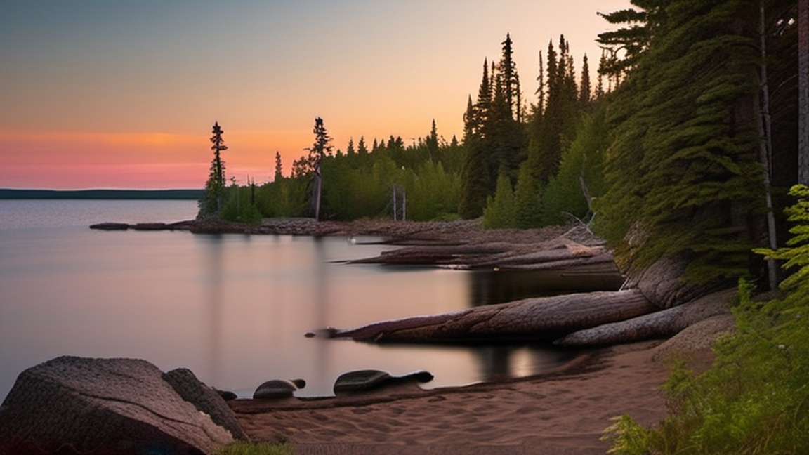
True backcountry camping – hiking off the trails and camping in non-designated sites – is allowed only with a special "cross-country" camping permit. It's advised only for experienced wilderness hikers due to the frequent ruggedness of the terrain and difficulty navigating in mostly-wooded areas.
37 Rock Harbor Lodge (east end of Snug Harbor), ☏ +1 906 337-4993 (summers), +1 270-773-2191 (winters). Open Memorial Day through Labor Day. The only option for those wanting a bed and four walls, the lodge offers both modest modern hotel rooms overlooking Rock Harbor and Lake Superior, and modern duplex "housekeeping" cabins inland with nice big picture-window views of the surrounding trees, all a short stroll from the dock. $209-232 (cabin), $215-239 ('European plan' room without meals), $336-360 ('American plan' room with meals), double occupancy, tax and fees included; peak season is mid-July to mid-August.
The Brothers Grimm gave wolves a very unfair portrayal; unless you are a young or feeble moose, you're in no danger from them. Although they've gotten a little less furtive lately as they look harder for moose (whose numbers have gone down substantially), they're still very good at avoiding humans, and even mere sightings are still infrequent. On the other hand, moose can be very dangerous if provoked (there's a reason wolves only go after the weak ones, and do so in packs), especially if you get between a mother and her calf, or if you confront a bull during mating season. But otherwise they're nothing to be afraid of, and will probably regard you the same way.
The greatest danger is your own foolishness: pushing yourself too hard, or ignoring basic principles of wilderness health and safety (e.g. keeping dry, water sanitation, floatation devices on the water). Canoeing, kayaking, or swimming in Lake Superior can be particularly hazardous due to the potential roughness of the water (it's more like a freshwater sea than a mere lake) and the hypothermia-inducing temperature just below the surface year-round.
The water from Lake Superior is safe enough when filtered, but some streams and inland lake sources are not as wholesome. Good filtration (not iodine tablets) is a must and some water from marshlands may need to be pre-filtered to prevent clogging. The taller ridges can reach 80+ degrees on a warm summer's day, and there are no water sources up there. Plan ahead and bring plenty of water, as the ridge trails are a strenuous hike. Nothing is worse than being exhausted and out of water 1000 feet above Lake Superior!
If you're injured, there's limited medical assistance available on the island, and it's going to have a difficult time getting to you in the backcountry. There are ranger stations at Snug Harbor, Windigo, Malone Bay (on the south shore), and Amygdaloid Island (off the northeast shore), and a ranger resident at Daisy Farm, any of which can radio for help and arrange for helicopter transport to the mainland (at your expense) for professional medical care.
Surprisingly, there is a theft problem at Isle Royale campgrounds, and the culprits inevitably escape prosecution on the grounds that they are not human. Foxes are the worst culprits, potentially stealing anything left unattended, including boots, socks, and even cameras. Squirrels – especially those who've had a previous taste of the exotic foods humans eat – will brazenly steal food from your hand when your head is turned (not much caring if they bite you in the process), or chew through your backpack if they catch a whiff of such ambrosia inside. Double-plastic-bagging and vigilance are advised. This is important both for your own well-being and that of the animals; camp foxes quickly become dependent on human food and stop hunting, which is both nutritionally bad for them and leaves them to starve when the humans all go away for the long winter.
The phone numbers included here are useful for planning your trip, not for calling from Isle Royale, where phone service is almost non-existent. At Snug Harbor there's a cellular pay phone on an amplified antenna for "Yeah, Mom, I made it back to the ranger station" calls (credit cards only; $5 for the first two minutes). Mobile phones won't work unless you're on a ridge or a part of the island close to Thunder Bay, Ontario, where maybe you'll get a weak signal. You can bring your phone along "for emergencies", but the odds of it working when you want it to are slim enough to make it just a half pound of dead weight in your pack. Don't even think about trying to blog your trip.
If traveling through Grand Portage, the Boundary Waters Canoe Area of Minnesota and Quetico Provincial Park of Ontario provide a paddling paradise to the west. Houghton-Hancock and Copper Harbor are located on the scenic Keweenaw Peninsula (Isle Royale's geological sibling), and it's not far from there to Pictured Rocks National Lakeshore, another nice hiking area to the southeast.
[edit] Further information: List of islands in Isle Royale National Park In 1875, Isle Royale was split off from Keweenaw County, as a separate county, Isle Royale County. In 1897, the county was dissolved, and the island was reincorporated into Keweenaw County. The highest point on the island is Mount Desor at 1,394 ft (425 m), or about 800 ft (240 m) above lake level. Isle Royale, the largest island in Lake Superior, is over 45 mi (72 km) in length and 9 mi (14 km) wide at its widest point. The park is made up of Isle Royale itself and approximately 400 smaller islands, along with any submerged lands within 4.5 mi (7.2 km) of the surrounding islands (16USC408g). Isle Royale is within about 15 mi (24 km) of the shore of the Canadian province of Ontario (near the city of Thunder Bay) and adjacently, the state of Minnesota (near Grand Portage in Cook County), and is 56 mi (90 km) from the Michigan shore, on the Keweenaw Peninsula, itself part of Upper Peninsula. There are no roads on the island, and wheeled vehicles or devices, other than wheelchairs, are not permitted. Rock Harbor has wheeled carts available to move personal belongings from the Rock Harbor marina to the cabins and hotel. Also, the National Park Service employs tractors and utility terrain vehicles to move items around the developed areas at Ozaagaateng, Rock Harbor, and Mott Island. Topsoil tends to be thin, which favors trees that have horizontal root patterns such as balsam fir, white spruce, and black spruce. Interior lakes[edit] Siskiwit Lake is the largest lake on the island. It has cold, clear water which is relatively low in nutrients. Siskiwit Lake contains several islands, including Ryan Island, the largest. Other lakes include: Chicken Bone Lake Lake Desor Feldtmann Lake Intermediate Lake (Isle Royale) Lake Ritchie Sargent Lake Hatchet Lake
[edit] According to the Köppen climate classification system, Isle Royale National Park has a mild summer Humid continental climate (Dfb). According to the United States Department of Agriculture, the Plant Hardiness zone is 4b at 1178 ft (359 m) elevation with an average annual extreme minimum temperature of -24.2 °F (-31.2 °C). There is no weather station in the park, but the PRISM Climate Group, a project of Oregon State University, provides interpolated data for the island based on the climates of nearby areas. Climate data for Isle Royale National Park. Elev: 1184 ft (361 m) Month Jan Feb Mar Apr May Jun Jul Aug Sep Oct Nov Dec Year Mean daily maximum °F (°C) 17.6(−8.0) 24.0(−4.4) 35.2(1.8) 45.9(7.7) 57.9(14.4) 66.1(18.9) 72.1(22.3) 71.8(22.1) 63.0(17.2) 49.2(9.6) 34.9(1.6) 22.5(−5.3) 46.8(8.2) Daily mean °F (°C) 8.4(−13.1) 13.6(−10.2) 24.2(−4.3) 35.9(2.2) 46.8(8.2) 56.0(13.3) 61.7(16.5) 61.2(16.2) 53.4(11.9) 41.1(5.1) 28.1(−2.2) 14.9(−9.5) 37.2(2.9) Mean daily minimum °F (°C) −0.8(−18.2) 3.3(−15.9) 13.2(−10.4) 25.8(−3.4) 35.7(2.1) 46.0(7.8) 51.4(10.8) 50.6(10.3) 43.7(6.5) 33.0(0.6) 21.2(−6.0) 7.3(−13.7) 27.6(−2.4) Average precipitation inches (mm) 1.97(50) 1.18(30) 1.62(41) 2.14(54) 2.80(71) 3.15(80) 3.26(83) 3.02(77) 3.17(81) 3.22(82) 2.39(61) 2.03(52) 29.95(761) Average relative humidity (%) 78.9 73.2 66.6 59.1 60.9 68.5 69.7 73.9 76.5 75.4 76.6 81.6 71.7 Average dew point °F (°C) 3.2(−16.0) 6.6(−14.1) 14.7(−9.6) 23.0(−5.0) 34.0(1.1) 45.8(7.7) 51.7(10.9) 52.8(11.6) 46.2(7.9) 33.9(1.1) 21.7(−5.7) 10.3(−12.1) 28.8(−1.8) Source: PRISM Climate Group
[edit] Prehistory[edit] The island was a common hunting ground for native people from nearby Minnesota and Ontario. A canoe voyage of thirteen miles is necessary to reach the island's west end from the mainland. Large quantities of copper artifacts found in indian mounds and settlements, some dating back to 3000 B.C., were most likely mined on Isle Royale and the nearby Keweenaw Peninsula. The island has hundreds of pits and trenches up to 65 feet (20 m) deep from these indigenous peoples, with most in the McCargoe Cove area. Carbon-14 testing of wood remains found in sockets of copper artifacts indicates that they are at least 6500 years old.An abandoned copper mine shaftIn Prehistoric Copper Mining in the Lake Superior Region, Drier and Du Temple estimated that over 750,000 tons of copper had been mined from the region. However, David Johnson and Susan Martin contend that their estimate was based on exaggerated and inaccurate assumptions. The Jesuit missionary Dablon published an account in 1669–70 of "an island called Menong, celebrated for its copper". Menong, or Minong, was the native term for the island, and is the basis for Minong Ridge. Prospecting began in earnest when the Chippewas relinquished their claims to the island in 1843, starting with many of the original native pits. This activity had ended by 1855, when no economic deposits were found. The Minong Mine and Island Mine were the result of renewed but short-lived activity from 1873 to 1881. Isle Royale was given to the United States by the 1783 treaty with Great Britain (formerly part of the Indian Reserve disputed by the United States) but the British remained in control until after the War of 1812, and the Ojibwa peoples considered the island to be their territory.  The Ojibwas ceded the island to the U.S. in the 1842 Treaty of La Pointe, with the Grand Portage Band unaware that neither they nor Isle Royale were in British territory. With the clarification to the Ojibwas of the 1842 Webster–Ashburton Treaty that was signed before the Treaty of La Pointe, the Ojibwas re-affirmed the 1842 Treaty of La Pointe in the 1844 Isle Royale Agreement, with the Grand Portage Band signing the agreement as an addendum to the 1842 treaty. In the mid-1840s, a report by Douglass Houghton, Michigan's first state geologist, set off a copper boom in the state, and the first modern copper mines were opened on the island. Evidence of the earlier mining efforts was everywhere, in the form of many stone hammers, some copper artifacts, and places where copper had been partially worked out of the rock but left in place. The ancient pits and trenches led to the discovery of many of the copper deposits that were mined in the 19th century. The remoteness of the island, combined with the small veins of copper, caused most of the 19th-century mines to fail quickly. Between the miners and commercial loggers, much of the island was deforested during the late 19th century. Once the island became a national park in 1940, logging and other exploitive activities ended, and the forest began to regenerate. The island was once the site of several lake trout and whitefish fisheries, as well as a few resorts. The fishing industry has declined considerably, but continues at Edisen Fishery. Today, it has no permanent inhabitants; the small communities of Scandinavian fishermen were removed by the United States National Park Service after the island became a national park in the 1940s. About 12 families still have lifetime leases for their cabins and claim Isle Royale as their heritage, and several descendant fishermen fish the Isle Royale waters commercially. Because numerous small islands surround Isle Royale, ships were once guided through the area by lighthouses at Passage Island, Rock Harbor, Rock of Ages, and Isle Royale Lighthouse on Menagerie Island. The western tip of the island is home to several shipwrecks that are very popular with scuba divers, including the SS America. The NPS Submerged Resources Center mapped the 10 most famous of the shipwrecks contained within the park, and published Shipwrecks of Isle Royale National Park; The Archeological Survey, which gives an overview of the maritime history of the area. The area's notoriously harsh weather, dramatic underwater topography, the island's central location on historic shipping routes, and the cold, fresh water have resulted in largely intact, well preserved wrecks throughout the park. In January 2019, the entire island chain was added to the National Register of Historic Places by the federal government. On the Register it is called 'the Minong Traditional Cultural Property.' Angelique Mott[edit] Main article: Angelique Mott In 1845, an Ojibwe woman named Angelique and her voyageur husband Charles Mott were left on Isle Royale, as hires for Cyrus Mendenhall and the Lake Superior Copper Company. They were hired and carried to Isle Royale by Mendenhall's schooner, the Algonquin, first to scout for copper. Angelique found a large mass of copper ore. She and her husband were hired to stay and guard it until a barge could come to retrieve it, promised in no more than 3 months' time. They were dropped off in July and were left stranded there until the following spring. They were left with minimal provisions, which consisted of a half-barrel of flour, six pounds of butter, and some beans. A supply boat was promised to arrive after the first few weeks, but it was never sent out. The full events were chronicled in a footnote as told by Angelique, in the first printing of a book called "The Honorable Peter White" by Ralph D. Williams in 1907; Angelique's story was pulled from the subsequent printing, thus making it the only written record that survives. Humans have not normally settled year-round on Isle Royale. For about three thousand years, Native Americans used the land for copper and fish. These Native Americans usually limited their visits to the island in the summer. Americans in the nineteenth century did likewise.
[edit] Tobin Harbor Trail in the Laurentian Mixed Forest ProvinceA number of habitats exist on the island, the primary being boreal forest, similar to neighboring Ontario and Minnesota. Upland areas along some of the ridges are effectively "balds" with exposed bedrock and a few scrubby trees, blueberry bushes, and hardy grasses. Occasional marshes exist, which are typically the by-product of beaver activities. There are also several lakes, often with wooded or marshy shores. The climate, especially in lowland areas, is heavily influenced by the cold waters of Lake Superior. Flora[edit] According to the A. W. Kuchler U.S. Potential natural vegetation Types, Isle Royale National Park has a Great Lakes Spruce/Fir (93) potential vegetation type and a Northern Conifer Forest (22) potential vegetation form. The predominant floral habitats of Isle Royale are within the Laurentian Mixed Forest Province. The area is a temperate broadleaf and mixed forests biome transition zone between the true boreal forest to the north and Big Woods to the south, with characteristics of each. It has areas of both broadleaf and conifer forest cover, and bodies of water ranging from conifer bogs to swamps. Conifers include jack pines (Pinus banksiana), black and white spruces (Picea mariana and Picea glauca), balsam firs (Abies balsamea), and eastern redcedars (Juniperus virginiana). Deciduous trees include quaking aspens (Populus tremuloides), red oaks (Quercus rubra), paper birches (Betula papyrifera), American mountain ash (Sorbus americana), red maples (Acer rubrum), sugar maples (Acer saccharum), and mountain maples (Acer spicatum). There are over 600 species of flowering plants found in Isle Royale National Park such as wild sarsaparilla, marsh-marigold, wood lily and prickly wild rose. Fauna[edit] See also: Wolves and moose on Isle Royale and List of fish of Isle Royale National Park Moose swimming at Isle Royale. Isle Royale National Park is known for its timber wolf and moose populations, which are studied by scientists investigating predator-prey relationships in a closed environment. There is a cyclical relationship between the two animals: as the moose increase in population, so do the wolves. Eventually, the wolves kill too many moose and begin to starve and lower their reproductive rates. This is made easier because Isle Royale has been colonized by roughly just one third of the mainland mammal species, because it is so remote. In addition, the environment is unique in that it is the only known place where wolves and moose coexist without the presence of bears. Other common mammals are red foxes, beavers, and red squirrels. Some foxes are accustomed to human contact and can be seen prowling the campgrounds at dawn, looking for stray scraps left by unwary campers. For its part, the wolf is an elusive species which avoids human interaction. Few documented cases of direct wolf/human contact existed for most of the island's history. In the 2024 season dozens of wolf sightings were reported around the Rock Harbor area. Ermine have been periodically sighted around docks. Other mammals that can be seen include mink along the various lake shores and muskrats (occasionally) at beaver ponds. Several species of bat also exist on the island. Reptiles include the eastern garter snake, painted turtle, and northern redbelly snake. Six species of frogs and three species of salamander also live on the island. Historically neither moose nor wolves inhabited Isle Royale. Just prior to becoming a national park the large mammals on Isle Royale were Canada lynx and the boreal woodland caribou. Archeological evidence indicates both of these species were present on Isle Royale for 3,500 years prior to being removed by direct human actions (hunting, trapping, mining, logging, fires, competition for resources from exotic species and possibly disease due to the introduction of invasive species). The last caribou documented on Isle Royale was in 1925. Though lynx were removed by the 1930s, some have periodically crossed the ice bridge from neighboring Ontario, Canada, the most recent being an individual sighting in 1980. Although lynx are no longer present on the island, their primary prey, snowshoe hares, remain. Before the appearance of wolves, coyotes were also predators on the island. Coyotes appeared around 1905 and disappeared shortly after wolves arrived in the 1950s. Four wolves were brought from Minnesota in 2018 after some debate as to whether or not the introduction was an unnatural intervention. Rocky shoreline Moose are believed to have colonized Isle Royale sometime between 1905 and 1912. It was initially believed that a small herd of moose (moose typically do not travel in herds) colonized the islands by crossing the ice from the adjacent mainland; later this theory was modified to a herd of moose swimming 20 miles across Lake Superior from the nearest mainland. The improbability of these theories received little scrutiny until recent years. Although no thorough scientific investigation to determine how moose arrived on Isle Royale has been carried out to date, both cultural and genetic evidence indicates they were likely introduced by humans to create a private hunting preserve in the early 1900s. The cultural evidence that moose were trapped in northwestern Minnesota and transported to Isle Royale seemed unlikely until decades later when genetic evidence revealed the moose on Isle Royale were more closely related to moose in the far northwestern Minnesota/Manitoba border area than the mainland adjacent to Isle Royale in far northeastern Minnesota bordering Ontario. Further evidence has also shown that the Washington Harbor Club, a group of well-to-do businessmen, owned various buildings on Isle Royale in addition to railroads that ran from Baudette to Duluth and Two Harbors and so had the means to transport moose from northwestern Minnesota to Two Harbors. There are usually around 25 wolves and 1000 moose on the island, but the numbers change greatly year to year. In the 2006–2007 winter, a survey found 385 moose and 21 wolves in 3 packs. In spring 2008, 23 wolves and approximately 650 moose were counted. However, recent reductions in winter pack ice had ended replenishment of the wolf population from the mainland. Due to genetic inbreeding, the wolf population had declined to two individuals in 2016, causing researchers to expect that the island's wolf population would eventually become extinct. At the same time, the island's moose population had exploded to an estimated 1600. By November 2017, the wolf population was down to one, a female. In December 2016, the National Park Service put forward an initial plan to bring additional wolves to the island in order to prevent the pack from disappearing completely. The decision to relocate 20–30 wolves to the island was approved and from September 2018 to September 2019, 19 wolves were relocated to Isle Royale from various locations in Minnesota, Michigan, and Ontario. As of April 14, 2020, there were an estimated 14 wolves remaining on the island. Geology[edit] Isle Royale geological map Cross-section of the Lake Superior basin showing the tilted strata of volcanic rock that form Isle Royale The island is composed largely of ridges, running roughly southwest-to-northeast. The main ridge, Greenstone Ridge, is over 1,000 ft (300 m) in many places. Greenstone belts are exposed, with rounded stones of chlorastrolite, also known as greenstone, near and in the lake. The two main rock assemblages found on the island include the Portage Lake Volcanics and the Copper Harbor Conglomerate, both Precambrian in age. The volcanics are mainly ophitic flood basalts, some 100 individual flows over an accumulated thickness of at least 10,000 feet. The conglomerate outcrops on the southwestern portion of the island and consists of sedimentary rock derived from volcanic rocks in present-day Minnesota. Glacial erosion accentuated the ridge and valley topography from pre-glacial stream erosion. Glacial striations indicate a generally westward movement of the glaciers as do the recessional moraines west of Lake Desor. Drumlins are found west of Siskiwit Lake.: 8, 14–15, 21, 25, 42, 45  Recent analyses by the USGS of both unmineralized basalt and copper-mineralized rock show that a small amount of naturally occurring mercury is associated with mineralization. Native copper and chlorastrolite, the official state gem of Michigan, are secondary minerals filling pore spaces formed by vesicles and fractures within the volcanic rocks. Prehnite and agate amygdules are also plentiful island gemstones.: 55, 58–61 
[edit] Recreational activity on Isle Royale includes hiking, backpacking, fishing, boating, canoeing, kayaking, and observing nature. Wheeled vehicles are not permitted on Isle Royale; though wheelchairs are allowed. Hiking[edit] The island offers approximately 170 mi (270 km) of hiking trails for everything from day hikes to a two-week circumnavigation hike. Some of the hiking trails are quite challenging, with steep grades. The Greenstone Ridge is a high ridge in the center of the island and carries the longest trail in the park, the Greenstone Ridge Trail, which runs 40 mi (64 km) from one end of the island to the other. This is generally done as a 4 or 5 day hike. A boat shuttle can carry hikers back to their starting point. The trail leads to the peak of Mount Desor, at 1,394 ft (425 m), the highest point on the island, and passes through northwoods wilderness, and by inland glacial lakes, swamps, bogs and scenic shorelines. In total there are 165 mi (266 km) of hiking trails. There are also canoe/kayak routes, many involving portages, along coastal bays and inland lakes. Services[edit] The park has two developed areas: Ozaagaateng (formerly Windigo), at the southwest end of the island (docking site for the ferries from Minnesota), with a campstore, showers, campsites, rustic camper cabins, and a boat dock. Rock Harbor on the south side of the northeast end (docking site for the ferries from Michigan), with a campstore, showers, restaurant, lodge, campsites, and a boat dock. Non-camping sleeping accommodations at the park are limited to the lodge at Rock Harbor and the camper cabins at Ozaagaateng. Camping[edit] A typical three-sided screened shelter in Isle Royale National Park as seen at the Washington Creek campground. The park has 36 designated wilderness campgrounds. Some campgrounds in the interior are accessible only by trail or by canoe/kayak on the island lakes. Other campgrounds are accessible only by private boat. The campsites vary in capacity but typically include a few three-sided wood shelters (the fourth wall is screened) with floors and roofs, and several individual sites suitable for pitching a small tent. Some tent sites with space for groups of up to 10 are available, and are used for overflow if all the individual sites are filled. The only amenities at the campgrounds are pit toilets, picnic tables, and fire-rings at specific areas. Campfires are not permitted at most campgrounds; gas or alcohol camp stoves are recommended. Drinking and cooking water must be drawn from local water sources (Lake Superior and inland lakes) and filtered, treated, or boiled to avoid parasites. Hunting is not permitted, but fishing is, and edible berries (blueberries, thimbleberries) may be picked from the trail. Access[edit] See also: Isle Royale Ferry ServiceFloatplane taking off from Ozaagaateng on Washington Harbor—Beaver Island can be seen in the background at rightThe park is accessible by ferries, floatplanes, and passenger ships during the summer months—from Houghton and Copper Harbor in Michigan and Grand Portage in Minnesota. Private boats travel to the island from the coasts of Michigan, Minnesota, and Ontario. Isle Royale is quite popular with day-trippers in private boats, and day-trip ferry service is provided from Copper Harbor and Grand Portage to and from the park. Isle Royale is the only American national park to entirely close in the winter months, from November 1 through April 15, due to extreme weather conditions and for the safety and protection of visitors. Isle Royale is the least-visited national park in the contiguous United States, due to the winter closing and the distance across Lake Superior to reach the park. The average annual visitation was about 19,000 in the period from 2009 to 2018, with 25,798 visiting in 2018. Only three of the most remote Alaskan national parks—Lake Clark, Kobuk Valley and Gates of the Arctic—receive fewer visitors. Ships[edit] Isle Royale Queen IV at Copper Harbor Scheduled ferry service operates from Grand Portage, Copper Harbor and Houghton. The Grand Portage ferries reach the island in 1½ hours, and stay 4 hours at the island, allowing time for hiking, a guided hike or program by the park staff, and picnics. The Isle Royale Queen serves park visitors out of Copper Harbor, on the northern Upper Peninsula coast of Michigan. It arrives at Rock Harbor in the park in 3 to 3½ hours and spends 3½ hours before returning to Copper Harbor. The Sea Hunter operates round-trips and offers day trips to the Ozaagaateng visitor center through much of the season, and less frequently in early summer and autumn; it will transport kayaks and canoes for visitors wanting to explore the park from the water. It is the fastest ferry serving the island and arrives in 1½ hours, including some sightseeing points along the way out and back. Because of the relatively short boat ride, day visitors are able to get four hours on the island, and get back to the mainland earlier in the afternoon. This gives visitors on a tight schedule time to visit the Grand Portage National Monument or other attractions in the same day. The Ranger III is a 165 ft (50 m) ship that serves park visitors from Houghton, Michigan to Rock Harbor. It is operated by the National Park Service, and is said to be the largest piece of equipment in the National Park system. It carries 125 passengers, along with canoes, kayaks, and even small powerboats. It is a six-hour voyage from Houghton to the park. The ship stays overnight at Rock Harbor before returning the next day, making two round trips each week from June to mid-September. Briefly in the 2008 season, the Ranger III carried visitors to and from Ozaagaateng. This was not continued after four trips, due to low interest and long crossing times. In 2012, Park Superintendent Phyllis Green required the Ranger III to purify its ballast water. The Voyageur II, out of Grand Portage, crosses up to three times a week, overnighting at Rock Harbor and providing transportation between popular lakeside campgrounds. In the fall season, in addition to carrying campers and hikers, it provides day-trip service to Ozaagaateng on weekends. The Voyageur transports kayaks and canoes for visitors wanting to explore the island from the water. The Voyageur II and other boat taxi services ferry hikers to points along the island, allowing a one-way hike back to Rock Harbor or Ozaagaateng. Visitors may land at Rock Harbor and depart from Ozaagaateng several days later, or vice versa. Hikers frequently ride it in one direction to do a cross-island hike and then get picked up at the other end.