Back to cities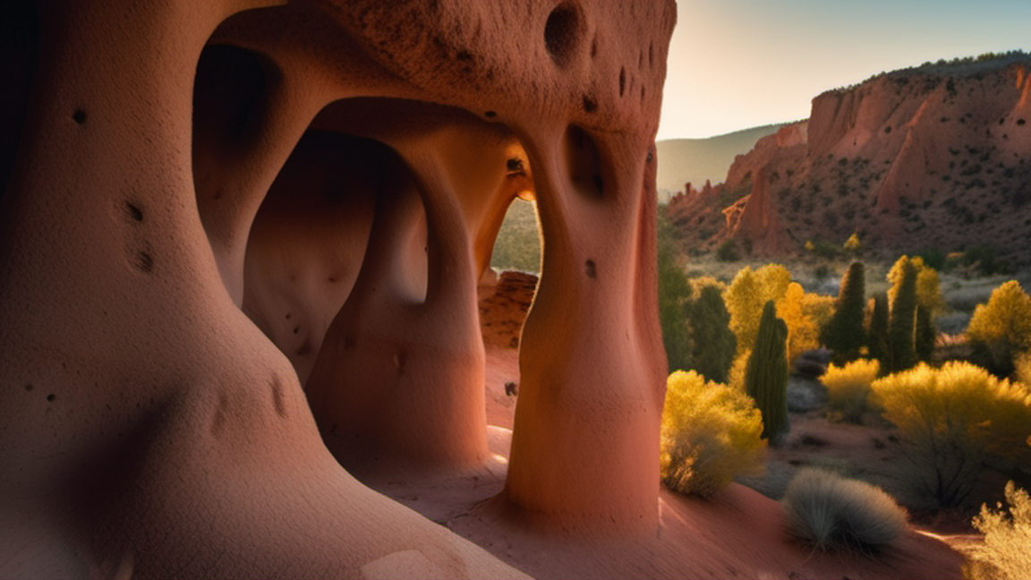
cities
Bandelier National Monument
Overview
Bandelier National Monument is a national monument in the North Central region of New Mexico. It was once inhabited by the ancient Puebloans (incorrectly known as the Anasazi), the ancestors of some of the modern-day Nat
Wikivoyage guide · 20 sections
▸Introduction568 chars
Bandelier National Monument is a national monument in the North Central region of New Mexico. It was once inhabited by the ancient Puebloans (incorrectly known as the Anasazi), the ancestors of some of the modern-day Native American pueblos of northern New Mexico. For some unknown reason probably related to drought and decline in agriculture, the Puebloans abandoned this site, but the area is still honored by the present-day Pueblo people. They left behind a land of enigmatic ruins and superb canyon/mesa scenery that beckons the hiker, student and photographer.
▸Understand3,154 chars
As with other units of the national park system, Bandelier was created for both conservation and recreation. The primary resources being conserved are cultural (archaeological and anthropological) and scenic (canyon and mesa country, merging into mountain scenery at the upper end of the park). Both follow from Bandelier's setting atop the Pajarito Plateau, a gigantic, ancient (1-2 million year old) ash flow from a volcanic eruption in the nearby Jemez Mountains, that over time has eroded into a network of canyons and mesas. This rugged terrain is responsible for both the scenic beauty of the monument and the capacity of this otherwise arid landscape to maintain an indigenous population that lived along the streams in the canyons, and in some cases, on the mesa tops above them. The early Puebloans have moved on to other locations in northern New Mexico, but the ruins of their habitations and ceremonial structures remain to be protected by the monument.
The monument's headquarters, visitor center, and most accessible features are in Frijoles Canyon, a typical example of the canyons incised in the plateau, but notable for its abundance of ruins. These result from the fact that in contrast to most canyons on the plateau, Frijoles has a stream in its bottom, the Rito de los Frijoles -- Bean Creek—that runs nearly year-round. (Most canyons have seasonal streams that dry up during parts of the year.) Frijoles Canyon is also fairly wide for much of its length, and the combination of the resulting open spaces and available water allowed the ancestral Puebloans to practice agriculture relatively successfully. Remnants of Puebloan agriculture can still be seen in the canyon, even though the dwellings were abandoned centuries ago.
Many of the ruins in Frijoles Canyon have been excavated, studied and preserved. The main loop trail from the visitor center (see under "See") passes by several types of restored dwellings: communal stone structures along the canyon floor (think of a prehistoric "apartment complex"), "cliff houses" built of stone and mud backed against the canyon wall, and a few "cave dwellings" in holes in the volcanic tuff of the canyon wall. Other archaeological features typical of the Puebloans are the religious structures known as kivas. These are circular, half-buried structures that in Puebloan times would have had flat roofs and entrance ways. Most kivas were perhaps 15 feet (5 meters) in diameter, but many Puebloan villages were built around a "great kiva" that was much larger. An example of a great kiva has been restored in Frijoles Canyon. Today's pueblos along the Rio Grande still use kivas in ceremonies. All of these types of ruins can be found in some of the park's other areas, although most have not been restored; in fact, you may encounter archaeologists on the job at some sites (please don't disturb).
▸Visitor information12 chars
Park website
▸Get in2,288 chars
Bandelier is most easily reached by automobile, there being no nearby bus or train stations. The nearest airport with significant commercial service is in Albuquerque, about 90 miles (150 km) away by road. Santa Fe is closer but has only very limited commercial air service. Los Alamos has no commercial air service but does have an airport suitable for private planes. (Its high elevation, single east-west runway, and rugged terrain make this airport quite a challenge for landing and take-off.) Rental cars may be obtained in any of these three cities. Bicycling to the monument is feasible for the fit cyclist, but the roads have a great deal of up-and-down and will challenge the cyclist recently up from sea level (the monument entrance is at an elevation near 6500 feet, or 2000 meters); puncture-resistant tires are also important as tire-penetrating thorns are common on the road.
To reach Bandelier from Santa Fe, follow US Highway 285 north to the small town of Pojoaque. Exit 285 on State Highway 502 heading west, following signs for Los Alamos until a fork in the road is encountered that directs travelers to Los Alamos via 502 or Bandelier/White Rock via State Highway 4. Follow the route on 4 (bear right at the fork). This highway leads directly to Bandelier, passing en route the small town of White Rock, an outlying part of Los Alamos. The photographically-inclined traveler may wish to take the left fork instead for a short distance, as the road climbs the side of a colorful mesa en route to Los Alamos, passing the stunning Clinton P. Anderson Scenic Overlook with superb views of the canyon-and-mesa country with the Sangre de Cristo Mountains in the background. Photography from this viewpoint is particularly rewarding at sunrise and sunset. Retracing the route leads back to the fork, and a right-hand turn (sic!) then connects with 4 and Bandelier.
During the summer months, the most visited section of the park, Frijoles Canyon, is closed to automobiles from 9AM-3PM due to the very limited amount of parking spots available. Instead, you can park at the 1 White Rock Visitor Center on State Highway 4 in White Rock and take a free shuttle bus to the visitor center in the park. If you're arriving before 9AM or after 3PM, you can still drive in.
▸Fees and permits2,275 chars
Entrances fees are valid for seven days, allowing unlimited re-entry for the week. Fees as of 2020 are:
$15 Bicycle/pedestrian
$20 Motorcycle
$25 Per vehicle
$45 Bandelier Annual Pass
The America the Beautiful Pass, also called the Interagency Pass, provides entry to Bandelier National Monument and all national parks, as well as some national monuments, national wildlife refuges, and national forests. A single pass applies for an entire group traveling together in a private vehicle, or up to four people on foot or bike. There are several pass types:
The Annual Pass (valid for twelve months from date of issue) can be purchased by anyone. $80 for U.S. citizens and residents, $250 for non-U.S. residents, $20 for U.S. citizens or permanent residents age 62 or over, and free for current military personnel (must show a Common Access Card (CAC) or Military ID).
The Lifetime Pass (valid for the life of the holder) is available for $80 to U.S. citizens or permanent residents age 62 or over, and free for veterans and Gold Star families (families of servicemembers who were killed in action). Applicants must provide documentation showing they are eligible. This pass also provides a 50% discount on some park amenities.
The Access Pass (valid for the life of the holder) is available for free to U.S. citizens or permanent residents with permanent disabilities. Applicants must provide documentation of citizenship and permanent disability. This pass also provides a 50% discount on some park amenities.
The Volunteer Pass is available for free to individuals who have volunteered 250 or more hours with federal agencies that participate in the Interagency Pass Program.
The free Annual 4th Grade Pass (valid for September to August of the 4th grade school year) allows entry to the bearer and any accompanying passengers in a private non-commercial vehicle. Registration at the Every Kid Outdoors website is required.
In 2026, the National Park Service offers free admission to all national parks on 10 days:
President's Day (February 16)
Memorial Day (May 25)
Flag Day (June 14)
Independence Day Weekend (July 3-5)
The National Park Service Birthday (August 25)
Constitution Day (September 17)
Theodore Roosevelt's birthday (October 27)
Veterans Day (November 11)
▸Get around1,422 chars
The visitor center and most other areas of interest to the casual visitor are in Frijoles Canyon, past the entrance station on good but steep paved road. The road descends along the side of the canyon, with some exposure, and may be a bit intimidating to the motorist unused to mountain driving. Parking at the bottom can be tight during peak periods, and it has gotten to the point that the park has closed Frijoles Canyon to automobiles from 9AM-3PM during the summer months; visitors are now required to take a shuttle bus from a visitor center in nearby White Rock during these hours. Parking in a separate lot in Frijoles Canyon is available (and required) for backpackers planning on hiking into the backcountry from trailheads near the visitor center.
Some outlying areas (see under "Do" and "Go next") are far enough from the visitor center to require driving to reach them. The routes to the Tsankawi outlier and the cross-country ski trails are on good paved road (State Highway 4), although the road to the skiing can be snow-packed and hazardous during winter months. Some of the backcountry trailheads are reached from St. Peters Dome Road, off State Highway 4 in the Jemez Mountains via a gravel forest road. Passenger cars can negotiate the forest road, but a high-clearance vehicle may be desirable for reaching the trailheads. There is no shuttle service from the main monument sites to these areas.
▸See2,784 chars
The 1 Visitor Center in Frijoles Canyon offers a multimedia show on the monument, and there is a small gallery containing artifacts of archaeological, historical and cultural interest. However, most of the attractions of the main area are outdoors. A one-mile (1.6-km) loop trail starts behind the visitor center and leads to a variety of restored ruins of lodgings and ceremonial kivas on the canyon's floor and north wall, with interpretive signs en route and numbered references to an explanatory pamphlet available by purchase or returnable with deposit at the visitor center. Much of this trail is paved and accessible to wheelchairs, but the section along the canyon wall is rougher and includes stairs. Wooden ladders afford (optional) access to some of the cliff dwellings created by ancient Puebloans who enlarged natural voids ("caves," although the structures have nothing to do with classical limestone caves) in the soft tuff of the canyon wall.
A hiking option going to or from the cliff dwellings is the nature trail along the Rito de los Frijoles, the small creek in the canyon's bottom; this is posted with interpretive signs describing the plant and animal life along the trail. This nature trail is heavily shaded, surrounded by greenery, and very close to the creek, creating an oasis-like atmosphere for anyone tired of sun-bleached sand and rock.
A short extension beyond the loop trail leads to 2 Alcove House, formerly known as Ceremonial Cave (and still so called on some older maps and guides), a large shelter cave some 300 feet (100 meters) above the canyon floor. The trail to Alcove House is open; however, the wooden ladders bolted into the lava rock that connect the cave to the valley floor are closed as of Oct 2020 The trail beyond Alcove Cave becomes increasingly rough and leads into the backcountry (see next section).
The canyon bottom near the visitor center is a suitable location for picnics, with parking, picnic tables, and toilets. Parking spots in the picnic area to the northwest of the visitor center are sometimes the last to be filled during peak visitation times. The picnic area can be quite crowded during peak season (summer), as can the interpretive trail. Visiting during the off season can reduce the crowds significantly. Frijoles Canyon is particularly pleasant during the fall, when the crowds are reduced, temperatures are moderate, and neither the high winds of spring nor the monsoonal rains of late summer are likely to interfere with the visitor's enjoyment; however, the area is open, and usually easily accessible, during daylight hours year-round, except for Christmas and New Years. Visitors are expected to be off the interpretive trail and out of the visitors' area by dusk, except for special events.
▸Do693 chars
Bandelier is a superb hikers' park, with options ranging from the shortest excursions past the paved loop trail all the way to multi-day backpacks. It is usually available for purchase at the visitor center. Don't underestimate this park. There have been a number of deaths in the backcountry, some of them befalling experienced hikers. Overnight backpacking is controlled by a permit system, but no permits are required for day hiking.
Trails in the Monument may be closed during conditions of extreme fire danger or for other reasons. For up to date information on closures contact the Visitor Center at +1 505-672-3861 x 517. Fire closures are most likely during June and early July.
▸Hiking in Frijoles Canyon2,030 chars
Trails lead both upstream and downstream from the visitor center and loop trail. Downstream, the primary trail climbs a short distance above the canyon bottom (hot and exposed during summer) en route to 2 Upper Frijoles Falls, an attractive waterfall where Rito de los Frijoles cascades over resistant basalt cliffs interbedded with the prevailing tuff. The falls are usually at their most scenic in spring, when runoff from the mountains upstream guarantees adequate water flow; in the fall they may be nearly dry. Unfortunately, there used to be a trail leading past the Upper Falls down to the Lower Falls and the Rio Grande, but a landslide took out this section of the trail and it's unlikely to be rebuilt anytime soon. Total round-trip distance is about 3 miles (5 km).
The upstream trail leads past Alcove House (see above) and into one of the monument's few sections of truly narrow canyon. (Tread carefully here in potential flash-flood conditions.) The Bandelier Wilderness is soon entered and the crowds are left behind; fewer hikers pass this way than downstream. The trail continues to "Upper Crossing," where a trail coming down the canyon side from Ponderosa Campground meets the canyon trail, crosses the stream and continues up the south side of the canyon and into the wilderness. Travel along the canyon bottom beyond this point becomes rugged. Camping is prohibited in Frijoles Canyon; the backpacker will need to follow one of the trails up the south wall (see next section) to a campsite deeper in the backcountry.
In addition to hiking in the canyon, hiking into the canyon is possible, both from Ponderosa Campground en route to Upper Crossing and from Juniper Campground near the main entrance. The Frey Trail starts at Juniper and switchbacks down the canyon side with terrific views, eventually reaching the main loop trail. Remember, what goes down must come back up; both the Frey Trail and the trail to Upper Crossing are gut-busters in the uphill direction. Try to arrange a car shuttle.
▸Canyon and mesa hiking2,840 chars
Trails lead up the south side of Frijoles Canyon at Upper Crossing and closer to the visitor center, offering the hiker access to the greater part of the Bandelier Wilderness. The nearest notable destination to the trailhead at the visitor center is Frijolito Ruin, a largely unexcavated archaeological site on the mesa top just past the canyon rim. The hike to Frijolito covers only 1.5 miles (2.5 km) but is considerably more punishing than the mileage suggests, as it switchbacks steeply up the canyon wall, gaining about 600 feet (180 meters) in a very short distance. This is a good short day hike for getting oriented to the Bandelier backcountry. The wilderness boundary is just beyond Frijolito.
Whether entering the wilderness via this route or from Upper Crossing, a network of trails covers the mesa top, with attractive views of the Jemez Mountains beyond a major scarp (terrain uplifted along a fault). At least the views used to be attractive; this area has been badly damaged by several forest fires in the last few years, and much of the terrain is just plain bleak despite the re-emerging young forest. Burned trees or no burned trees, these trails are a good place to see wildlife. The next major canyon south of Frijoles is Alamo Canyon, with smaller Lummis Canyon en route. Strong hikers can reach fine overlooks of Alamo and make it back to the visitor center in a reasonably comfortable day.
One of the better-known archaeological sites in the park lies beyond Alamo Canyon: Stone Lions Shrine, a pair of stylized mountain lions (if you use your imagination) carved from rock buried in the ground. This shrine is still viewed as significant by some members of nearby pueblos, and you may find evidence of recent ceremonial activity there; please be respectful and don't disturb the artifacts. Another unexcavated dwelling site, Yapashi Pueblo, is en route to the Stone Lions. Hiking all the way from the visitor center to Stone Lions and back is possible in a day, but it's a real grunt; the hike is enjoyable as an overnighter.
Other trails follow the mesa between Frijoles and Alamo Canyons southeast toward the Rio Grande, with various other scenic opportunities. Many of the archaeological sites in this part of the park have been destroyed or damaged by flooding that resulted from the construction of Cochiti Dam downstream on the river, with Cochiti Lake forming behind it and sometimes reaching the mouths of the Bandelier canyons and beyond. It used to be straightforward to follow trails atop the mesa or in Alamo Canyon all the way to the Rio, walk upstream, and return to the visitor center via the trail in Frijoles Canyon. Depending on water levels, etc., this trip may or may not be possible now, but even if it is, water damage along the river banks will take some of the fun out of it.
▸Trails from St. Peters Dome871 chars
If the previous trails are still too crowded for you (even though, at least in off-season, you might hike to Stone Lions and back without seeing more than half a dozen people), try the trailheads reached via St. Peters Dome, a volcanic ridge on the northwest side of the monument. Trails here provide alternative routes to Stone Lions and also to the remote mesas and canyons beyond Alamo. You'll likely have this area to yourself—and the rattlesnakes. This is a remote area. Make sure you leave word where you're going, and gas up in Los Alamos or White Rock before setting out.
Capulin Canyon is the next major canyon beyond Alamo. There are good backpacking campsites here, but check on availability when you get your permit. One difference between Capulin and the other backcountry canyons is that there are "modern" ruins as well as the usual prehistoric ones.
▸Nightwalk855 chars
For a different kind of hiking experience, if you're in the park during the summer, see if you can get on a "Nightwalk." This is a ranger-led stroll by flashlight along the loop trail (which is otherwise closed at dusk), with an emphasis on "atmosphere" that is accentuated by poetry, Native American stories, etc. -- but to give the atmospheric details would spoil the fun, so just go and experience it for yourself. There is a fee, and advance registration is necessary; contact the visitor center for details. Nightwalks are only done during the summer months (there may be a very few around Christmas), and only once or twice a week, so some advance planning is required, but it's highly recommended for the visitor with poetry in his/her soul. Not suitable for most small children, as strict silence is expected and contributes to the experience.
▸Photography736 chars
Frijoles Canyon is at its most photogenic in early morning and around sundown, when the shadows are most interesting and there is a little extra color in the rocks. Photos taken near noon often look a bit stark. Good viewpoints for photographs looking down at the ruins exist along the "Long House" part of the main loop trail; better ones are along the Frey Trail. Skilled use of flash photography through the windows and vents of caves and dwellings make it possible to see both the interior and exterior views in the same photo. Ancient petroglyphs, both painted and incised, are visible along the walls of the canyon, but some of the incised petroglyphs can only be seen at certain times of the day due to the angle of the sun.
▸Buy1,198 chars
Books on the monument and region are sold at the visitor center. A small, separate gift shop next to the visitor center offers the usual tourist paraphernalia (t-shirts, mugs, etc.) and sundries, including hiking supplies. More interesting, however, is its selection of artwork from nearby Indian pueblos. It is usually possible to find a small but diverse selection of jewelry and pottery from highly-regarded centers (e.g. Cochiti and Santo Domingo Pueblos for jewelry, Santa Clara, San Ildefonso and Acoma Pueblos for pottery), and one can even stumble across a good Navajo rug—somewhat ironically, as the Navajo were the ancestral enemies of the Puebloans who created the dwellings in Frijoles Canyon. Quality is variable; some pieces are "tourist trash," plain and simple, but the shopper with a discerning eye can often find high-quality (if not museum-class) work, sometimes at prices better than those for comparable pieces at galleries in Santa Fe. Be prepared for sticker shock; a 6-inch (15-cm) diameter black-on-black pot from San Ildefonso Pueblo can easily go for $500 or more if it's by a first-rate potter. Still, the prices are fair, and you won't do better in the galleries.
▸Eat224 chars
A basic menu of hot dogs and hamburgers is available at a snack bar associated with the gift shop. The snack bar usually closes before 5PM, so plan accordingly. There are also restaurants in nearby White Rock and Los Alamos.
▸Camping3,936 chars
1 Juniper Campground (near the park entrance station), ☏ +1 505 672-3861 ext 517. 52 sites, 2 group sites. 2 sites can be reserved in advance, 50 sites are first-come, first-served. Open most of the year, but may close in the winter depending on the weather. The gate to Frijoles Canyon closes for the night at sundown and opens at 7AM, the entrance to this campground is just before the gate. There is a 24-hour paystation close to the entrance to pay camping fees (not entrance fees). The station accepts cash and most credit cards using a do-it-yourself keypad and credit card reader. After dark, its lights turn on automatically when someone approaches the station. Campsite fees are good until noon, more than a single day can be paid for at one time. First-come, first-serve, no reservations. 94 sites, no hook-ups, but centrally-located water taps and a dump station are available. Each site has a paved parking pad, picnic table and fire grill. Parking pads, picnic tables and tent sites are nearly all sloped, a few pieces of 2 inch x 6 inch slabs of wood will usually prove helpful in levelling vehicles and picnic tables. During extreme fire hazard conditions building of fires in the grills may be prohibited. It is always a good idea to bring a fueled stove for cooking rather than to rely only on the possibility of building a fire in the grill. The restrooms have electrical outlets, flush toilets, sinks with hand soap dispensers, and special sanitary sinks to dump small portable toilets and gray water from dishwashing. No showers (available for a fee at the public pool and the YMCA in Los Alamos, 12 miles/20 km away). Limit 10 people/2 vehicles/3 tents per site. Firewood gathering is not permitted. Pets are permitted only in campsites, parking areas, or along roadways, and must be on leash. Evening programs are offered at campground amphitheater in summer as staffing permits; check the bulletin boards on the restrooms. $12 per night (2020 rates). (updated Jun 2020)
2 Ponderosa Group Campground (along State Route 4, just south of the intersection with State Route 501, about 6 miles (9.7 km) west of the Bandelier entrance station), ☏ +1 505 672-3861, band_group_reservations@nps.gov. 2 sites. Ponderosa group campground is open year round, with water available May - October only. Site is available by reservation only. For use of groups of 10 or more only. Sites can also be reserved for day use. Two sites, capacity 50 people each; fee is $35/night/site. Parking is limited, and any group may have only 1 RV among its vehicles. Central water taps, pit toilets, fire grills, picnic tables; no hook-ups. No showers in the park, but showers are available at the public pool and the YMCA in Los Alamos (5 miles) for a small fee. Firewood gathering not permitted. Sites can also be reserved for day use. Picnic tables at this campground are available to non-campers when no group is using the campground. $35 per night (2020 rates). (updated Jun 2020)
▸Backcountry371 chars
Free permits are required for overnight trips; obtain them in person at the Visitor Center during regular hours. Campfires are never permitted in the Bandelier wilderness, but fuel-type stoves are OK. No pets, weapons, or fireworks permitted. Be prepared to hang food at night and to purify water. For further information call the park service at +1 505 672-3861 ex 517.
▸Lodging624 chars
The nearest hotel/motel is a Hampton Inn in White Rock, about 8 miles (13 km) away. Los Alamos proper has more hotel options. Satisfactory bed-and-breakfasts can be found in both towns, but do a curiously poor job of advertising their existence and seem to change hands often enough to make information rapidly obsolete. One that appears to have been around for a while is Canyon Inn B&B in Los Alamos, phone +1 505 662-9595. Competition for the tourist dollar in Los Alamos is not exactly cutthroat; if they don't have a room available when you want to visit, they can probably tell you about some other B&B that might.
▸Stay safe3,330 chars
The elevation of Bandelier ranges from about 5600 ft (1700 m) at the Rio Grande to more than 8000 ft (2400 m) in the mountains. Visitors from lower elevations should be mindful of the risk of altitude sickness, particularly at the upper reaches of the park. Sunburn and dehydration are intensified by the altitude, so be sure to wear sunscreen, to bring a hat, and if venturing into the backcountry, to carry more water than you think you'll need. Be mindful of the terrain: the canyon walls are steep and comprised mainly of soft, friable tuff that is not suitable for rock climbing or scrambling. The "Stay on the Trails" signs are there for a reason, and people have died in the Bandelier backcountry from simple falls.
The weather in the semi-arid country around Bandelier is prone to rapid and sometimes extreme variations in temperature and precipitation. During "monsoon" season, from about mid-July through Labor Day, thunderstorms are frequent and sometimes severe. Lightning is a serious hazard, especially on the mesa tops, where there are few trees and even fewer places to hide. Consult the day's forecast before beginning a hike and plan an early start to the day; most storms can be avoided by ensuring your hike is over by early- to mid-afternoon. Winter weather in Bandelier is often pleasant in the lower reaches of the park, with daytime temperatures usually in the 40-50 °F (4-10 °C) range, and sunny days far outnumbering cloudy or snowy ones. However, the winter camper should be prepared for night-time lows as cold as -10 °F (-23 °C), although lows of +10 °F (-11 °C) are more typical, at least at lower elevations. Night-time temperatures usually drop rapidly in the few days following a snowstorm. Sunburn can easily occur in the winter owing to the altitude, so sun-screen up if you're going to be out for a while, even in December.
Visitors hiking the backcountry should be mindful of the hazards posed by rattlesnakes and black bears. Mountain lions also live in the area, but are most active between dusk and dawn when the park is closed. Watch your step, be aware of your surroundings, and never hike the backcountry alone. Avoid close contact with all wildlife, including rodents, which can expose you to hantavirus and plague.
To prevent petty theft, unattended cars should be locked and any valuables inside should be hidden from view.
Unlike the narrower "slot canyons" of Utah and Arizona, the Bandelier canyons are generally not susceptible to flash floods, although caution is still a good idea when there are storms over the mountains. (There are exceptions: for example, a narrow and scenic section of Frijoles Canyon upstream of Ceremonial Cave should be hiked only with great caution when flooding appears possible.) If you're caught in a lightning storm, do not take shelter under a tree, unless you happen to be close to one of the rare thick stands of Ponderosa pines on mesa tops or at the higher elevations; instead, head for a topographic low (avoid canyon rims) and stay there until the storm passes, which usually only takes a few minutes. It is better to see a storm coming and prolong one's stay in a canyon bottom (assuming it's not so narrow as to pose a flash-flood hazard) until it passes, than to have to sprint for the canyon if the storm catches you on the mesa top.
▸Go next3,418 chars
Two parts of Bandelier itself lie off the beaten path. 3 Tsankawi is a detached part of the monument that offers a chance to see ruins in an unrestored state and hike on more primitive trails or even cross-country. There are excellent petroglyphs in profusion here. It is on the southeast side of State Highway 4 shortly after it splits off from 502 (coming from Santa Fe) and before White Rock. Bring hiking boots and plan to spend 2–3 hours; the hike is not long, but as you must find many of the attractions (particularly the petroglyphs) for yourself, you'll be moving slowly.
In the winter, cross-country skiing is possible on loop trails at the upper end of the monument. Follow 502 northwest (left) from the main entrance, with sites of Los Alamos National Laboratory on your right (closed to public). The drive will show evidence of the disastrous forest fire in 2000 that started as a controlled burn within Bandelier, got out of control, and spread into the town of Los Alamos, destroying about 400 homes and apartments. A spectacularly winding and exposed road eventually reaches a parking lot high in the mountains, with the ski loops on the left-hand side. The trails range in length from 1.1 mile (1.8 km) to 8 miles (13 km) and are maintained for in-line skiing only, not being wide enough for diagonal technique. The terrain is suitable for the beginning XC skier as the trails wind through serene conifer forest to superb views of the canyon. Check locally on snow conditions before embarking on this trip; snowfall in the Jemez Mountains varies greatly from year to year, and conditions can range from excellent through completely unskiable even in deepest winter. Hiking on these trails during summer is possible, though unexceptional; the road to St. Peters Dome takes off from 502 just beyond the parking lot and leads to more scenic and challenging trails.
Beyond St. Peters Dome road, 502 continues into the Jemez Mountains and passes through Valles Caldera National Preserve, another unit of the national park system. This is one of the newest of the national-park units and opportunities for the visitor are still being developed. Valles Caldera protects gorgeous mountainous terrain surrounding an enormous volcanic structure that erupted catastrophically about 1.5 million years ago and again 1.1 million years ago to produce the tuff that makes up the mesas and canyons of Bandelier. Forays into Valle Grande, the largest valley in the caldera, and to surrounding peaks can be arranged, and there is interesting cross-country skiing in winter that is somewhat more likely to have satisfactory snow conditions than the Bandelier loop. Inquire locally; doing things in Valles Caldera takes some advance planning owing to access restrictions.
Facts
Rank
—
Coordinates
—
Source
WBP almanac
External sources
Media
From Wikipedia2,387 words
WBP editorial3
Seasonal light and photography
The canyon walls of this high‑desert landscape shift dramatically with the sun. In late autumn, the low angle light creates deep shadows that accentuate the ancient cliff dwellings, while winter's crisp air often yields crystal‑clear vistas unblurred by dust. Early mornings bring a cool, quiet that allows you to hear the subtle echo of water dripping in the alcoves—an ambience invisible in the tourist rush of summer. Photographers who time their visits to the shoulder seasons can capture the stark palette of ochre and slate without the crowds, and the longer shadows help reveal the subtle carving marks that hint at how the Puebloans shaped the rock.
Walking the less‑trodden trails
Beyond the main Loop Trail, a network of side paths weaves through lesser‑known alcoves and narrow slot canyons. The three‑mile Alcove House Trail, for instance, drops you into a series of shallow cave dwellings where the floor is still covered in a thin layer of sediment that cushions each step. For those comfortable with modest scrambling, the distant Shaft Canyon route offers a chance to trace ancient footpaths that once linked seasonal agricultural terraces. Carrying a reliable water source and a lightweight headlamp is advisable, as these routes lack signage and can become disorienting after a sudden summer storm.