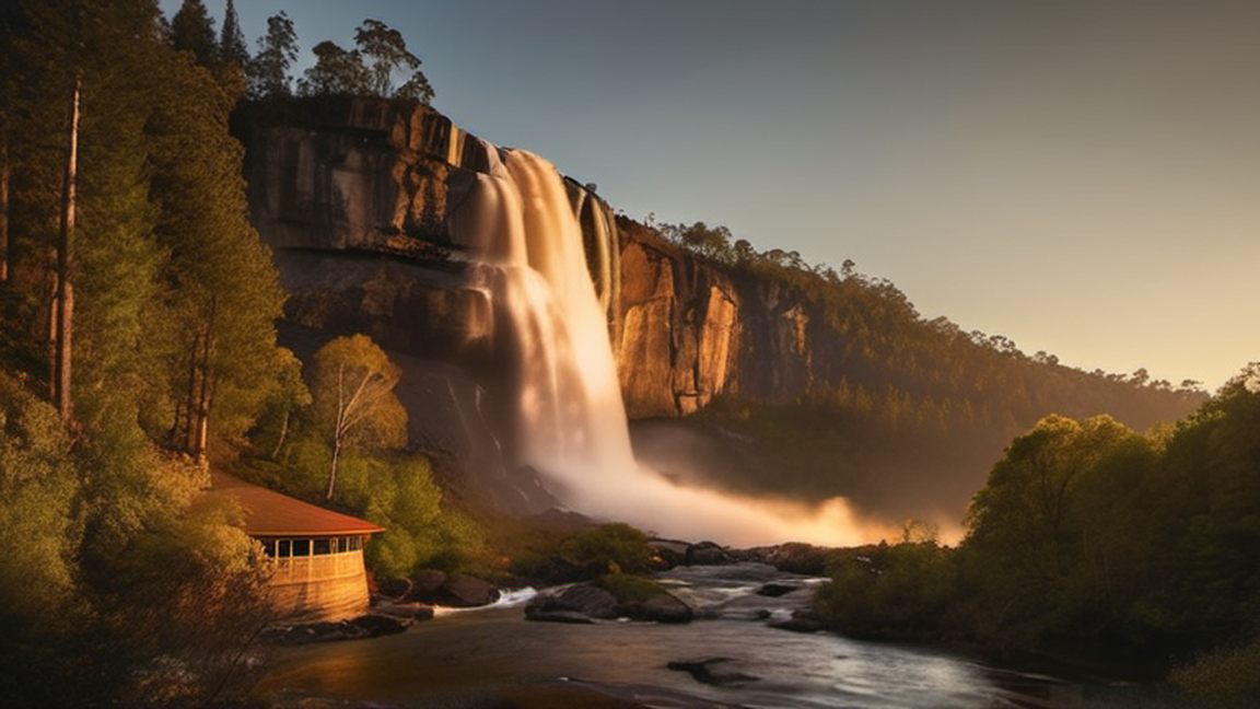
The Apsley Falls are two waterfalls on the Apsley River in the Northern Tablelands region of New South Wales, Australia. The falls are located about 20 kilometres (12 mi) east of Walcha, and 1 kilometre off the Oxley Highway in a deep gorge, that is part of the Oxley Wild Rivers National Park. They are the first falls in a succession of dramatic drops in an area that has some of the most remarkable scenery in Eastern Australia. The first drop of the falls is about 65 metres (213 ft) in depth, and the second, which is about 800 metres (2,625 ft) further on, plummets 58 metres (190 ft) to the bottom of the gorge.
Giant waterfall and gorge – that sums Apsley Falls in Oxley Wild Rivers National Park – a mid-sized precinct centring around the falls of its same name in the southern New England region of New South Wales. Although it is part of Oxley Wild Rivers National Park, it has no direct connection to any other part of the park – via car or foot – and in practice, is a park of its own.
Apsley had significance even thousands of years ago; the story of how the Rainbow Serpent created the Apsley Falls in the Dreamtime holds immense cultural significance. According to the tale, the Rainbow Serpent travelled underground from the base of the falls, reemerging 20 km upstream at Mill Hole on the Apsley River in Walcha. This site is marked with a mosaic of the Rainbow Serpent, created with the help of the local Indigenous community.
Beyond its cultural significance as a meeting place for Aboriginal people, the area also has a history tied to European exploration. On September 13, 1818, John Oxley passed by the falls, naming them Bathurst Falls. He described them as "one of the most magnificent waterfalls we have seen." Oxley also named nearby the Apsley River.
In 1902, three men built a wooden staircase that cross-crossed from the top of the gorge to the base of the falls. The timber for this risky and labour-intensive project was hand-cut using only axes and adzes. The original staircase was in use until 1932, when it was declared unsafe and partially dismantled. This marked the start of tourism to the falls.
Years later, after the wooden stairs had deteriorated, the Walcha Lions Club undertook the major task of building a steel staircase and halfway lookout. The local council supplied all the materials, and club members dedicated over 1,700 hours to complete the project before opening in October 1961.

Most visitors focus on the dramatic plunge, but the surrounding gorge rewards those who linger. A short, unsealed track leads along the riverbank, winding past ancient sandstone outcrops and pockets of fern‑laden woodland that feel worlds apart from the highway. The micro‑climate here supports a surprising diversity of birdlife; early morning is prime for spotting the elusive glossy black‑cockatoo or listening to the plaintive call of the eastern whipbird. Because the trail is relatively flat and well‑shaded, it makes an excellent option for families who want a gentle hike while still feeling immersed in the landscape’s ruggedness. Pack a water bottle, a light rain jacket and keep an eye out for the native brush-tailed rock-wallaby that occasionally darts across the path.
The visual drama of the falls peaks after heavy rain, when the river swells and the spray creates a fine mist that catches the low winter sun. However, the sheer volume of tourists can be noticeable during the school holidays. For a quieter experience, aim for late autumn (April–May) when rainfall is moderate and the surrounding eucalypt forest begins to turn amber. The cooler air sharpens the scent of eucalyptus, and the reduced humidity makes the gorge’s vertical walls appear cleaner, revealing subtle striations in the rock. Evening visits, just before sunset, provide a soft, golden glow that photographers cherish, while the nearby campgrounds become less congested.
Today Apsley Falls primarily remains as a stopover point for travellers driving along the Oxley Highway, which is particularly popular with motorcyclists. However, the nature of Oxley Highway and the fact that it sees very little use by car drivers and road trippers due to its obscure location means the park is often very quiet at most times of the day – if you visit on a weekday outside the holiday season, chances are you will be the only one in the park. It sees considerably fewer visitors compared to its similar counterparts such as Dorrigo or Ebor along Waterfall Way.
As part of being part of Oxley Wild Rivers National Park, which is in the Hastings-Macleay Group of Gondwana Rainforests of Australia, Apsley Falls is also a UNESCO World Heritage Site.
The steep walls of the upper Apsley Gorge are mainly caused by the vertical splitting of slate in the area. With this, in addition to the Apsley River that flows through the area, is what results in the 100+-metre-high Apsley Falls.
Around the gorge, you'll find forest vegetation with only a light undergrowth of shrubs. Some of the common plants include brambles, boomerang wattle (Acacia amoena), silver wattle (Acacia dealbata), fern-leaved wattle (Acacia filicifolia), and green briars. There are also tea trees, broad-leaved stringybark (Eucalyptus caliginosa), ribbon gum (Eucalyptus viminalis), narrow-leaved black peppermint (Eucalyptus nicholii), forest red gum, yellow box (Eucalyptus melliodora), hyacinth orchids (Dipodium punctatum), gorge hakea (Hakea fraseri), native broom (Jacksonia scoparia), and daisy shrubs.
The area is great for spotting wildlife. You might see bald eagles soaring on the thermals, kangaroos hopping around, colourful parrots like crimson rosellas, echidnas (also called spiny anteaters), and wallabies.
The climate is generally quite cool all-year around and there is no specific time that's better for visiting, though keep in mind that the elevation does mean you will need a jacket in winter and it can get a little bit hot during the summer. Unlike its counterparts on Waterfall Way, it does not always rain here; nonetheless you're still more likely to experience rain during the summer, but this also means that the falls are all the more grand.
Oxley Wild Rivers National Park website
The park is only accessible by car, but can be reached by 2WD all-year as all the park's roads are sealed.
Walcha is the closest town to the park – from Walcha, head 19 km east from the intersection between Thunderbolts Way and Oxley Highway. There will be signs indicating the approach to Apsley Falls around 1–2 km before the turnoff onto Apsley Falls Road. Pay extra attention as the approach can come rather quickly as you'll be travelling 110 km/h between the two. The same applies travelling west from Wauchope, except the park is 144 km west of Wauchope and it takes 2 hours from the east.
Once you have turned onto Apsley Falls Road, continue on the sealed road for a few hundred metres and parking will appear to your left. Parking is also available close to Apsley Falls itself.
Apsley Falls is in Oxley Wild Rivers National Park, which is not a fee-collecting park – meaning no fee required other than camping fees (if you're camping).
The core part of the park is no greater than 3 km across by foot; you can get around most of the park by foot, though from the campground you do have the option to drive a few hundred metres to get closer to the falls and both walking trails.
All roads in the park are strictly 40 km/h.
Everything in this section of the park is either on two walks, Gorge Rim Track (coloured on map) or Oxley Walk (coloured on map). Gorge Rim Circuit is the shorter of the two walks; if you're short on time, the shorter walk has most of the important sights, but Oxley is well worth a walk if you have the extra time.
The Gorge Rim Circuit is a 1.2-km loop trail, very easy and good if you're travelling with children who don't want to walk long distances. It should take no more than 30 minutes to complete, even with stops at all of the lookouts. The track also makes a spur to the campground; this part can be safely skipped if you aren't camping.
Starting clockwise from the picnic area, the lookouts on this circuit are as follows:
📍 1 Apsley Main Falls Lookout (McMillan Lookout). The main lookout where you can see Apsley Falls in its glory with its 123-metre-high drop – not much else to do other than enjoy the waterfall which in itself is the experience. Occasionally after heavy rain the mist from the waterfall may cross the gorge; make sure not to get your cameras wet! (updated Nov 2024)
📍 2 Lower Pool Lookout. Well, the water from Apsley Gorge has to flow somewhere; that somewhere is this tiny innocuous deep-plunge pool just further down along with great views of the gorge. (updated Nov 2024)
3 Landslide Lookout. 1987 marked a massive landslide that resulted in the giant slate walls in Apsley Gorge. A smaller landslide also added to this in 2005. The result of this is you being able to see massive gorge and the immense natural beauty that stemmed from it. (updated Nov 2024)
4 Lions Lookout. The final lookout along the walk further down – not much is unique about this lookout compared to the other three, except the colours of the walls which are to be admired. (updated Nov 2024)
Oxley Track in contrast is a much longer walk but still relatively short compared to most walking trails and is only 2.8 km return. Most of what you see on this track can be seen from Gorge Rim Circuit with the excepton of the Lower Falls which can only be seen from this track.
Some people also only walk along the suspension bridge and back as the bridge is quite the walk.
Lookouts and points of interests along the walk, starting from the picnic area, are as follows:
📍 5 Apsley Falls Suspension Bridge. A nice small neat suspension bridge with a good view of the stream before the falls. Just don't jump on it when others around... (updated Nov 2024)
6 Oxley Lookout. Very much a companion to Apsley Main Falls Lookout along the Gorge Rim Cct, except the views of the waterfall are a lot more clearer from here and you also get uninterrupted views of the gorge. (updated Nov 2024)
7 Chasm Lookout. Similar to Oxley and Lower Pool Lookouts but provides better views of the lower drop and the gorge, especially views that you cannot see from the other side of the gorge. (updated Nov 2024)
8 Lower Falls Lookout. Another lookout but with an even nicer view of the lower falls compared to the previous two lookouts. (updated Nov 2024)
9 Slate Walls Lookout. This lookout is very similar in nature to Landslide and Lions Lookouts on the Gorge Rim Circuit – however, unlike the other lookouts on this track, you're more likely to get better views from Lions Lookout than here. (updated Nov 2024)
There are no shops in Apsley Falls – bring your own supplies. If you forget, very basic/essential supplies can be purchased at nearby Walcha.
You will need to bring your own food. A picnic area, 1 Apsley Falls picnic area, near the suspension bridge, is a good place to bring the food you brought. However, keep in mind that picnic area only conssts of a single picnic bench and a single BBQ area. Although it is seldom used due to the low number of visitors, you'd be out of luck if it were in use. No bins are provided; please take your rubbish home.
Although water is available, it is non-potable and you are better off bringing your own water (or purchasing it from a supermarket in nearby Walcha). If you do use the water here, make sure to boil it for at least 10 minutes before consuming it.
The precinct only has one campground, which is the only place you may sleep within the park.
1 Apsley Falls Campground, Apsley Falls Camping Area Rd. Contains 14 campsites, all of which are marked. The campsite also has additional exclusive picnic tables and barbecue facilities. (updated Nov 2024)
Very little needs to be said about this section of the park other than what applies to most of regional NSW. Be wary for bushfires in the summer and watch out for the occasional snake on the walking tracks.
Your only options are to head west towards Walcha and thus Tamworth, a regional centre, or east towards Wauchope and Port Macquarie passing through Cottan-Bimbang National Park.
If you head east, Tia Falls is also worth a visit if you have the time. However, unlike Apsley Falls, there is no sealed road access, but it can comfortably be reached with an SUV.
Long before the landscape was marked on modern maps, the Wiradjuri people regarded the river and its cascades as a spiritual corridor. Oral histories speak of the water as a conduit for ancestral beings, with the two main drops representing steps in a ritual journey towards the Dreaming. While there are no formal visitor centres, modest signage near the highway offers a glimpse of this cultural narrative. Respectful travellers can enhance their visit by learning a few Wiradjuri words – for instance, ‘guyah’ meaning ‘water’ – and by observing the customary practice of leaving no trace, especially when picnicking on the river’s edge. Engaging with this perspective adds depth to the visual spectacle.
Two waterfalls on the Apsley River in New South Wales, Australia Apsley FallsThe second drop of the Apsley FallsLocationNorthern Tablelands, New South Wales, AustraliaCoordinates31°3′01″S 151°46′10″E / 31.05028°S 151.76944°E / -31.05028; 151.76944TypeCascadeTotal height123 metres (404 ft)Number of drops2Longest drop65 metres (213 ft) The Apsley Falls are two waterfalls on the Apsley River in the Northern Tablelands region of New South Wales, Australia. The falls are located about 20 kilometres (12 mi) east of Walcha, and 1 kilometre off the Oxley Highway in a deep gorge, that is part of the Oxley Wild Rivers National Park. They are the first falls in a succession of dramatic drops in an area that has some of the most remarkable scenery in Eastern Australia. The first drop of the falls is about 65 metres (213 ft) in depth, and the second, which is about 800 metres (2,625 ft) further on, plummets 58 metres (190 ft) to the bottom of the gorge.
[edit] The old wooden stairway, Apsley Falls, Walcha. Aboriginal people tell the story of how the Rainbow Serpent created the gorge at Apsley Falls in the Dreamtime. The Rainbow Serpent is said to travel underground from the base of the falls to reappear 20 km upstream at the Mill Hole on the Apsley River in Walcha. The site is now marked at the Mill Hole by the Rainbow Serpent mosaic made with the help of the local Aboriginal community. Apart from Aboriginal significance of the area as a meeting place, John Oxley passed by the falls on 13 September 1818 and he named them the Bathurst Falls. He described it as "one of the most magnificent waterfalls we have seen". Oxley named the Apsley River and wrote in his journal that he was "lost in astonishment at the sight of this wonderful natural sublimity". In 1902 three men, Ted Baker, Jim McMillan and "Wattie" Joiner built the wooden stairway that zigzagged its way from the top of the gorge to the water's edge. All timber used in this dangerous and mammoth task was hand dressed with an axe and adze by this trio. The original stairway was used until 1932, when it was declared unsafe and partly demolished. in 2020 the wooden stairway was fully demolished. Quite some time after parts of this stairway rotted and became dangerous, the Walcha Lions Club set about the huge task of erecting a steel staircase and viewing platform to halfway down the gorge. One of the Lions, Lindsay McMillan (son of the above Jim McMillan), designed the steel structure, lookout and platform. All materials were supplied by the Walcha Shire Council and it took the Lions Club members 1,745 hours to complete the job during 1961. The Lions were internationally, and justly, recognised for their tremendous contribution here. The official opening of the scenic stairway was on 14 October 1961 by the state member for Armidale, Davis Hughes.
[edit] The sheer sided walls of the upper Apsley Gorge are largely caused by the slate in this area which splits vertically. The gorge rim supports a vegetation of forest and woodland with a limited understorey of shrubby plants. Common plants include a number of wattles, Acacia amoena (boomerang wattle), Acacia dealbata (silver wattle), Acacia filicifolia (fern-leaved wattle), plus tea trees, Eucalyptus caliginosa (broad-leaved stringy barks), Eucalyptus viminalis (ribbon gums), Eucalyptus nicholii (narrow leaved peppermint), forest red gum, Eucalyptus melliodora (yellow box), Dipodium punctatum (hyacinth orchids), Hakea fraseri (gorge hakea), Jacksonia scoparia (dogwood or native broom) and daisy bush. Wedge-tailed eagles may be seen soaring on the thermals in the area. Kangaroos, crimson rosellas, echidnas also known as "spiny anteaters" and wallabies frequent the area.
[edit] Since the NSW National Parks & Wildlife Service took over they have constructed additional lookouts and walkways to view and photograph this magnificent gorge and the two falls. There are several short walks that can be taken from the car parks and these are highlighted in the information shelter erected in the area near the toilet facilities. The main falls and gorge can be easily viewed from a lookout accessible from the main carpark. in addition the Oxley Walk is a 2.7 km, 1+1⁄2 hours walk on a sealed walkway, which crosses the river via a footbridge, then continues around the northern side of the gorge. A further lookout offers fine views of the main falls (650 m) and the track continues past another three lookouts, where one can view a second waterfall and the dramatic cliffs of the chasm. This bridge was washed away in a flood on 28 December 2009, but the replacement was opened in June 2012. Good facilities are available for caravan or tent campers, including fire wood, toilets, interpretive information, hardened walking tracks, access for disabled people, ten viewing platforms, Aboriginal history, flora and fauna. A small camping fee applies. Dogs and other domestic pets are not allowed.