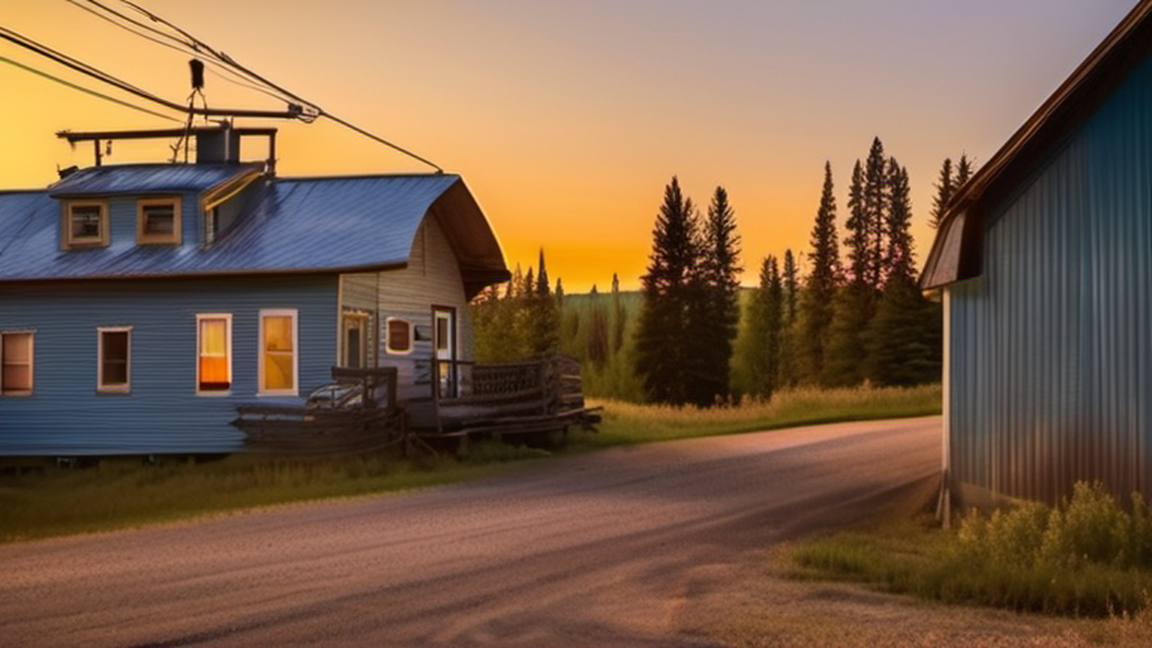
Alberta spans great, contrasting sceneries of mountains, forests and prairies. It offers the visitor six UNESCO World Heritage sites, preserving mountain vistas (Banff and Jasper National Parks), the world's largest inla
Alberta spans great, contrasting sceneries of mountains, forests and prairies. It offers the visitor six UNESCO World Heritage sites, preserving mountain vistas (Banff and Jasper National Parks), the world's largest inland delta and largest protected boreal forest (Wood Buffalo National Park), one of the world's great dinosaur fossil beds (Dinosaur Provincial Park), historic Indigenous rock art (Writing-on-Stone Provincial Park), and ancient buffalo hunting sites (Head Smashed In Buffalo Jump). And for sports fans, this is the home to one of the world's greatest rodeos every July in Calgary, two famous professional ice hockey teams, and one of the longest ski seasons in the northern hemisphere. Like colder versions of other oil towns (Houston comes to mind), the burgeoning cities of Edmonton and Calgary are adding new skyscrapers, museums, art galleries, concert venues, and libraries as these cities are still very much in their youth.
Alberta, Canada's fourth largest province by size and population, stretches from British Columbia at the Rocky Mountains in the west, to Saskatchewan in the east and from the Northwest Territories in the north, to Montana, U.S.A. in the south.
Alberta is a huge province, about three times the size of the United Kingdom (from where many of its people can trace a heritage) or nearly as large as Texas (with which is shares a historic connection though the cattle and petroleum industries). In this huge expanse of territory, only four and half million Albertans reside, and about half of those live in just the two main cities of Calgary and Edmonton, with most of the rest of population clustered near the main highways. The rest of the province has a tiny population, but is far from empty: on this land you will find Indigenous cultures that have survived here for thousands of years, rural settlements with a proud pioneering history, and new immigrants arriving daily from all corners of the world in one of the developed world's wealthiest and fastest-growing regions.
Alberta is not well known by non-Canadians, but if you do know much about it you might associate the province with the Rocky Mountains (which in truth are only found along Alberta's western boundary), perhaps the 1988 Winter Olympics which were held in Calgary, the cowboy country of Southern Alberta, or the controversial "oil sands"/"tar sands" of Fort McMurray.
In a province as large and dynamic as Alberta, there shouldn't be any problem finding enough to see and do, no matter what your travel style is.
Below are 8 cities frequently considered to have the most interest for the visitor.
1 Edmonton - the capital city of Alberta and the second largest urban population (1,010,899 city; 1,418,118 metro region). Known for the largest urban parks system in North America, North America's largest indoor shopping mall, and is self-proclaimed as "Canada's Festival City". Also home to Western Canada's largest indoor museum (since 2018), a huge outdoor museum, the provincial art gallery, a science centre, and an iconic pyramid-shaped plant conservatory.
2 Calgary - Alberta's largest city (1,306,784 city; 1,481,806 metro region). It is home to a beautiful river, nice museum, high-rise architecture, a world class zoo, and shopping. Famous for the 1988 Winter Olympics and the annual Calgary Stampede.
3 Banff - vacation destination in the Rockies offering a variety of outdoor activities. By far the busiest resort town in Alberta and one of the most popular in all of North America.
4 Drumheller - the dinosaur-lover's mecca, site of the Royal Tyrell Museum, the largest paleontology museum in Canada, set in the desert-like "badlands" landscape.
5 Jasper - Banff's northerly neighbour - less visited than Banff but no less stunning.
6 Lethbridge - a city in southern Alberta with a population of about 93,000 and most famous for "coulees" (canyons) and proximity to four world heritage sites.
7 Medicine Hat - is in southern Alberta with a population nearing 60,000. The main stop on the Trans-Canada Highway between Calgary and Regina, Saskatchewan and jumping-off point for the Cypress Hills.
8 Red Deer - midway between Edmonton and Calgary and, with about 100,000 people, the third largest city in the province behind those two. The main centre for tourist services in Central Alberta.
1 Banff National Park - the oldest and most famous of all of Canada's national parks, and home to the town of Banff which holds unique shopping and entertainment. Outside that, there's Lake Louise and world class skiing, hiking, and camping
2 Elk Island National Park - free ranging bison ("buffalo") and wapiti near Edmonton
3 David Thompson Country - a series of parks, campgrounds, and rustic lodges, along Highway 11 between Red Deer and the Rocky Mountains.
4 Jasper National Park - beautiful mountain and shopping attractions without the hustle of Banff
5 Kalyna Country - Alberta's Ukrainian ethnic enclave in Edmonton's eastern hinterland
6 Kananaskis Country - major natural recreation area in southern Alberta at the foot of the Rockies south of Calgary
7 Waterton Lakes National Park - a true natural gem in the Rockies in Alberta's extreme southwest
8 Wood Buffalo National Park - the largest national park in Canada home to the world's largest freshwater delta and free-ranging wood bison ("buffalo")
The province of Alberta inherited its name from one of the old districts of the North West Territories, which was named after an English princess, Louis Caroline Alberta, Duchess of Argyll (1848 – 1939), the sixth child and fourth daughter of Queen Victoria and Prince Albert.
Since Alberta gained self-government as a province in 1905, its capital has been Edmonton, which is roughly in the middle of the province, while the main centre in terms of corporate headquarters is Calgary to the south. Most of the population of Alberta lives along the "Highway 2 Corridor" between Edmonton and Calgary, although Lethbridge to the south, Grande Prairie to the northwest, and Fort McMurray to the northeast are also notable settlements of 50,000 or more.
Alberta is by far the richest province in Canada in terms of average salary. Its wealth is derived mainly from oil and gas production, though historically farming and cattle raising were important. Ranching maintains an important place in the economy and culture, particularly in Southern Alberta and seventy percent of the Canadian cattle herd is in Alberta. Alberta is subject to repeated booms and busts tied to the price of oil (and gas): when the United States began producing more oil and gas through fracking in the 2010s Alberta's economy suffered for most of the next decade, with the next Albertan boom not starting until the onset of the Russian full scale invasion of Ukraine (2022-present) and the consequent spike in energy prices.
Alberta is widely considered to be the most conservative area of Canada, however this is relative: Alberta has universal medical insurance, a social safety net and well-funded public education in a way that would seem "left wing" to many Americans. Its two largest cities, Calgary and Edmonton, each have growing urban light rail systems and local bus networks that are well patronized; with ridership per capita and per mile exceeding that of any US city, and ongoing construction to expand the light rail system. Nevertheless, Alberta is definitely distinct from the other provinces and has historically had a tense relationship with the federal government in Ottawa, mostly over control of natural resources. These days Albertan conservatism tends to express itself as a pro-business, pro-corporate and pro-development attitude, and a suspicion of environmentalism, especially if it's thought to be unfairly targeted against Alberta's petroleum industry by climate scientists and biased "outsiders" (usually other Canadians, but occasionally foreigners as well). This won't affect the average traveller, and many benefit as Alberta's taxes are lower than that of the rest of Canada (there is no provincial sales tax).
Deep in the interior of North America and cut off from the coasts by the Rockies to the west and the rugged Canadian Shield to the north and east, Alberta was one of the last parts of North America explored by Europeans, last to be effectively controlled by a colonial force, and the last agricultural region to be settled by non-Indigenous people. Yet this area experienced several dramatic turns in a few short decades, and went from being mostly wilderness in 1870 when it joined Canada (as a sort of colony) to a mostly agricultural but economically struggling full province by 1930, to the urbanized economic powerhouse of Canada by the 1970s, to major global investment hub and migration destination by the early 2000s, to global environmental pariah in the 2010s.
The original inhabitants were (and are) the various Indigenous peoples, who belong to a number of different ethno-linguistic groups (usually called "First Nations" in Canada, not "tribes" as in the US), namely the Cree, Blackfoot, Sarcee, Stoney, Chipewyan, Beaver, and Slavey. These peoples were all nomadic hunters at the time of European contact, so travellers will not find any giant temples or monuments to see. There are however, "stone circles" (like smaller versions of Stonehenge) and rock art (painting and carvings) as well as archaeological remains of camps and hunting sites, including World Heritage sites at Writing-on-Stone Provincial Park and Head Smashed In Buffalo Jump.
European goods arrived, second-hand, in what would be Alberta long before the European themselves did and the local Indigenous people were able to take advantage of the horse, firearms, metal tools, and so on, to make their lives much easier. However, with this trade new diseases were introduced that repeatedly devastated local communities over several centuries, opening the way for European expansion. Alberta was never seriously contested by any other European power besides Britain, or more precisely the Hudson's Bay Company (HBC), a privately-owned British corporation that made money by selling animal furs in England. The HBC did have to fend off incursions from other trading companies, however, by building posts further inland, reaching Edmonton by 1795. At the same time Christian missionaries from various denominations were competing to convert the natives, often setting up missions within the walls of the trading posts. Trading posts are preserved or rebuilt at several places around the province, notably Dunvegan, Fort Edmonton Park, Fort George and Buckingham House, Fort Victoria, and Rocky Mountain House, with major missionary sites at the Mission Hill historic district of St. Albert, Fort Victoria, and Pigeon Lake.
All of Alberta has a continental climate and is in the rain shadow of the Rockies, meaning it's mostly dry and there are profound differences between the seasons. Within Alberta there is considerable variation from north to south.
Northern Alberta has a subarctic climate; outside of Siberia, northern Alberta has some of the most dramatic seasonal variations in the world, with winter averages nearly 40 degrees Celsius lower than summer averages. Snow that falls in November often doesn't melt until April. Summers are brief but warm and dry.
The central and southern parts of the province are slightly warmer and drier than the north. The far south is effected in winter by the "Chinook winds" from the Pacific that can raise the temperature 20 °C in a matter of hours, so snow often melts there even in otherwise cold months.
Summers are mild to warm and very dry, with almost no rain showers and most summer precipitation being brought only by thunderstorms. Summer emperatures across much of the province are generally around 20 °C (68 °F) to 25 °C (77 °F) during the day and 10 °C (50 °F)to 15 °C (59 °F) at night, though mountainous locations near the border with British Columbia may have chillier summer nights around 5 °C (41 °F). There can still be days in the summer months where temperatures climb up to around 30 °C (86 °F) to 35 °C (95 °F).
As Alberta is a land of Indigenous peoples and immigrants, it should not be surprising some of Alberta's greatest literature is not in the English language. One of the greatest poets of the Icelandic language, Stephan G. Stephansson (1853 – 1927), lived on a pioneer farm in Central Alberta. Some of his poetry references his time in Alberta and is available in translation.
Perhaps the two most famous modern novels set in Alberta are about the struggles of ethnic minorities in this often majoritarian province. Obasan (1981) is the definitive novel of the internment of Japanese Canadians during the Second World War and is considered a classic of Canadian literature. Green Grass, Running Water (1993) is a novel of magical realism that intertwines a modern-day reworking of an Indigenous Blackfoot creation story with ordinary events on the Blackfoot Indian Reserve in Southern Alberta.
There are many movies and television shows that have been filmed in Alberta, but not set here (usually Alberta is masquerading as the Western United States). To see some of Alberta's best scenery, you can watch major Hollywood releases like Unforgiven (1992), The Revenant (2015), Brokeback Mountain (2005), The Assassination of Jesse James by the Coward Robert Ford (2007), Inception (2010), and Legends of the Fall (1994), and the HBO Series The Last of Us (2023-). But if you want to see something actually set in Alberta, try the television series Heartland (2007-2020).
Travel Alberta website
English is the main language spoken by most people in Alberta, and 98% of the population understands it to some degree. The main minority languages are French (6.7%), Tagalog (3.5%), and Spanish (2.6%), and although there are many other languages spoken by small communities within Alberta, you should only expect services at most businesses in English. The notable exceptions to this rule is that French is available at all federal government institutions (national parks, post offices, and Royal Canadian Mounted Police detachments), and services at provincial and municipal government offices are available in French in a few areas with significant Francophone communities. You might also find French services in the Campus Saint-Jean in Bonnie Doon neighbourhood, Edmonton.
First Nations languages such as Cree, Dené and Blackfoot are spoken to varying degrees among those communities as both mother tongue and as a second language, but travellers at First Nations art galleries or powwows (gatherings) will have no trouble being understood in English.
Calgary and Edmonton have international airports. Calgary's is the third largest in Canada (by passenger volume). It serves as the base of low-priced airline WestJet, which provides service to North American (mainly Canadian), Mexican and Caribbean destinations. Edmonton's was the fastest growing in Canada (before COVID) with multiple recent expansions, and had recovered to pre-pandemic levels as of early 2023. International service is provided by several carriers at both locations, including multiple direct flights to London and Frankfurt each day. Other destinations are usually connected to through Vancouver or Toronto. Both airports act as collection points, Calgary for the prairie provinces, and Edmonton for destinations in the Canadian North like Grande Prairie and Yellowknife.
VIA Rail Canada, toll-free: +1-888-842-7245. Operates trains routes across Canada. (updated Apr 2022) Operates the following routes in Alberta:
The Canadian (between Toronto, Ontario and Vancouver, British Columbia) two to three times per week. Stops in Alberta include Edmonton and Jasper. Other major stops include from Saskatoon, Saskatchewan and Winnipeg, Manitoba
"The Skeena" (between Jasper and Prince Rupert, British Columbia) Trip involves an overnight stay in Prince George, British Columbia. Operates twice per week.
Rider Express, toll-free: +1-833-583-3636. Operates intercity bus routes in western Canada. (updated Feb 2021) The following routes travel between Alberta and out of province destinations:
From Vancouver and Kamloops to Banff and Calgary.
From Regina and Saskatoon to Lloydminster and Edmonton.
Mountain Man Mike's Bus Service, ☏ +1-778-382-7729, info@mountainmanmikes.ca. Once per week bus service from Nelson and Cranbrook in British Columbia to Fort Macleod and Calgary. (updated Mar 2022)
There are land border crossing with the United States at (form west to east) Chief Mountain, Carway, Del Bonita, Coutts, Aden, and Wild Horse. The most important of which certainly Coutts, which connects Interstate 15 to Alberta Highway 4 onward to Lethbridge. Some of these may not operate 24 hours per day at all times of the year, so plan to cross the border during daylight hours or check the Canada Border Services Agency website for exact times.
To enter from British Columbia, there are a limited number highways (generally through mountain passes) that can be used, from north to south the most notable are where Highway 2 (in British Columbia) / Highway 43 (Alberta) crosses near Dawson Creek, Highway 16 (Yellowhead Highway) at Yellowhead Pass in Jasper National Park, Highway 1 (Trans-Canada Highway) at Kicking Horse Pass, Highway 93 crosses at Vermilion Pass, and Highway 3 (Crowsnest Highway) Crowsnest Pass.
From Saskatchewan, since there are no mountains in the way there are literally thousands of local roads connecting the two provinces but the main ones of interest to tourists would be (from north to south) the Highway 16 (Yellowhead Highway) connecting Saskatoon to Edmonton; Saskatchewan 14 where it meets Alberta 13 to connect either Saskatoon or Regina to Red Deer; Saskatchewan 7 where it meets Alberta 9 connecting Saskatoon to Calgary, Highway 1 (Trans-Canada Highway) to connect Regina to Medicine Hat, Lethbridge and Calgary.
From the Northwest Territories there is only one highway (NWT 1, Alberta 35), plus the option of using the infamous "ice roads" in the winter.
Hitchhiking is illegal and rare in Alberta, so this is not recommended, but it is possible if you're willing to take your chances.
The vast distances make cycling across Western Canada all but impossible, the lack of dedicated infrastructure also makes it relatively dangerous, and the sparsity of things to see in the spaces between towns (outside of the Rockies) makes it quite boring. This should not stop you from cycling within certain parts of Alberta, which is a much more manageable project. But if you're extremely fit, have lots of time to spare and like a challenge, you can legally cycle on all of Alberta's highways or try the part of the Trans Canada Trail that crosses the province.
Alberta is quite large and sparsely populated, as are most Canadian provinces. For some comparisons with other parts of the Commonwealth, Alberta is twice as big as Rajasthan (the largest state in India) but with 1/16th of its population, or three-quarters the size of Nigeria, but with 1/50th of the population.
Albertan cities are infamous for their low-density "suburban sprawl" and are thus really big, area wise and difficult to walk without at least a little assistance from other modes of travel. Luckily both Edmonton and Calgary have bicycle paths, light rail transit (LRT) trains, extensive bus networks, taxi fleets, ride-hailing apps, and since 2019, rentable electric scooters. Outside of those two cities, however, options are more limited.
Car travel is almost essential unless you plan on staying within Edmonton or Calgary. It is certainly possible, though expensive, to fly to many of the smaller cities from Edmonton or Calgary, although those places are even more car-dependent so you would need to rent a car while there or be essentially stranded. An inter-city "bus" (coach) is much cheaper than a flight but will take up a lot of time given the distances involved and still leaves you without a car when you arrive in an isolated small town.
Driving regulations are the same as in most of Canada. Turning right (far right lane into far right lane) on a red light is allowed. Drunk driving is taken very seriously, but is disproportionately seen in rural areas; take care when driving there at night. Wildlife is another major concern. When driving on the highways, maintain a reasonable speed and look for sudden movements on the side. The most common animal hit is the deer (white-tailed or mule), which is usually not fatal for the car. But running into an elk or moose could be so. Moose are very dark coloured so keep a close eye out for them. If you see animals on the side of the road it is common to want to slow down. Do so in a safe manner and don't needlessly impede traffic. Don't get out of your car to see the animals.
The Government of Alberta operates 511 Alberta, a free traveller information service that may be accessed via phone, mobile device, or computer. The information covers highway conditions, roadwork, major incidents, weather alerts, availability of ferry services, and waiting times at border crossings. Users within Alberta may access the information via phone toll-free by simply calling 5-1-1, similar to the way they would call 9-1-1 for emergencies or 4-1-1 for directory assistance. Computer and mobile device users may also visit the 511 Alberta web site at www.511.alberta.ca. Likewise the Alberta Motor Association (AMA) is another good source of specific information. Calgary and Edmonton offer traffic radio stations - government-funded radio that only reports accidents, construction and weather. Watch for signs featuring the frequency in these cities.
Do not heed any warning about Albertan drivers being the most aggressive drivers in Canada - a common myth. They are not more so than Toronto and certainly are nothing compared with Southern Europe. High speeds and lane changes without signalling are generally the worst it gets.
Banff AIrporter, ☏ +1-403-762-3330, toll-free: +1-888-449-2901. Operates a route between Calgary and Banff. (updated May 2022)
Brewster Express, toll-free: +1-866-606-6700. Bus service throughout the year between Calgary and Lake Louise including stop in Banff. Limited summer service to Jasper. (updated May 2022)
Cold Shot, ☏ +1 587-557-7719, support@coldshot.ca. Service from Edmonton to destinations in Northern Alberta, and Calgary. (updated Feb 2021)
Ebus, toll-free: +1 877-769-3287. Bus services connecting destinations in Alberta such as Calgary, Edmonton, Fort McMurray, and Red Deer. (updated Mar 2022)
FlixBus. Service from Edmonton, Red Deer, Calgary, Banff, Medicine Hat, and Lethbridge. (updated Apr 2024)
Mountain Man Mike's Bus Service, ☏ +1-778-382-7729, info@mountainmanmikes.ca. Weekly service between Calgary and Fort Macleod. (updated Mar 2022)
Red Arrow, toll-free: +1-800-232-1958, customerservice@redarrow.ca. Bus services connecting destinations in Alberta such as Calgary, Edmonton, Fort McMurray, Lethbridge, and Red Deer. (updated Feb 2021)
SunDog Tours, ☏ +1-780-852-4056, toll-free: +1-888-786-3641, info@sundogtours.com. Operates daily service between Edmonton and Jasper. (updated Sep 2021)
The Canada Bus, ☏ +1-403-668-9600, info@thecanadabus.com. Service between Calgary and Edmonton. (updated May 2022)
Driving west out of Calgary towards British Columbia, the Rockies rise dramatically and quickly. The drive through Banff, Jasper or Glacier National Park can be quite spectacular. The Icefields Parkway between the towns of Banff and Jasper is definitely not to be missed.
In Edmonton, West Edmonton Mall is one of the province's larger attractions. With over 800 retail shops and the world's largest indoor entertainment centre, it's entertaining even for the non-shoppers. Edmonton calls itself "Canada's Festival City" so there are many things to do throughout the summer, most notably the world's second oldest and largest Fringe Theatre Festival (just behind Edinburgh) in mid-August, the Edmonton Heritage Festival, the world's largest festival devoted to multiculturalism (first weekend of August), and a large midway and free-admission concert series in July called K-Days. The city also boasts North America's largest urban parkland system, which is very beautiful and completes the skyline over the North Saskatchewan River Valley.
Calgary offers the Calgary Stampede, the wild west-themed festival held every July complete with rodeos and fairs. One should also check out the Calgary Zoo and get a view from the top of the Calgary Tower.
It is easy for people from more densely populated and well-travelled Old World countries visiting Alberta (or Canada) to underestimate the vast distances involved, and the sparse availability of tourist-focused accommodations (as opposed to industry-focused), and other tourist services in the rural areas. Nevertheless, with proper research and planning, a pleasant trip is easily achievable.
Many Americans pass through Alberta on their way to the famous Alaska Highway. There are numerous routes to take to get to the start of the highway at Dawson Creek near the B.C.-Alberta border. The exact route you choose will largely depend on where in the United States you are coming from. Most people with budget and time constraints pick their route first and decide what to see along the way later. If, however, you are interested in seeing the best of Alberta, even if it takes you off the most direct path, then consult the "circle tour" below, which can easily be modified into a through route by doing either the western (Rocky Mountain) or eastern (prairie) sections.
If, however, you are mostly concerned about "making time", the most direct route from Montana would be Alberta Highway 2 (also called the Queen Elizabeth II Highway or "QE2") from Interstate 15 to Edmonton, a short bit of Alberta Highway 16 (Yellowhead Highway), then Alberta Highway 43 to Grande Prairie, and a short bit of Highway 2 again to Dawson.
If time and money are no object, there is also the famous "scenic route to Alaska" (if you think the thousands of miles of wilderness you're about to pass through aren't long and scenic enough) which follows Alberta Highway 40 and which provides a beautiful but isolated route from the Rockies to Grand Prairie.
Assuming you were starting in Calgary, had a week or more to spend, and didn't mind a few longer drives, this would cover virtually every major attraction in the province. It could be done in either direction, or using Edmonton or Lethbridge as the starting or end points instead.
From Calgary International Airport, drive 80 km (1 hr) to find Diamond Valley (former twin towns of Black Diamond and Turner Valley) which hosts Alberta's early energy industry history at the Turner Valley Gas Plant historic site (seasonal May to September). From there learn about two different historic industries at Bar U Ranch National Historic Site (35 km, 30 min) to learn about cowboy culture, then 129 km (1½ hr) to Crowsnest Pass to see the coal mining history of the region at Frank Slide and Leitch Collieries historic sites and a restored police barracks at the Crowsnest Museum. Camp or rent a cabin in Crowsnest.
The next day, drive to the UNESCO World Heritage Site at Head Smashed In Buffalo Jump (140 km, 1½ hr) to learn about ancient Indigenous hunting practices and then continue to Waterton Lakes National Park (100 km, 1 hr) to see the Rockies up close and stay there a day or two to hike, or take the lake ferry into Montana (USA) and back.
On the next travel day, drive to Cardston (55 km, ¾ hr) to see the grain elevators, Mormon temple, and Remington-Alberta Carriage Museum, then on to Writing-on-Stone Provincial Park (155 km, 1½ hr) to see the petroglyphs (rock carvings). This is the southernmost point, where you could continue into Montana if you like. You can also camp here or drive to Lethbridge (130 km, 1½ hr) for your choice of hotels and see the Japanese gardens while you are there. An extension is possible here to Cypress Hills Interprovincial Park as well.
From Lethbridge, it's 200 km (2¼ hr) to Dinosaur Provincial Park where you can have a guided bus tour and walk in the "badlands" and see the dig site where many of Alberta's dinosaur fossils have been found, and another 170 km (1¾ hr) to the Royal Tyrell Museum in Drumheller where those same fossils are displayed in one of the world's greatest dinosaur exhibits. Camping and hotels are both available in "Drum" but plan ahead as it is very busy during high season.
The next day drive 30 km (½ hr) north to the ghost town of Rowley (Alberta) to sight-see (or nearby Big Valley to see the "creation museum") before continuing to Wetaskiwin (190 km, 2 hr), to see the Reynolds-Alberta Museum with its huge collection of automobiles, aircraft, and machinery. The following day, drive 110 km (1¼ hr) to Elk Island National Park to explore the Ukrainian Cultural Heritage Village outdoor museum explaining Alberta's Eastern European heritage (seasonal May to September) and see the famous bison (buffalo) herds, then camp here or drive to Edmonton for a hotel (35 km to the easternmost suburbs, 50 km to the City Centre). While there, get lost in Canada's largest shopping mall and entertainment complex and see the art gallery, museum, and arena. This is the northernmost point on this itinerary, but only the centre of Alberta. Continue north from here if you are going to the Alaska Highway, for example.
Considered one of the world's most scenic single-day drives, from Lake Louise to Jasper, you drive right past the edge of the Columbia Glacier, the largest glacier in northern hemisphere outside of the Arctic.
This can easily to turned into a circle tour (see above) by adding stops in Edmonton and Calgary. It can also be part of a route to Alaska by linking with Alberta Highway 40 (see above).
During the mid twentieth century there was a mania for building roadside attractions in Alberta, especially if it could be called the "world's largest". For example:
1 World's biggest Baseball Bat – Edmonton (North Edmonton)
2 World's largest Baseball glove – Heisler
3 World's biggest Beaver – Beaverlodge
4 World's biggest Bee – Falher
5 World's biggest Chuckwagon – Dewberry
6 World's biggest Dinosaur – Drumheller
7 World's biggest Dragonfly – Wabamun
8 World's biggest Golf Putter – Bow Island
9 World's largest Golf Tee – Trochu
10 World's biggest Mallard Duck – Whitford Lake Bird Sanctuary (Andrew)
11 World's biggest Mushrooms – Vilna
12 World's largest Oil Lamp – Donalda
13 World's biggest Perogy – Glendon
14 World's biggest Piggy Bank – Crowsnest Pass (Coleman)
15 World's biggest Pysanka Easter Egg – Vegreville
16 World's largest Railroad Spike – Hines Creek
17 World's biggest Sausage – Mundare
18 Susie the World's largest Softball – Chauvin
19 World's biggest Star Trek Enterprise Replica – Vulcan
20 World's biggest Sun dial – Lloydminster
21 World's biggest Tipi – Medicine Hat
22 World's first UFO landing pad – St. Paul
23 World's largest Weather Vane – Westlock
24 World's largest Western Boot – Edmonton (West End)
For more, visit: Large Canadian Roadside Attractions
The major year-round places to learn about Indigenous culture would be the Royal Alberta Museum in Central Edmonton, Fort Edmonton Park in West Edmonton, the Glenbown Museum in downtown Calgary, the Buffalo Nations Luxton Museum in Banff, Blackfoot Crossing on the Siksika reserve near Strathmore, Head Smashed In Buffalo Jump near Fort Macleod, Heritage Park in Calgary, Tsuut'ina Nation Culture/Museum just outside Calgary. Seasonal sites include Metis Crossing in Kalyna Country, Writing-on-Stone Provincial Park near Milk River, and the Majorville Cairn and Medicine Wheel near Bassano.
One of the best ways to see Indigenous culture up close is to take in a "powwow" (a festival centred around dancing, drumming, and singing competitions). Most "reserves" (as First Nations communities are often called) have at least one each summer; for a listing see Windspeaker. There are also two famous ones attached to the Calgary Stampede and Edmonton's "K-Days" fair in July. Several stand-alone powwows are also found in cities now as well, often around National Indigenous Day on June 20th. Events are also common around National Truth and Reconciliation Day in late September or during National Métis Week during the first week of November. Increasingly, Indigenous themes are integrated into other types of festivals, such as the arts, notably the Dreamspeakers International Film Festival in Edmonton the last week of April and the Rubaboo Arts Festival the following week.
Indigenous-inspired cuisine is surprisingly difficult to find in Alberta, partly due to (overly?) strict regulations on using wild-harvested meats and plants. Compared to the Nordic countries, there is comparatively little emphasis on using wild foods among Albertan chefs. It is possible to find farmed bison and elk meat but it is much more expensive than beef for a similar taste, which perhaps explains the lack of uptake. The one Indigenous food than every Albertan knows, "bannock" (fry bread or flat bread), is very recent in origin. To be sure, for thousands of years Indigenous people here made various kinds of flat bread from flours made of maize, nuts, roots, and so on. But the modern recipe of wheat flour, lard, and baking soda, is entirely based on goods introduced by Canadian fur traders in the last 250 years. Nevertheless, bannock is considered thoroughly nativized, and you will find it at every museum and powwow.
Shopping for Indigenous souvenirs typically means leather clothing, especially moccasins (slippers) and mittens, decorated with glass beads. Other handicrafts could include tobacco pipes, saddles, parkas (fur coats) and ribbon skirts. Nowadays, however, many Indigenous artists prefer to work in media like sculpture and painting and their work can be found more often at art galleries than at souvenir shops on the sides of highways.
The main attraction in Alberta (outside of the two big cities) are the open spaces and the proximity to nature. This is a good place to visit if you like the idea of outdoor life.
Horse riding is a major attraction here, especially in the south and west: cowboy country. Guest ranches and trail rides are plentiful.
The ski resorts of Marmot Basin in Jasper National Park, and Sunshine Village, Lake Louise and Norquay in Banff National Park dish up almost every kind of terrain for the hardcore skier, yet allow novice skiers to have fun through green runs and long cruising runs. If the crowds bother you, there are other, smaller, ski areas in the province.
Great hiking can be had in the Rockies or on Alberta's sections of the Trans Canada Trail.
There are a few lakes that allow one to do boating, "sea-dooing" (jetskiing) or most other watersports despite Alberta's landlocked nature.
There are many excellent golf courses available to the public across the provinces. Areas of particular interest include the mountain parks where Banff Springs, Jasper Park Lodge, Kananaskis Country, Stewart Creek, and Silver Tip are recognized as some of Canada's best courses. Central Alberta also offers several excellent courses, including Wolf Creek and Alberta Springs. In the Edmonton area, popular courses include the Northern Bear, Cougar Creek, The Ranch, and Goose Hummock. In Drumheller, the back nine of the Dinosaur Point Golf Course features several very dramatic and spectacular holes.
Offroad driving using "quad" bikes, trucks, dirtbikes, and even snowmobiles is practically the official sport in Alberta. If it is loud, fast, and spews noxious emissions, it can be bought or rented in Alberta.
The biggest festivals in the province are the Calgary Stampede in July combining rodeo and carnival and Edmonton's Fringe Festival in August showcasing avant-garde theatre and street performers. However, hosting festivals has become the unofficial provincial obsession, especially in the short summer months, so expect local media and social media to have lots of suggestions every day from May to September and at least weekly the rest of the year. Notable genres of festival include modern folk music (Calgary, Edmonton, Canmore), film (Edmonton, Calgary, Banff), food trucks (Edmonton, Calgary), multi-ethnic food and dance (Edmonton, Calgary), rodeo (Calgary, Red Deer, Ponoka), as well as street festivals for each of the province's main ethnic communities, notably the Ukrainians (Edmonton, Calgary, Ukrainian Village museum, Vegreville, Lamont), Indigenous peoples (province-wide around summer solstice, as well as sporadically the rest of the year), and in Edmonton and Calgary: Caribbean carnivals, Latin American fiestas, Filipino street parties, and more.
Alberta is one of the world's heartlands of ice hockey. Two of world's top professional teams located here in Edmonton and Calgary playing from September to April, and if they qualify for the Stanley Cup playoffs, possibly as late as June. But if you'd just like an inexpensive taste of the game without overpriced beer, laser light shows, and deafening music that have infected the professional game, there are dozens of elite amateur and university teams found across the province. Hockey is so popular here that people had to enter a lottery just for the chance to buy tickets to the (later postponed) under-21 Men's World Championships in Edmonton and Red Deer in January 2022.
Winter sports more generally are easy to try here, with Calgary's Canada Olympic Park being a good place to try bobsleigh, for example. And every small town and city neighbourhood will have a skating rink with public skating times and a curling rink, where locals can show you how to throw a stone if you're willing to ask.
Rodeo is a major sport here as well, often tied in to the main fair of many towns, including even big-city Calgary. Check the "see" section above to watch rodeo, but you can't really "do" rodeo without being trained first. A better idea is to try a dude ranch first.
Alberta is a popular destination for international students, primarily at the university level, but also at colleges and high schools. There are dozens of institutions that are designated as international student ready, so the best idea is to consult the provincial government's website on the topic.
The most popular choice would undoubtedly be the University of Alberta in Edmonton which has one of Canada's largest medical schools and teaching hospitals as well as schools of dentistry, pharmacy, engineering, business, and others that are popular with foreign learners. Classes in all these disciplines are available in English and sometimes also in French. The University of Calgary also has a similar offering of faculties.
Since Alberta was settled after the industrial revolution was already well established, it completely lacks a regional food culture based on millennia of peasant traditions as one would expect in the Old World or even many local specialties based on a few generations of adaptation and hybridization as you might expect in longer-settled parts of North America. What it does have is an abundance of quality beef (and bison!), raised on its rich grasses and finished on local barley (not corn [maize], as in the US) and a high tolerance for international influences, going back right to the beginning when men from China's Fujian province often worked as cooks in railway-building camps. To this was added the British influence, American cowboy traditions, and continental European dishes. As a result the smallest towns will have a "Chinese café" usually serving an odd assortment of hamburgers, spring rolls, won ton soup, "perogies" (Ukrainian dumplings), and poutine. In the bigger towns and suburban neighbourhoods this quirky eclecticism has sadly been largely replaced by an assortment of chain restaurants. However, in the main resort towns of the Rockies one can find fine dining, and in the two major cities it is possible to find a number of more experimental restaurants as well as variety of ethnic dishes from every corner of the globe, due to recent immigration (Calgary has the province's only Uzbek restaurant, for example). The only thing truly hard to find is good seafood; but when in Rome do as the Romans do, and when in Alberta, go for beef. If you're vegetarian, you will still be distinctly in the minority and might suffer from a lack variety outside the major cities, though even the big chains are much better than in years past.
The drinking age is 18 - younger than most other provinces in Canada. Alcohol is available from the many private liquor stores and beer/wine stores throughout the province. Unlike other provinces, liquor retail is privatized, there's no government-owned alcohol monopoly; unlike most American states, you cannot buy alcohol directly in grocery stores, although many grocery stores have liquor stores in unattached buildings nearby.
Since 2018, possession of 30 grams of recreational cannabis has been legal everywhere in Canada. You can find cannabis retail stores in most towns and cities in Alberta, which has the most of any province. As with alcohol and unlike the other provinces Alberta has chosen to let private business do the selling.
Production of craft beer and spirits were significantly deregulated in 2015, leading to an explosion of new microbreweries and distilleries. The province is now home to a burgeoning craft scene. Even small towns like Lacombe are now home to breweries making once-obscure brews like fruited kettle sours.
The main attraction is West Edmonton Mall, which was the world's largest shopping centre from 1983 to 2004 and includes over 800 shops, an ice rink, an indoor waterslide park and wave pool, a bowling alley, a gun range, a minigolf course, an amusement park, a multiscreen cinema, a casino, two hotels, over 100 restaurants or food kiosks, several bars and nightclubs and parking for more than 20,000 vehicles. This is really more of an enclosed neighbourhood than a "mall" as typically conceived. It is Alberta's most visited attraction with over 32 million visitors each year.
Besides that, there are other smaller malls, typical "high streets" in Edmonton and Calgary and two notably large "power centres" (outdoor malls), South Edmonton Common in Edmonton and CrossIron Mills in Balzac near Calgary.
Uniquely among the provinces, Alberta does not have a provincial sales tax, although the federal 5% sales tax still applies and is added to the price at the till and is not shown on price tags.
The following areas of Alberta are considered higher risk areas with respect to crime.
Calgary - walking during night hours should be avoided in the East Village, Victoria Park, and the Bow River Pathway between Eau Claire Market and the Calgary Zoo. These areas are prone to drugs and prostitution. There are panhandlers on various downtown streets.
Edmonton - an area northeast of downtown is a prostitution stroll. There is also a stretch of Whyte Avenue that can be a problem after 7PM, given its high bar concentration.
Otherwise, Alberta as a whole is a relatively safe area. However common sense should be applied. Do not leave valuables visible in vehicles and lock all vehicle doors.
Growth in urban centres in Alberta has led to increased traffic. Allow plenty of time to reach a destination, especially during rush hour or during adverse weather.
Alberta's weather is very changeable and volatile, especially in the mountains and the foothills and also during the spring season. Driving conditions can deteriorate quickly. Before going out, always check the local forecast. Road conditions are available through the Alberta Motor Association.
During winter strong Chinook winds in the foothills, especially south of Calgary, can blow a vehicle off the road. Highways 2, 3, 4, 5, 6, 22 and 23 south of Calgary are the most vulnerable to these conditions, with Highway 22 usually being the worst. Extra caution is advised, particularly for higher-height vehicles such as trucks and SUVs.
Alberta has had cases of the West Nile Virus. In the spring and summer, it is wise to be protected using Deet-based repellents.
The area within and around the mountain parks is bear country. Hikers, hunters and campers in these areas should follow all bear safety tips. Campsites should be kept clean, all dishes properly washed, and all tables wiped clean after a meal. Never leave any food or garbage loose or unattended. Hikers should travel as a group, make noise regularly and stay on established trails. Pets should be kept out of bear country.
Taxis can be in short supply in Calgary and Edmonton at times, especially during holidays, poor weather, and on weekends. It is advisable to phone ahead in the daytime for a reservation if you realize you may need a taxi. In most cases, taxis are easily available at the airports.
During summers tornadoes are not uncommon and happen most in central Alberta. Edmonton has been hit by many tornadoes, the biggest of which was an F4 in 1987. Hail is very common during these storms — usually very small but sometimes as big as softballs. Check Environment Canada about risks.
Since Alberta shares the Rocky Mountains with British Columbia (to the west) and several American states (to the south and southwest), travellers interested in skiing, camping, hiking and other outdoor pursuits need not limit themselves to just the Albertan section of the mountain chain. The other major cities with notable attractions and international air connections near to Alberta—relatively, but still many hours drive away— would be Vancouver, Seattle, or Denver, though there are intra-U.S. connections via smaller airports like Billings or Spokane as well.
A less common path is to the east or southeast, into the wide open spaces of the Great Plains. Here there are no rail connections and few major airports, so driving is virtually a must. When travelling across Saskatchewan or the northern tier of the neighbouring states, you are far from the usual tourist trail, but you can find little-known natural gems here like Grasslands National Park or the Great Sandhills. For urban destinations, the only other main city on the Canadian Prairies to rival Calgary or Edmonton is Winnipeg, with its historic centre, Canadian Museum of Human Rights and an international airport. A little further to the south, major attractions like the Badlands and Black Hills region of South Dakota are accessible with enough time, and from there on to more commonly-travelled parts of the U.S.A.
The most adventurous next step from Alberta is certainly to the north, where literally millions of square miles of boreal forests are to be found. The Alaska Highway through the Yukon is the obvious choice in terms of routes to the great north country, but consider also the Northwest Territories for those who truly want to be off the beaten path.
Of course, once you've mastered the rugged-mountains-and-vast-arid-plains combination of Alberta perhaps you'd like to compare to similar experiences on the other side of the globe. Consider Australia's Great Dividing Range and Outback, Russia's Urals and Steppes, South Africa's Drakensberg and Veld, or Argentina's Andes and Pampas.

While Alberta’s economy is often summed up in terms of energy extraction, an emerging cultural circuit is reshaping its identity. In Calgary’s Beltline, former warehouse spaces now house experimental galleries, indie music venues and co‑working hubs that attract artists from across the Prairies. The annual Streetwise Arts Festival leverages the city’s expansive sky‑line, projecting light installations onto the towering CTT Tower, a reminder that the province’s visual narrative is extending beyond the rugged outdoors. For travellers keen on the contemporary side of Albertan life, a few evenings in these repurposed districts reveal a community negotiating its resource‑rich legacy with a fresh, urban aesthetic.
The plains and foothills of Alberta have been stewarded for millennia by the Blackfoot, Cree, and Dene peoples. Today, several Interpretive Centres – such as the Siksikaitsitapi Heritage Centre in Calgary – offer guided walks that foreground Indigenous place‑names and seasonal cycles long overlooked in conventional tour itineraries. Engaging with local knowledge keep you aware of the subtle ecological markers, from the timing of elk migrations to the bloom of sagebrush, which inform both traditional subsistence and modern conservation. Visitors who invest time in these narratives gain a layered understanding of the land that goes beyond its scenic vistas.
The HBC recruited its traders mostly from French Canada and Scotland's Orkney Islands. These traders often had temporary "country marriages" with local Indigenous women while posted in Canada, and from these mixed marriages by the 1810s, a new population had emerged and moved into the void left by the decimation of the original groups: the "half-breeds", known in French (and nowadays, also in English) as the Métis. Métis history is notably present at St. Albert and the Métis Crossing historic site.
When the new country of Canada bought the HBC's claim to what later became Alberta in 1869, the tiny population (perhaps ten thousand) was mostly First Nations or Métis. In order to solidify Canada's claim on the region, the famous "mounties" (North-West Mounted Police) were sent to Alberta in 1874, establishing outposts at Fort Walsh, Cardston, Lethbridge, and Fort Macleod near the American border, and Fort Calgary and Fort Saskatchewan further north There are reconstructions of those forts preserved as open-air museums in Fort Macleod and Fort Saskatchewan and a museum on the former site of Fort Calgary. Although called "police", these were paramilitary forts responsible for negotiating treaties with Indigenous peoples, expelling American traders and hunters who had moved across the so-called "medicine line" (49th parallel), and generally asserting Canada's claim to the area. The site of the signing of Treaty #7 between Canada and the Blackfoot Confederacy in 1877 is commemorated at Blackfoot Crossing.
At this time, Indigenous people in central and southern Alberta were suffering from the near-extinction of the bison, once their primary food source, so they signed treaties in the hope of getting desperately needed emergency assistance from the Canadians. When this aid didn't always arrive when and where it was needed or without strings attached, some Cree people in Alberta decided to join a campaign of violent resistance against Canada started by a Métis community in nearby Saskatchewan. The result was the massacre of white settlers at Frog Lake in 1885, the only instance of such an attack in Alberta's history. Canada responded by sending in the military via the newly-completed Canadian Pacific Railway, crushing Indigenous resistance, hanging several warriors, confining whole communities to their small reserve lands, taking away the children to be educated in missionary schools and generally beginning a long and dark chapter of Indigenous disenfranchisement in Alberta.
At the same time the federal government offered incentives for settlers to come to Alberta, and hundreds of thousands of people arrived in Alberta between 1885 and the First World War, many from elsewhere in Canada, but also with significant ethnic pockets in various regions, such as Austro-Hungarian subjects (Ukrainians, Poles, Romanians, etc.) in Eastern Alberta, Scandinavians in Central Alberta, and American Mormons in Southern Alberta. With this new labour, the economy shifted to the mass export of unprocessed natural resources, notably beef, lumber, and, especially, wheat. Several living history and outdoor museums interpret this era of mass settlement in Alberta, the largest of which are Fort Edmonton Park, Heritage Park in Calgary, and the Ukrainian Cultural Heritage Village. For sites related to expansion of particular industries, try Leitch Collieries or Atlas Coal Mine for coal mining, the Reynolds Alberta Museum or Remington Carriage Museum for transportation and agriculture, or Bar U Ranch for cattle ranching.
Alberta received self-government as a province in 1905, with Edmonton as the capital and the Alberta Legislature Building was built soon thereafter in 1913 in the midst of a major land boom in that city. Most of the heritage buildings in the Old Strathcona neighbourhood in Edmonton date from this time.
The Great War was a tense time, with most of the British-descended majority enthusiastically backing the war effort and enlisting in the Canadian Expeditionary Force in huge numbers, while looking with suspicion upon those who did not join up, with many recently-arrived German and Austro-Hungarian subjects (most of whom were ethnic Ukrainians) placed on watch lists or even interned in camps. For the province's military story, see the Military Museums in Calgary and the Prince of Wales Armoury in Edmonton, and for the history of internment consult the two church-run Ukrainian museums in Edmonton or see the internment sites in person near Banff and Jasper.
As well there were tensions with the more urbanized parts of Central Canada, as Albertan farmers were profiting from high wartime prices. This prosperity ground to a halt when wheat prices collapsed in 1921, just as the rest of North America was enjoying the "roaring twenties". This reignited simmering political tensions and led to the election of a United Farmers party government committed to bold social and political experimentation: women's suffrage and farmer-owned cooperatives taking over grain exporting from private companies were the two boldest examples. Their efforts were all but destroyed by the Great Depression, however, and Alberta defaulted on its debts in 1935, just as the United Farmers were replaced by Social Credit party, radical in a very different way. Social Credit tried to abolish banking and replace it with government-provided loans and a universal basic income scheme, but the plans were blocked by the courts and the federal government. This might have led to further tensions, but the Second World War intervened, and all sides rallied to the colours. For more on the turbulent politics of the early 20th century visit the Alberta Legislature or Government House (the former lieutenant governor's mansion) in Edmonton.
The Second World War again resulted in a "suspect" ethnic group being put into camps, this time the Japanese, who were forced to work on sugar beet farms near Taber and built difficult mountain roads, such through the Yellowhead Pass near Jasper. Besides the thousands who enlisted to serve in the Canadian Armed Forces, Alberta's other major contribution to the Allied war effort was the pilot training schools and network of airfields in Alberta that helped relay aircraft across to Alaska and on to the Soviet Union. This story is told at the Alberta Aviation Museum. Edmonton also served as the staging area for construction of the famous Alaska Highway, swelling its population with American engineers and soldiers.
Although natural gas had already been found decades earlier in the province, the decisive date in Alberta's economic history is February 13, 1947 when a major crude oil deposit was found at the Leduc No. 1 oil well near Edmonton. Within a generation, small towns mushroomed into major cities with new institutions. Notable landmarks from the 1950s and 1960s era include the main university campuses in Calgary and Lethbridge, the twin Jubilee Auditoria (concert halls) in Edmonton and Calgary, and the Calgary Tower and Edmonton's CN Tower. As well, many of the low-density residential suburbs ringing all of Alberta's town and cities date from this time.
During oil price spikes of the 1970s and 2000s, Alberta became one of the world's richest regions, attracting investment and immigrants from all over the globe, and this is reflected in the many skyscrapers in Edmonton and Calgary dating from those decades (or, more often, slightly after the boom had ended). But during price falls (the 1980s and 2010s) everything went into reverse, with companies and people leaving; while many projects were finished during these times that had been started earlier, almost no new major buildings were conceived or begun during these economic busts. For example Edmonton's famous giant shopping mall was planned in the 1970s but built in the 80s, Calgary's main arena and Olympic park were planned during good times but opened just ahead of the 1988 Winter Olympics in the midst of an otherwise depressed economy, and Edmonton's new provincial art gallery, provincial museum, main arena, and main library, were all built in the 2010s but with money made during the 2000s. Likewise, the two tallest buildings in the province the Stantec Tower (66 stories, 250 m, 2019) in Edmonton and Brookfield Place East (56 stories, 247 m, 2017) in Calgary were both planned during a boom and finished during a bust. The booms and bust don't just produce new buildings, they also destroy old ones: there are very few pre-1947 buildings left in most of central Calgary or Edmonton because they were bulldozed in boom times to make room for something new, allowed to deteriorate during busts until they were un-salvageable, or just demolished to save money: famously Calgary's main central hospital was blown up in 1998 as a cost-cutting measure by an austerity-minded provincial government.
As cyclical as the main cities are, in resource-dependent towns like Fort McMurray or Grande Prairie, the changes from boom to bust are even more dramatic. These are problems that Albertans have been grappling with for decades now, but they have grown more complicated since the 2010s as Indigenous people have reasserted their political influence over land-use decisions (particularly the route of pipelines) and international environmental opinion has turned against the fossil fuel industry. In the 2020s Alberta will certainly be one of the hot spots in a global debate over the future of the energy industry.
Edmonton to Jasper is the longest stretch on this itinerary at nearly 4 hours, so consider stopping at Wabamun Lake or Pembina River Provincial Park for a picnic, or go in to Edson or Hinton for a restaurant meal, or shorten the trip and stay in a cabin or tipi (indigenous-style tent) in Brule. At Jasper, you are back in the Rockies with lots of hikes to do or a gondola to ride if you prefer.
From Jasper the world-famous Icefields Parkway (230 km, 3 hr) takes you to Lake Louise, reputed to be one of the most beautiful places on earth. If you can afford it, the Chateau Lake Louis hotel is one of Canada's most famous, otherwise proceed to Banff (55 km, 45 min) or Canmore (an additional 25 km, 20 min) for more reasonable accommodations but still in the beautiful setting of the Canadian Rocky Mountains. There are more hikes and drives from here and the town of Banff is also home to several historic sites and museums and lots of touristy shops. From here, you can make side trips to Kananaskis Country for more mountains or Cochrane to get back to cowboy country.
Finally from Canmore to Calgary's airport is 120 km, or 1 hr 15 min in good traffic.
Alberta’s vastness rewards timing. Spring brings a brief window when the Icefields are still accessible but the notorious spring melt has receded, allowing quieter drives along the Icefields Parkway without the summer crowds. In contrast, autumn’s crisp air makes for ideal hiking in Kananaskis, when the aspen leaves turn gold and the temperature stays comfortably low for long treks. Winter, though harsh, opens a different world: the frozen Bow River becomes a scenic ice‑skating trail, and the province’s network of backcountry ski routes offers powder that rivals European resorts. Aligning your itinerary with these seasonal moods ensures you experience each facet of the province’s character.
Province of Canada This article is about the Canadian province. For other uses, see Alberta (disambiguation). Province in CanadaAlbertaProvince FlagCoat of armsMotto: Fortis et liber (Latin for 'strong and free') BC AB SK MB ON QC NB PE NS NL YT NT NU Coordinates: 54°30′N 115°00′W / 54.5°N 115°W / 54.5; -115CountryCanadaBefore confederationDistricts of Alberta, Assiniboia, Athabasca, SaskatchewanConfederationSeptember 1, 1905; 120 years ago (1905-09-01) (split from NWT) (10th, with Saskatchewan)CapitalEdmontonLargest cityCalgary Largest metroCalgary Region Government • TypeParliamentary constitutional monarchy • Lieutenant GovernorSalma Lakhani • PremierDanielle Smith LegislatureLegislative Assembly of AlbertaFederal representationParliament of CanadaHouse seats37 of 343 (10.8%)Senate seats6 of 105 (5.7%) Area • Total661,849 km2 (255,541 sq mi) • Land640,082 km2 (247,137 sq mi) • Water19,532 km2 (7,541 sq mi)  3% • Rank6th 6.6% of CanadaPopulation (2021) • Total4,368,370 • Estimate (Q1 2026)5,048,151 • Rank4th in Canada • Density6.82/km2 (17.7/sq mi)DemonymAlbertan Official languagesEnglish GDP • Rank3rd (provincial) • Total (2023)CA$459.288 billion • Per capitaCA$96,576 (2023)  (1st (provincial), ≈12th (see: List of countries by past and projected GDP (nominal) per capita (global)HDI • HDI (2023)0.943—Very high (3rd (provincial))Time zoneUTC−7 (Mountain) • Summer (DST)UTC−6 (Mountain DST)Canadian postal abbr.ABPostal code prefixTISO 3166 codeCA-ABFlowerWild roseTreeLodgepole pineBirdGreat horned owlWebsitealberta.caRankings include all provinces and territories Alberta is a province in Canada. It is a part of Western Canada and is one of the three prairie provinces. Alberta is bordered by British Columbia to its west, Saskatchewan to its east, the Northwest Territories to its north, and the U.S. state of Montana to its south. Alberta and Saskatchewan are the only two landlocked provinces. The eastern part of the province is occupied by the Great Plains, while the western part borders the Rocky Mountains. The province has a predominantly continental climate, but seasonal temperatures tend to swing rapidly due to its aridity. Those swings are less pronounced in western Alberta because of its occasional Chinook winds. Alberta is Canada's fourth-largest province by area, at 661,848 square kilometres (255,541 sq mi), and the fourth-most populous, with 4,262,635 residents. Alberta's capital is Edmonton; its largest city is Calgary. The two cities are Alberta's largest census metropolitan areas. More than half of Albertans live in Edmonton or Calgary, which encourages a continuing rivalry between the two cities. English is the province's official language. In 2016, 76.0% of Albertans were anglophone, 1.8% were francophone and 22.2% were allophone. Alberta's economy is advanced, open, market-based, and characterized by a highly educated workforce, strong institutions and property rights, and sophisticated financial markets. The service sector employs 80% of Albertans, in fields like healthcare, education, professional services, retail, tourism and financial services. The industrial base includes manufacturing, construction, and agriculture (10%, 5%, and 2% of employment respectively), while the knowledge economy includes about 3000 tech companies employing an estimated 60,000 people, mainly in Calgary and Edmonton. The energy sector employs 5% of Albertans but significantly impacts exports and GDP. Alberta's exports, primarily US-bound, consist of 70% oil and gas, 13% food products, and 12% industrial products. Oil and gas are culturally influential, having shaped politics, generated "striking it rich" narratives, and created boom-and-bust cycles. In 2023, Alberta's output was $350 billion, 15% of Canada's GDP. Until the 1930s, Alberta's political landscape consisted of two major parties: the centre-left Liberals and the agrarian United Farmers of Alberta. Today, Alberta is generally perceived as a conservative province. The right-wing Social Credit Party held office continually from 1935 to 1971 before the centre-right Progressive Conservatives held office continually from 1971 to 2015, the latter being the longest unbroken run in government at the provincial or federal level in Canadian history. The United Conservative Party has held office since 2019. Since before it became part of Canada, Alberta has been home to several First Nations, such as Plains Indians and Woodland Cree. It was historically also a territory used by fur traders of the rival companies Hudson's Bay Company and North West Company. The Dominion of Canada bought the lands that would become Alberta as part of the NWT in 1870. From the late 1800s to the early 1900s, many immigrants arrived in an effort to prevent the prairies from being annexed by the United States. Growing wheat and cattle ranching became very profitable during this period. In 1905, the Alberta Act was passed, creating the province of Alberta. Massive oil reserves were discovered in 1947. The exploitation of oil sands began in 1967. Alberta is renowned for its natural beauty and is home to important nature reserves. It is also well known as a rich source of fossils. It is home to six UNESCO-designated World Heritage Sites: the Canadian Rocky Mountain Parks, Dinosaur Provincial Park, Head-Smashed-In Buffalo Jump, Waterton-Glacier International Peace Park, Wood Buffalo National Park and Writing-on-Stone Provincial Park. Other popular sites include Banff National Park, Elk Island National Park, Jasper National Park, Waterton Lakes National Park, and Drumheller.
[edit] Alberta was named after Princess Louise Caroline Alberta (1848–1939), the fourth daughter of Queen Victoria. Princess Louise was the wife of John Campbell, Marquess of Lorne, Governor General of Canada (1878–83). Lake Louise and Mount Alberta were also named in her honour. The name "Alberta" is a feminine Latinized form of Albert, the name of Princess Louise's father, the Prince Consort (cf. Medieval Latin: Albertus, masculine) and its Germanic cognates, ultimately derived from the Proto-Germanic language *Aþalaberhtaz (compound of "noble" + "bright/famous").
[edit] Main article: Geography of Alberta A topographic map of Alberta, showing cities, towns, municipal district (county) and rural municipality borders, and natural features Alberta, with an area of 661,848 km2 (255,541 sq mi), is the fourth-largest province after Quebec, Ontario, and British Columbia. Alberta's southern border is the 49th parallel north, which separates it from the U.S. state of Montana. The 60th parallel north divides Alberta from the Northwest Territories. The 110th meridian west separates it from the province of Saskatchewan; while on the west, its boundary with British Columbia follows the 120th meridian west south from the Northwest Territories at 60°N until it reaches the Continental Divide at the Rocky Mountains, and from that point follows the line of peaks marking the Continental Divide in a generally southeasterly direction until it reaches the Montana border at 49°N. The province extends 1,223 kilometres (760 mi) north to south and 660 km (410 mi) east to west at its maximum width. Its highest point is 3,747 metres (12,293 ft) at the summit of Mount Columbia in the Rocky Mountains along the southwest border while its lowest point is 152 m (499 ft) on the Slave River in Wood Buffalo National Park in the northeast. With the exception of the semi-arid climate of the steppe in the south-eastern section, the province has adequate water resources. There are numerous rivers and lakes in Alberta used for swimming, fishing and a range of water sports. There are three large lakes, Lake Claire (1,436 km2 [554 sq mi]) in Wood Buffalo National Park, Lesser Slave Lake (1,168 km2 or 451 sq mi), and Lake Athabasca (7,898 km2 or 3,049 sq mi), which lies in both Alberta and Saskatchewan. The longest river in the province is the Athabasca River, which travels 1,538 km (956 mi) from the Columbia Icefield in the Rocky Mountains to Lake Athabasca. The largest river is the Peace River with an average flow of 2,100 cubic metres per second (74,000 cu ft/s). The Peace River originates in the Rocky Mountains of northern British Columbia and flows through northern Alberta and into the Slave River, a tributary of the Mackenzie River. Alberta's capital city, Edmonton, is located roughly at the geographic centre of the province. It is the most northerly major city in Canada and serves as a gateway and hub for resource development in northern Canada. With its proximity to Canada's largest oil fields, the region has most of western Canada's oil refinery capacity. Calgary is about 280 km (170 mi) south of Edmonton and 240 km (150 mi) north of Montana by highway, surrounded by extensive ranching country. Almost 75% of the province's population lives in the Calgary–Edmonton Corridor. The land grant policy to the railways served as a means to populate the province in its early years. Moraine Lake at Banff National Park. The Alberta Mountain forests makes up the southwestern boundary of Alberta. Most of the northern half of the province is boreal forest, while the Rocky Mountains along the southwestern boundary are largely temperate coniferous forests of the Alberta Mountain forests and Alberta–British Columbia foothills forests. The southern quarter of the province is prairie, ranging from shortgrass prairie in the southeastern corner to mixed grass prairie in an arc to the west and north of it. The central aspen parkland region extending in a broad arc between the prairies and the forests, from Calgary, north to Edmonton, and then east to Lloydminster, contains the most fertile soil in the province and most of the population. Much of the unforested part of Alberta is given over either to grain farming or cattle ranching, with mixed farming more common in the north and centre, while ranching and irrigated agriculture predominate in the south. The Alberta badlands are in southeastern Alberta, where the Red Deer River crosses the flat prairie and farmland, and features deep canyons and striking landforms. Dinosaur Provincial Park, near Brooks, showcases the badlands terrain, desert flora, and remnants from Alberta's past when dinosaurs roamed the then lush landscape. Climate[edit] Köppen climate types in Alberta Alberta extends for over 1,200 km (750 mi) from north to south; its climate, therefore, varies considerably. Average high temperatures in January range from 0 °C (32 °F) in the southwest to −24 °C (−11 °F) in the far north. The presence of the Rocky Mountains also influences the climate to the southwest, which disrupts the flow of the prevailing westerly winds and causes them to drop most of their moisture on the western slopes of the mountain ranges before reaching the province, casting a rain shadow over much of Alberta. The northerly location and isolation from the weather systems of the Pacific Ocean cause Alberta to have a dry climate with little moderation from the ocean. Annual precipitation ranges from 300 millimetres (12 in) in the southeast to 450 mm (18 in) in the north, except in the foothills of the Rocky Mountains where total precipitation including snowfall can reach 600 mm (24 in) annually. Southeastern Alberta features a semi-arid steppe climate. Northern Alberta is mostly covered by boreal forest and has a subarctic climate. The agricultural area of southern Alberta has a semi-arid steppe climate because the annual precipitation is less than the water that evaporates or is used by plants. The southeastern corner of Alberta, part of the Palliser Triangle, experiences greater summer heat and lower rainfall than the rest of the province, and as a result, suffers frequent crop yield problems and occasional severe droughts. Western Alberta is protected by the mountains and enjoys the mild temperatures brought by winter Chinook winds. Central and parts of northwestern Alberta in the Peace River region are largely aspen parkland, a biome transitional between prairie to the south and boreal forest to the north. Alberta has a humid continental climate with warm summers and cold winters. The province is open to cold Arctic weather systems from the north, which often produce cold winter conditions. As the fronts between the air masses shift north and south across Alberta, the temperature can change rapidly. Arctic air masses in the winter produce extreme minimum temperatures varying from −54 °C (−65 °F) in northern Alberta to −46 °C (−51 °F) in southern Alberta, although temperatures at these extremes are rare. In the summer, continental air masses have produced record maximum temperatures from 32 °C (90 °F) in the mountains to over 40 °C (104 °F) in southeastern Alberta. Alberta is a sunny province. Annual bright sunshine totals range between 1,900 up to just under 2,600 hours per year. Northern Alberta gets about 18 hours of daylight in the summer. The average daytime temperatures range from around 21 °C (70 °F) in the Rocky Mountain valleys and far north, up to around 28 °C (82 °F) in the dry prairie of the southeast. The northern and western parts of the province experience higher rainfall and lower evaporation rates caused by cooler summer temperatures. The south and east-central portions are prone to drought-like conditions sometimes persisting for several years, although even these areas can receive heavy precipitation, sometimes resulting in flooding. In the winter, the Alberta clipper, a type of intense, fast-moving winter storm that generally forms over or near the province and, pushed with great speed by the continental polar jetstream, descends over the rest of southern Canada and the northern tier of the United States. In southwestern Alberta, the cold winters are frequently interrupted by warm, dry Chinook winds blowing from the mountains, which can propel temperatures upward from frigid conditions to well above the freezing point in a very short period. During one Chinook recorded at Pincher Creek, temperatures soared from −19 to 22 °C (−2 to 72 °F) in just one hour. The region around Lethbridge has the most Chinooks, averaging 30 to 35 Chinook days per year. Calgary has a 56% chance of a white Christmas, while Edmonton has an 86% chance. After Saskatchewan, Alberta experiences the most tornadoes in Canada with an average of 15 verified per year. Thunderstorms, some of them severe, are frequent in the summer, especially in central and southern Alberta. The region surrounding the Calgary–Edmonton Corridor is notable for having the highest frequency of hail in Canada, which is caused by orographic lifting from the nearby Rocky Mountains, enhancing the updraft/downdraft cycle necessary for the formation of hail. Climate averages for communities in Alberta Community Region July dailymaximum January dailymaximum Annualprecipitation Planthardinesszone Medicine Hat Southern Alberta 28 °C (82 °F) −3 °C (27 °F) 323 mm (12.7 in) 4b Brooks Southern Alberta 28 °C (82 °F) −4 °C (25 °F) 301 mm (11.9 in) 4a Lethbridge Southern Alberta 26 °C (79 °F) 0 °C (32 °F) 380 mm (15 in) 4b Fort McMurray Northern Alberta 24 °C (75 °F) −12 °C (10 °F) 419 mm (16.5 in) 3a Wetaskiwin Central Alberta 24 °C (75 °F) −5 °C (23 °F) 497 mm (19.6 in) 3b Edmonton Edmonton Metropolitan Region 23 °C (73 °F) −6 °C (21 °F) 456 mm (18.0 in) 4a Cold Lake Northern Alberta 23 °C (73 °F) −10 °C (14 °F) 421 mm (16.6 in) 3a Camrose Central Alberta 23 °C (73 °F) −6 °C (21 °F) 438 mm (17.2 in) 3b Fort Saskatchewan Edmonton Metropolitan Region 23 °C (73 °F) −7 °C (19 °F) 455 mm (17.9 in) 3b Lloydminster Central Alberta 23 °C (73 °F) −10 °C (14 °F) 409 mm (16.1 in) 3a Red Deer Central Alberta 23 °C (73 °F) −5 °C (23 °F) 486 mm (19.1 in) 4a Grande Prairie Northern Alberta 23 °C (73 °F) −8 °C (18 °F) 445 mm (17.5 in) 3b Leduc Edmonton Metropolitan Region 23 °C (73 °F) −6 °C (21 °F) 446 mm (17.6 in) 3b Calgary Calgary Metropolitan Region 23 °C (73 °F) −1 °C (30 °F) 419 mm (16.5 in) 4a Chestermere Calgary Metropolitan Region 23 °C (73 °F) −3 °C (27 °F) 412 mm (16.2 in) 3b St. Albert Edmonton Metropolitan Region 22 °C (72 °F) −6 °C (21 °F) 466 mm (18.3 in) 4a Lacombe Central Alberta 22 °C (72 °F) −5 °C (23 °F) 446 mm (17.6 in) 3b Ecology[edit] Flora[edit] The wild rose is the provincial flower of Alberta. In central and northern Alberta the arrival of spring is marked by the early flowering of the prairie crocus (Pulsatilla nuttalliana) anemone; this member of the buttercup family has been recorded flowering as early as March, though April is the usual month for the general population. Other prairie flora known to flower early are the golden bean (Thermopsis rhombifolia) and wild rose (Rosa acicularis). Members of the sunflower (Helianthus) family blossom on the prairie in the summer months between July and September. The southern and east central parts of Alberta are covered by short prairie grass, which dries up as summer lengthens, to be replaced by hardy perennials such as the prairie coneflower (Ratibida), fleabane, and sage (Artemisia). Both yellow and white sweet clover (Melilotus) can be found throughout the southern and central areas of the province. The trees in the parkland region of the province grow in clumps and belts on the hillsides. These are largely deciduous, typically aspen, poplar, and willow. Many species of willow and other shrubs grow in virtually any terrain. North of the North Saskatchewan River, evergreen forests prevail for thousands of square kilometres. Aspen poplar, balsam poplar (Populus balsamifera) or in some parts cottonwood (Populus deltoides), and paper birch (Betula papyrifera) are the primary large deciduous species. Conifers include jack pine (Pinus banksiana), Rocky Mountain pine, lodgepole pine (Pinus contorta), both white and black spruce, and the deciduous conifer tamarack (Larix laricina). Fauna[edit] A bighorn sheep in Kananaskis Country. The bighorn sheep is the provincial mammal of Alberta. The four climatic regions (alpine, boreal forest, parkland, and prairie) of Alberta are home to many different species of animals. The south and central prairie was the homeland of the American bison, also known as buffalo, with its grasses providing pasture and breeding ground for millions of buffalo. The buffalo population was decimated during early settlement, but since then, buffalo have made a comeback, living on farms and in parks all over Alberta. Herbivores are found throughout the province. Moose, mule deer, elk, and white-tailed deer are found in the wooded regions, and pronghorn can be found in the prairies of southern Alberta. Bighorn sheep and mountain goats live in the Rocky Mountains. Rabbits, porcupines, skunks, squirrels, and many species of rodents and reptiles live in every corner of the province. Alberta is home to only one venomous snake species, the prairie rattlesnake. Alberta is home to many large carnivores such as wolves, grizzly bears, black bears, and mountain lions, which are found in the mountains and wooded regions. Smaller carnivores of the canine and feline families include coyotes, red foxes, Canada lynx, and bobcats. Wolverines can also be found in the northwestern areas of the province. Alberta Department of Public Health rat poster (1948) Central and northern Alberta and the region farther north are the nesting ground of many migratory birds. Vast numbers of ducks, geese, swans and pelicans arrive in Alberta every spring and nest on or near one of the hundreds of small lakes that dot northern Alberta. Eagles, hawks, owls, and crows are plentiful, and a huge variety of smaller seed and insect-eating birds can be found. Alberta, like other temperate regions, is home to mosquitoes, flies, wasps, and bees. Rivers and lakes are populated with pike, walleye, whitefish, rainbow, speckled, brown trout, and sturgeon. Native to the province, the bull trout, is the provincial fish and an official symbol of Alberta. Turtles are found in some water bodies in the southern part of the province. Frogs and salamanders are a few of the amphibians that make their homes in Alberta. Alberta is the only province in Canada—as well as one of the few places in the world—that is free from Norwegian rats. Since the early 1950s, the Government of Alberta has operated a rat-control program, which has been so successful that only isolated instances of wild rat sightings are reported, usually of rats arriving in the province aboard trucks or by rail. In 2006, Alberta Agriculture reported zero findings of wild rats; the only rat interceptions have been domesticated rats that have been seized from their owners. It is illegal for individual Albertans to own or keep Norwegian rats of any description; the animals can only be kept in the province by zoos, universities and colleges, and recognized research institutions. In 2009, several rats were found and captured, in small pockets in southern Alberta, putting Alberta's rat-free status in jeopardy. A colony of rats was subsequently found in a landfill near Medicine Hat in 2012 and again in 2014. Paleontology[edit] Specimens at the Royal Tyrrell Museum of Palaeontology, in the Horseshoe Canyon Formation at Dinosaur Provincial Park. Some of the specimens, from left to right, are Hypacrosaurus, Edmontosaurus, Lambeosaurus, Gorgosaurus (both in the background), Tyrannosaurus, and Triceratops. Alberta has one of the greatest diversities and abundances of Late Cretaceous dinosaur fossils worldwide. Taxa are represented by complete fossil skeletons, isolated material, microvertebrate remains, and even mass graves. At least 38 dinosaur type specimens were collected in the province. The Foremost Formation, Oldman Formation and Dinosaur Park Formations collectively compose the Judith River Group and are the most thoroughly studied dinosaur-bearing strata in Alberta. Dinosaur-bearing strata are distributed widely throughout Alberta. The Dinosaur Provincial Park area contains outcrops of the Dinosaur Park Formation and Oldman Formation. In Alberta's central and southern regions are intermittent Scollard Formation outcrops. In the Drumheller Valley and Edmonton regions there are exposed Horseshoe Canyon facies. Other formations have been recorded as well, like the Milk River and Foremost Formations. The latter two have a lower diversity of documented dinosaurs, primarily due to their lower total fossil quantity and neglect from collectors who are hindered by the isolation and scarcity of exposed outcrops. Their dinosaur fossils are primarily teeth recovered from microvertebrate fossil sites. Additional geologic formations that have produced only a few fossils are the Belly River Group and St. Mary River Formations of the southwest and the northwestern Wapiti Formation, which contains two Pachyrhinosaurus bone beds. The Bearpaw Formation represents strata deposited during a marine transgression. Dinosaurs are known from this formation, but represent specimens washed out to sea or reworked from older sediments.
[edit] Main article: History of Alberta See also: Timeline of Alberta history Blackfoot Confederacy warriors in Macleod in 1907 Paleo-Indians arrived in what would later be Alberta at least 10,000 years ago, toward the end of the last ice age. They are thought to have migrated from Siberia to Alaska on a land bridge across the Bering Strait and then possibly moved south along the east side of the Rocky Mountains through Alberta, settling along the way or moving on to settle other parts of the Americas. Others may have travelled south along the west coast and then moved inland. Over time they differentiated into various First Nations peoples, including the Plains Indians of southern Alberta such as those of the Blackfoot Confederacy and the Plains Cree, who generally lived by hunting buffalo, and the more northerly tribes such as the Woodland Cree and Chipewyan who hunted and trapped other types of animals, and fished for a living. The first Europeans to visit Alberta were French Canadian fur traders in the early 18th century. The first British subject to visit Alberta was Anthony Henday, in 1754. French Canadians integrated with local First Nations creating the Metis nation, with elements across the Prairies. French was the predominant European language in Alberta and was used in some early fur trading forts in the region, such as the first Fort Edmonton (in present-day Fort Saskatchewan), operated by the Hudson's Bay Company (HBC). After the British arrival in Canada, approximately half of Alberta's current territory, south of the Athabasca River drainage, became part of Rupert's Land, which consisted of all land drained by rivers flowing into Hudson Bay. This area was granted by King Charles II of England to the Hudson's Bay Company in 1670, and rival fur trading companies were not allowed to trade in it. The Athabasca River and the rivers north of it were not in HBC territory, because they drained into the Arctic Ocean instead of Hudson Bay. The north part of Alberta was a prime habitat for fur-bearing animals and was targeted by the HBC and other fur trading companies. The first European explorer of the Athabasca region was fur trader Peter Pond, who learned of the Methye Portage, a convenient route to travel from rivers in the Hudson Bay watershed to rivers north of Rupert's Land. He and other Canadian fur traders formed the North West Company (NWC) of Montreal in 1779, to compete with the HBC. The NWC built posts at many points across the northern part of Alberta territory. Peter Pond built Fort Athabasca on Lac la Biche in 1778. Roderick Mackenzie built Fort Chipewyan on Lake Athabasca ten years later in 1788. His cousin, Sir Alexander Mackenzie, followed the North Saskatchewan River to its northernmost point near Edmonton, then trekked on foot to the Athabasca River, which he followed downstream to Lake Athabasca. It was there he discovered the mighty outflow river that bears his name –  the Mackenzie River –  which he followed to its outlet in the Arctic Ocean. Returning to Lake Athabasca, he followed the Peace River upstream and crossed the Rockies, eventually reaching the Pacific Ocean, and so he became the first European to cross the North American continent north of Mexico. The extreme southernmost portion of Alberta was part of the French (and Spanish) territory of Louisiana, which was sold to the United States in 1803. In the Treaty of 1818, the portion of the Louisiana territory north of the Forty-Ninth Parallel was ceded to the United Kingdom. The area was grouped with Rupert's Land to make the North-Western Territory. Fort Chipewyan, a trading post and regional headquarters for the Hudson's Bay Company in 1820 Fur trade expanded in the north, but there was intense friction and competition between the rival HBC and NWC. In 1821 the British government forced them to merge to stop the hostilities. After amalgamation, the Hudson's Bay Company dominated the economy of Alberta until 1870, when HBC control of Rupert's Land was ended and the territory was transferred to the newly federated Canada. Southern Alberta, Northern Alberta, other parts of the Northland and Rupert's land became Canada's North-West Territories. Downtown Calgary was one of several areas afflicted during the 2013 Alberta floods. First Nations and representatives of the Crown negotiated the Numbered Treaties, in which the Crown gained title to the land that would later become Alberta, and the Crown committed to the ongoing support of the First Nations and guaranteed their hunting and fishing rights. The most significant treaties for Alberta are Treaty 6 (1876), Treaty 7 (1877) and Treaty 8 (1899). The District of Alberta was created as part of the North-West Territories on 8 May 1882. As settlement increased, local representatives to the North-West Legislative Assembly and the House of Commons were elected, and senators appointed, to represent Alberta. After a long campaign for autonomy, on 1 September 1905, the District of Alberta was enlarged and given provincial status, with the election of a Liberal majority with Alexander Cameron Rutherford as the first premier. At first the economy was very active, then around 1912, Alberta suffered a recession. The First World War presented special challenges to the new province as an extraordinary number of working-age men volunteered for active service, leaving relatively few workers to maintain services and production. Over 50% of Alberta's doctors volunteered for service overseas. In 1918 Albertans experienced the 1918 flu epidemic. Alberta voters sought innovation, electing a Farmers government in 1921, then the world's first Social Credit government in 1935. Alberta's economy stayed sluggish, especially during the Depression. But discovery of oil at Leduc in 1946 opened a new era of prosperity and wealth for the province. On June 21, 2013, during the 2013 Alberta floods Alberta experienced heavy rainfall that triggered catastrophic flooding throughout much of the southern half of the province along the Bow, Elbow, Highwood and Oldman rivers and tributaries. A dozen municipalities in Southern Alberta declared local states of emergency on June 21 as water levels rose and numerous communities were placed under evacuation orders. In 2016, the Fort McMurray wildfire resulted in the largest fire evacuation of residents in Alberta's history, as more than 80,000 people were ordered to evacuate. Like the rest of the world, Alberta was affected by the COVID-19 pandemic starting in 2020. The last restrictions were lifted in 2022.
[edit] Main article: Demographics of Alberta Population density of Alberta The 2021 Canadian census reported Alberta had a population of 4,262,635 living in 1,633,220 of its 1,772,670 total dwellings, a 4.8% change from its 2016 population of 4,067,175. With a land area of 634,658.27 km2 (245,042.93 sq mi), it had a population density of 6.7/km2 in 2021. Statistics Canada estimated the province to have a population of 4,931,601 in Q4 of 2024. Since 2000, Alberta's population has experienced a relatively high rate of growth, mainly because of its burgeoning economy. Between 2003 and 2004, the province had high birthrates (on par with some larger provinces such as British Columbia), relatively high immigration, and a high rate of interprovincial migration compared to other provinces. In 2016, Alberta continued to have the youngest population among the provinces with a median age of 36.7 years, compared with the national median of 41.2 years. Also in 2016, Alberta had the smallest proportion of seniors (12.3%) among the provinces and one of the highest population shares of children (19.2%), further contributing to Alberta's young and growing population. About 81% of the population lives in urban areas and only about 19% in rural areas. The Calgary–Edmonton Corridor is the most urbanized area in the province and is one of the most densely populated areas of Canada. Many of Alberta's cities and towns have experienced very high rates of growth in recent history.[when?] Alberta's population rose from 73,022 in 1901 to 3,290,350 according to the 2006 census. According to the 2016 census Alberta has 779,155 residents (19.2%) between the ages of 0–14, 2,787,805 residents (68.5%) between the ages of 15–64, and 500,215 residents (12.3%) aged 65 and over. Additionally, as per the 2016 census, 1,769,500 residents hold a postsecondary certificate, diploma or degree, 895,885 residents have obtained a secondary (high) school diploma or equivalency certificate, and 540,665 residents do not have any certificate, diploma or degree. Municipalities[edit] Main article: List of communities in Alberta Largest metro areas and municipalities by population as of 2016 Census metropolitan areas: 2016 2011 2006 2001 1996 Calgary CMA 1,392,609 1,214,839 1,079,310 951,395 821,628 Edmonton CMA 1,321,426 1,159,869 1,034,945 937,845 862,597 Lethbridge CMA 117,394 105,999 95,196 87,388 82,025 Urban municipalities (10 largest): 2016 2011 2006 2001 1996 Calgary 1,239,220 1,096,833 988,193 878,866 768,082 Edmonton 932,546 812,201 730,372 666,104 616,306 Red Deer 100,418 90,564 82,772 67,707 60,080 Lethbridge 92,729 83,517 78,713 68,712 64,938 St. Albert (included in Edmonton CMA) 65,589 61,466 57,719 53,081 46,888 Medicine Hat 63,260 60,005 56,997 51,249 46,783 Grande Prairie 63,166 55,032 47,076 36,983 31,353 Airdrie (included in Calgary CMA) 61,581 42,564 28,927 20,382 15,946 Spruce Grove (included in Edmonton CMA) 34,066 26,171 19,496 15,983 14,271 Leduc (included in Edmonton CMA) 29,993 24,304 16,967 15,032 14,346 Specialized/rural municipalities (5 largest): 2016 2011 2006 2001 1996 Strathcona County (included in Edmonton CMA) 98,044 92,490 82,511 71,986 64,176 Regional Municipality of Wood Buffalo (includes Fort McMurray) 71,589 65,565 51,496 42,581 35,213 Rocky View County (included in Calgary CMA) 39,407 36,461 34,171 29,925 23,326 Parkland County (included in Edmonton CMA) 32,097 30,568 29,265 27,252 24,769 Municipal District of Foothills No. 31 22,766 21,258 19,736 16,764 13,714 Language[edit] Main article: Demographics of Alberta § Languages As of the 2021 Canadian Census, the ten most spoken languages in the province included English (4,109,720 or 98.37%), French (260,415 or 6.23%), Tagalog (172,625 or 4.13%), Punjabi (126,385 or 3.03%), Spanish (116,070 or 2.78%), Hindi (94,015 or 2.25%), Mandarin (82,095 or 1.97%), Arabic (76,760 or 1.84%), Cantonese (74,960 or 1.79%), and German (65,370 or 1.56%). The question on knowledge of languages allows for multiple responses. As of the 2016 census, English is the most common mother tongue, with 2,991,485 native speakers. This is followed by Tagalog, with 99,035 speakers, German, with 80,050 speakers, French, with 72,150 native speakers, and Punjabi, with 68,695 speakers. The 2006 census found that English, with 2,576,670 native speakers, was the most common mother tongue of Albertans, representing 79.99% of the population. The next most common mother tongues were Chinese with 97,275 native speakers (3.02%), followed by German with 84,505 native speakers (2.62%) and French with 61,225 (1.90%). Other mother tongues include: Punjabi, with 36,320 native speakers (1.13%); Tagalog, with 29,740 (0.92%); Ukrainian, with 29,455 (0.91%); Spanish, with 29,125 (0.90%); Polish, with 21,990 (0.68%); Arabic, with 20,495 (0.64%); Dutch, with 19,980 (0.62%); and Vietnamese, with 19,350 (0.60%). The most common aboriginal language is Cree 17,215 (0.53%). Other common mother tongues include Italian with 13,095 speakers (0.41%); Urdu with 11,275 (0.35%); and Korean with 10,845 (0.33%); then Hindi 8,985 (0.28%); Persian 7,700 (0.24%); Portuguese 7,205 (0.22%); and Hungarian 6,770 (0.21%). According to Statistics Canada, Alberta is home to the second-highest proportion (2%) of Francophones in western Canada (after Manitoba). Despite this, relatively few Albertans claim French as their mother tongue. Many of Alberta's French-speaking residents live in the central and northwestern regions of the province, after migration from other areas of Canada or descending from Métis. Ethnicity[edit] Main article: Demographics of Alberta § Ethnic origins Alberta has considerable ethnic diversity. In line with the rest of Canada, many Albertans are descended from immigrants of Western European nations, notably England, Scotland, Ireland, Wales and France, but large numbers later came from other regions of Europe, notably Germany, Ukraine and Scandinavia. More recently, Africans, Asians and South Americans in larger numbers have also contributed to Alberta's ethnic origins. Many Alberta families today can trace their ethnicity in many directions. In the 2006 Canadian census, the most commonly reported ethnic origins among Albertans were: 885,825 English (27.2%); 679,705 German (20.9%); 667,405 Canadian (20.5%); 661,265 Scottish (20.3%); 539,160 Irish (16.6%); 388,210 French (11.9%); 332,180 Ukrainian (10.2%); 172,910 Dutch (5.3%); 170,935 Polish (5.2%); 169,355 North American Indian (5.2%); 144,585 Norwegian (4.4%); and 137,600 Chinese (4.2%). (Each person could choose as many ethnicities as were applicable so the percentages add up to much more than 100.) Amongst those of British heritage, the Scots have had a particularly strong influence on place-names. Many cities and towns have names of Scottish origins, such as Calgary, Airdrie, Canmore, and Banff. Both Edmonton and Calgary have historic Chinatowns, and Calgary has Canada's third-largest Chinese community. The Chinese presence began with workers employed in the building of the Canadian Pacific Railway in the 1880s. In 2021, 27.8% of the population consisted of visible minorities and 6.8% of the population was Indigenous, mostly of First Nations and Métis descent. A small number of Inuit live in the province. The Indigenous population has been growing at a faster rate than the population of Alberta as a whole. Some of this increase is due to Albertans who are only now embracing their Metis lineage. Religion[edit] Main article: Demographics of Alberta § Religion St. Josaphat Ukrainian Catholic Cathedral in Edmonton According to the 2021 census, religious groups in Alberta included: Christianity (2,009,820 persons or 48.1%) Irreligion (1,676,045 persons or 40.1%) Islam (202,535 persons or 4.8%) Sikhism (103,600 persons or 2.5%) Hinduism (78,520 persons or 1.9%) Buddhism (42,830 persons or 1.0%) Indigenous Spirituality (19,755 persons or 0.5%) Judaism (11,390 persons or 0.3%) Other (33,220 persons or 0.8%) As of the 2011 National Household Survey, the largest religious group was Roman Catholic, representing 24.3% of the population. Alberta had the second-highest percentage of non-religious residents among the provinces (after British Columbia) at 31.6% of the population. Of the remainder, 7.5% of the population identified themselves as belonging to the United Church of Canada, while 3.9% were Anglican. Lutherans made up 3.3% of the population while Baptists constituted 1.9%. Members of LDS Church are mostly concentrated in the extreme south of the province. Alberta has a population of Hutterites, a communal Anabaptist sect similar to the Mennonites, and has a significant population of Seventh-day Adventists. Alberta is home to several Byzantine Rite Churches as part of the legacy of Eastern European immigration, including the Ukrainian Catholic Eparchy of Edmonton, and the Ukrainian Orthodox Church of Canada's Western Diocese which is based in Edmonton. Muslims made up 3.2% of the population, Sikhs 1.5%, Buddhists 1.2%, and Hindus 1.0%. Many of these are immigrants, but others have roots that go back to the first settlers of the prairies. Canada's oldest mosque, the Al-Rashid Mosque, is in Edmonton, whereas Calgary is home to Canada's largest mosque, the Baitun Nur Mosque. Alberta is also home to a growing Jewish population of about 15,400 people who constituted 0.3% of Alberta's population. Most of Alberta's Jews live in the metropolitan areas of Calgary (8,200) and Edmonton (5,500).
[edit] Main article: Economy of Alberta Alberta's economy is advanced, open, market-based, and characterized by a highly educated workforce, strong institutions and property rights, and sophisticated financial markets. While most Albertans work in the service sector, Alberta does possess a significant industrial base, intelligence economy and energy sector. This energy sector is famously focused in oil and gas extraction. Oil and gas has been culturally influential, having shaped politics, generated "striking it rich" narratives, and created boom-and-bust cycles. The majority of Alberta's exports are sent to the United States, and consist of 70% oil and gas, 13% food products, and 12% industrial products. In 2023, Alberta's output was $350 billion, 15% of Canada's GDP. Before European contact, Indigenous peoples maintained wide trade networks across Alberta. Then, the fur trade, dominated by the Hudson's Bay Company and the North West Company became the region's first major export economy in the 18th and 19th centuries. Following the transfer of Rupert's Land to Canada in 1870, Alberta's economy transitioned to agriculture and ranching. The completion of the Canadian Pacific Railway in the 1880s facilitated large-scale settlement and grain exports, particularly wheat, establishing agriculture as the province's new economic backbone. A major shift came in 1947 with the discovery of oil near Leduc, launching Alberta's rise as Canada's top oil producer. While oil brought prosperity, the 1980s, 2008 and 2014 saw economic setbacks due to price crashes. Since then, Alberta has worked to diversify its economy, expanding into technology, renewable energy, tourism, and finance to reduce its dependence on oil. Primary sector[edit] Cows in Rocky View. Nearly one-half of Canadian beef is produced here. Agriculture employed 35,900 people in 2021, representing roughly 2% of provincial employment. Out of them, 19,500 were employed in animal production, 11,800 were employed in crop production, 2,000 were employed in mix farming and 2,600 in support activities or agriculture. The province has over three million head of cattle, and Alberta beef has a healthy worldwide market. Forty per cent of all Canadian beef is produced in Alberta. The province also produces the most bison meat in Canada. Sheep for wool and mutton are also raised. Wheat and canola are primary farm crops, with Alberta leading the provinces in spring wheat production; other grains are also prominent. Much of the farming is dryland farming, often with fallow seasons interspersed with cultivation. Continuous cropping (in which there is no fallow season) is gradually becoming a more common mode of production because of increased profits and a reduction of soil erosion. Across the province, the once common grain elevator is slowly being lost as rail lines are decreasing; farmers typically truck the grain to central points.Canola field, Edmonton In 2016, forestry provided over 15,000 jobs and generated over $1.0 billion to employment income, $2.6 billion to the provincial GDP, and over $6.1 billion in revenue. Uses for harvested timber include pulpwood, hardwood, engineered wood and bioproducts such as chemicals and biofuels. Alberta is the leading beekeeping province of Canada, representing approximately 40% of honey bees in the country, with some beekeepers wintering hives indoors in specially designed barns in southern Alberta, then migrating north during the summer into the Peace River valley where the season is short but the working days are long for honeybees to produce honey from clover and fireweed. Hybrid canola also requires bee pollination, and some beekeepers service this need. The mining and quarrying sector, excluding oil and gas, employed approximately 4,300 Albertans in 2021 (around 0.2% of the population) and focused on the mining of coal and mineral resources, such as sand, gravel, salt, limestone, clay, shale and more. Oil and gas extraction itself however is Alberta's largest and most economically dominant primary industry. In 2021, the industry employed roughly 84,500 people in extraction, with another 50,500 in support activities—totaling approximately 135,000 jobs or about 5.6% of Alberta's total employment. In terms of economic output, the sector accounted for approximately 27% of Alberta's GDP in 2022. Alberta also produced about 4.3 million barrels (680,000 m3) of crude oil per day in 2023, making up 84% of Canada's total oil production. Oil extraction[edit] See also: Petroleum industry in Canada § DivisionsPetroleum resources in Alberta Alberta is the largest producer of conventional crude oil, synthetic crude, natural gas and gas products in Canada. Alberta is the world's second-largest exporter of natural gas and the fourth-largest producer. Two of the largest producers of petrochemicals in North America are in central and north-central Alberta. In both Red Deer and Edmonton, polyethylene and vinyl manufacturers produce products that are shipped all over the world. Edmonton's oil refineries provide the raw materials for a large petrochemical industry to the east of Edmonton. The Athabasca oil sands surrounding Fort McMurray have estimated unconventional oil reserves approximately equal to the conventional oil reserves of the rest of the world, estimated to be 1.6 trillion barrels (250 km3). Many companies employ both conventional strip mining and non-conventional in situ methods to extract the bitumen from the oil sands. Another factor determining the viability of oil extraction from the oil sands is the price of oil. The oil price increases since 2003 have made it profitable to extract this oil, which in the past would give little profit or even a loss. By mid-2014, rising costs and stabilizing oil prices threatened the economic viability of some projects. An example of this was the shelving of the Joslyn North project in the Athabasca region in May 2014. With concerted effort and support from the provincial government, several high-tech industries have found their birth in Alberta, notably patents related to interactive liquid-crystal display systems. Secondary sector[edit] Construction in Calgary as seen from the Calgary Tower in 2010 While not as important as its service sector or as influential as its oil and gas industry, Alberta's secondary sector — comprising manufacturing, construction, and utilities — is still of importance, especially to employment and economic diversification. In 2021, Alberta's manufacturing sector employed approximately 122,300 individuals, accounting for 5% of the province's total employment. The sector also contributed $23.4 billion, or 8%, to Alberta's Gross Domestic Product (GDP). Key subsectors include food manufacturing (15.8% of manufacturing employment), fabricated metal products (13.6%), machinery (9.8%), wood products (9.8%), and chemicals (8.7%). Notably, 96% of these jobs were full-time, and 73% of the workforce fell within the core working age of 25–54. However, with 20% of workers aged 55 and older, the sector faces impending retirements that could lead to significant job vacancies. Alberta's construction industry is a major employer, with 222,200 individuals working in the sector in 2021, representing 10% of the province's workforce. The industry contributed $23.6 billion to Alberta's GDP, equating to 8% of the total. Employment is distributed across trade contracting (54.8%), building construction (30.8%), and heavy and civil engineering construction (14.4%). The workforce is predominantly male (84%), with a significant portion (27%) being self-employed. Additionally, Indigenous workers constitute 13.5% of the construction labor force, surpassing their representation in the overall provincial workforce. The utilities sector, which encompasses electricity generation, transmission, and distribution, employed 13,354 Albertans in 2022. Employment here grew at an average annual rate of 2.6% between 2017 and 2022, largely because of the expansion of renewable energy sources. Tertiary sector[edit] Alberta's service sector employs around 80% of Albertans, in various fields like retail, healthcare, education, professional services, tourism, FIRE (finance, investment and real estate), transportation and warehousing, food services, public administration, arts and recreation, and more. Therefore, it unsurprisingly accounts for the majority of Alberta's economic activity. The West Edmonton Mall is home to hundreds of retail businesses and was once the biggest mall in the world The retail and wholesale trade sector is a significant employer in Alberta, accounting for approximately 15% of total provincial employment. In 2022, wholesale trade contributed $14.7 billion, and retail trade contributed $14.1 billion to Alberta's GDP, collectively making up about 8% of the province's total GDP. Healthcare and social assistance, which includes hospitals, clinics, nursing homes and community health programs, is similarly one of the largest employers in Alberta. In 2020, approximately 247,100 individuals were employed in this sector, representing about 11% of the province's total employment. About 88,800 of these jobs are in the ambulatory health care services sub-sector, while 107,800 are employed in the hospitals sub-sector and 50,500 are employed in nursing and residential care facilities. In terms of economic contribution, the sector added $16.7 billion to Alberta's GDP in 2020, accounting for 5.4% of the provincial total. Employment prospects here are good, due to an aging population and ongoing labor shortages, particularly in nursing and residential care facilities. Educational services account for 7.1% of total provincial employment in Alberta. In 2022, of the 168,100 people employed here, about 98,400 people (58.5%) worked in primary and secondary education, 36,400 people (21.7%) worked in university education, 17,800 (10.6%) worked in other schools and educational support, and 12,200 (7.3%) worked in post-secondary education. In 2022, the sector contributed $12.4 billion, or 4%, to the provincial GDP. The finance, insurance, real estate and leasing (or FIRE) is a big part of Alberta's economy. In 2023, the finance and insurance sector alone contributed $14.88 billion to the province's GDP, with a five-year average growth rate of 2.8%. In February 2025, activity in this sub-sector declined for the third consecutive month, reflecting a cooling in home resale activity across the country. The professional, scientific, and technical services sector has experienced rapid growth in recent times, with employment increasing by 28,700 jobs (15.1%) between 2021 and 2022. Since 2018, employment has grown by 47,300 jobs (27.6%), making it one of the fastest-growing sectors in Alberta. The transportation and warehousing sector employed 130,900 people in 2021, accounting for 6% of total provincial employment. Employment in this sector increased by 10,600 jobs (8.8%) from 2020 to 2021. In 2022, approximately 108,200 people were employed in Alberta's public administration sector, accounting for 4.6% of provincial employment. Employment in this sector increased by 5,000 jobs (4.8%) from 2021 to 2022. The arts, entertainment, and recreation sector contributed $1.61 billion to Alberta's GDP in 2023, with an 8.2% growth. However, over a five-year period, the sector experienced an annualized -3.7% GDP and -3.5% employment decline, despite employing 22,663 people in 2023. This may be due to COVID-19 pandemic-related disruptions, but lower funding from government, higher difficulty in obtaining and retaining staff, and shifts in consumer behaviour could also be contributing factors. The accommodation and food services -which encompasses accommodations, food and beverage services, recreation and entertainment, and travel services- is a significant component of Alberta's service economy. 140,400 people were employed here in 2023, which accounts for 6.1% of Alberta's total employment. Furthermore, in 2023, the sector contributed approximately $8.1 billion to Alberta's GDP, marking a 7.8% increase from the previous year. This growth indicates a strong recovery from the pandemic's impact, with the sector surpassing pre-pandemic levels for the first time. Tourism[edit] Main article: Tourism in Alberta The Three Sisters at Bow Valley Provincial Park in Canmore Alberta has been a tourist destination from the early days of the 20th century, with attractions including outdoor locales for skiing, hiking, and camping, shopping locales such as West Edmonton Mall, Calgary Stampede, outdoor festivals, professional athletic events, international sporting competitions such as the Commonwealth Games and Olympic Games, as well as more eclectic attractions. According to Alberta Economic Development, Calgary and Edmonton both host over four million visitors annually. Banff, Jasper and the Rocky Mountains are visited by about three million people per year. Alberta tourism relies heavily on Southern Ontario tourists, as well as tourists from other parts of Canada, the United States, and many other countries. There are also natural attractions like Elk Island National Park, Wood Buffalo National Park, and the Columbia Icefield. Alberta's Rockies include well-known tourist destinations Banff National Park and Jasper National Park. The two mountain parks are connected by the scenic Icefields Parkway. Banff is located 128 km (80 mi) west of Calgary on Highway 1, and Jasper is located 366 km (227 mi) west of Edmonton on the Yellowhead Highway. Five of Canada's fourteen UNESCO World Heritage Sites are located within the province: Canadian Rocky Mountain Parks, Waterton-Glacier International Peace Park, Wood Buffalo National Park, Dinosaur Provincial Park and Head-Smashed-In Buffalo Jump. A number of these areas hold ski resorts, most notably Banff Sunshine, Lake Louise, Marmot Basin, Norquay and Nakiska. Bronco riding at the Calgary Stampede. The event is one of the world's largest rodeos. About 1.2 million people visit the Calgary Stampede, a celebration of Canada's own Wild West and the cattle ranching industry. About 700,000 people enjoy Edmonton's K-Days (formerly Klondike Days and Capital EX). Edmonton was the gateway to the only all-Canadian route to the Yukon gold fields, and the only route which did not require gold-seekers to travel the exhausting and dangerous Chilkoot Pass. Another tourist destination that draws more than 650,000 visitors each year is the Drumheller Valley, located northeast of Calgary. Drumheller, known as the "Dinosaur Capital of The World", offers the Royal Tyrrell Museum of Palaeontology. Drumheller also had a rich mining history being one of Western Canada's largest coal producers during the war years. Another attraction in east-central Alberta is Alberta Prairie Railway Excursions, a popular tourist attraction operated out of Stettler, that offers train excursions into the prairie and caters to tens of thousands of visitors every year.
[edit] Main articles: Politics of Alberta and Monarchy in AlbertaSee also: List of premiers of Alberta, List of Alberta general elections, Executive Council of Alberta, and List of Alberta public agencies Distribution of Alberta's 6 specialized municipalities (red) and 74 rural municipalities, which include municipal districts (often named as counties) (orange), improvement districts (dark green) and special areas (light green) (2020) The Government of Alberta is organized as a parliamentary democracy with a unicameral legislature. Its unicameral legislature—the Legislative Assembly—consists of 87 members elected first past the post (FPTP) from single-member constituencies. Locally municipal governments and school boards are elected and operate separately. Their boundaries do not necessarily coincide. As King of Canada, Charles III is the head of state of Alberta. His duties concerning the Government of Alberta are carried out by Lieutenant Governor Salma Lakhani. The King and lieutenant governor are figureheads whose actions are highly restricted by custom and constitutional convention. The lieutenant governor handles numerous honorific duties in the name of the King. The government is headed by the premier. The premier is normally a member of the Legislative Assembly, and draws all the members of the Cabinet from among the members of the Legislative Assembly. The City of Edmonton is the seat of the provincial government—the capital of Alberta. The current premier is Danielle Smith, who was sworn in on October 11, 2022. The Alberta Legislative Building is the meeting place for the Legislative Assembly of Alberta Alberta's elections have tended to yield much more conservative outcomes than those of other Canadian provinces. From the 1980s to the 2010s, Alberta had three main political parties, the Progressive Conservatives ("Conservatives" or "Tories"), the Liberals, and the social democratic New Democrats. The Wildrose Party, a more libertarian party formed in early 2008, gained much support in the 2012 election and became the official opposition, a role it held until 2017 when it was dissolved and succeeded by the new United Conservative Party created by the merger of Wildrose and the Progressive Conservatives. The strongly conservative Social Credit Party was a power in Alberta for many decades, but fell from the political map after the Progressive Conservatives came to power in 1971. For 44 years the Progressive Conservatives governed Alberta. They lost the 2015 election to the NDP (which formed their own government for the first time in provincial history, breaking almost 80 consecutive years of right-wing rule), suggesting at the time a possible shift to the left in the province, also indicated by the election of progressive mayors in both of Alberta's major cities. Since becoming a province in 1905, Alberta has seen only five changes of government—only six parties have governed Alberta: the Liberals, from 1905 to 1921; the United Farmers of Alberta, from 1921 to 1935; the Social Credit Party, from 1935 to 1971; the Progressive Conservative Party, from 1971 to 2015; from 2015 to 2019, the Alberta New Democratic Party; and from 2019, the United Conservative Party, with the most recent transfer of power being the first time in provincial history that an incumbent government was not returned to a second term. Administrative divisions[edit] The province is divided into ten types of local governments – urban municipalities (including cities, towns, villages and summer villages), specialized municipalities, rural municipalities (including municipal districts (often named as counties), improvement districts, and special areas), Métis settlements, and Indian reserves. All types of municipalities are governed by local residents and were incorporated under various provincial acts, with the exception of improvement districts (governed by either the provincial or federal government), and Indian reserves (governed by local band governments under federal jurisdiction). Law enforcement[edit] Royal Canadian Mounted Police officers in St. Albert. The RCMP provides municipal policing throughout most of Alberta. Policing in the province of Alberta upon its creation was the responsibility of the Royal Northwest Mounted Police. In 1917, due to pressures of the First World War, the Alberta Provincial Police was created. This organization policed the province until it was disbanded as a Great Depression-era cost-cutting measure in 1932. It was at that time the, now renamed, Royal Canadian Mounted Police resumed policing of the province, specifically RCMP "K" Division. With the advent of the Alberta Sheriffs Branch, the distribution of duties of law enforcement in Alberta has been evolving as certain aspects, such as traffic enforcement, mobile surveillance and the close protection of the Premier of Alberta have been transferred to the Sheriffs. In 2006, Alberta formed the Alberta Law Enforcement Response Teams (ALERT) to combat organized crime and the serious offences that accompany it. ALERT is made up of members of the RCMP, Sheriffs Branch, and various major municipal police forces in Alberta. Military[edit] Military bases in Alberta include Canadian Forces Base (CFB) Cold Lake, CFB Edmonton, CFB Suffield and CFB Wainwright. Air force units stationed at CFB Cold Lake have access to the Cold Lake Air Weapons Range. CFB Edmonton is the headquarters for the 3rd Canadian Division. CFB Suffield hosts British troops and is the largest training facility in Canada. Taxation[edit] According to Alberta's 2009 budget, government revenue in that year came mainly from royalties on non-renewable natural resources (30.4%), personal income taxes (22.3%), corporate and other taxes (19.6%), and grants from the federal government primarily for infrastructure projects (9.8%). In 2014, Alberta received $6.1 billion in bitumen royalties. With the drop in the price of oil in 2015 it was down to $1.4 billion. In 2016, Alberta received "about $837 million in royalty payments from oil sands Royalty Projects". According to the 2018–2021 fiscal plan, the two top sources of revenue in 2016 were personal income tax at $10,763 million and federal transfers of $7,976 million with total resource revenue at $3,097 million.: 45  Alberta is the only province in Canada without a provincial sales tax. Alberta residents are subject to the federal sales tax, the Goods and Services Tax of 5%. 2018–2021 fiscal plan Revenue source in millions of dollars personal income tax 10,763 federal transfers 7,976 Other tax revenue 5,649 Corporate income tax 3,769 Premiums, fees and licenses 3,701 Investment income 3,698 Resource revenue – other 1,614 Resource revenue – Bitumen royalties 1,483 Net income from business enterprises 543 Total revenue 42,293 From 2001 to 2016, Alberta was the only Canadian province to have a flat tax of 10% of taxable income, which was introduced by Premier, Ralph Klein, as part of the Alberta Tax Advantage, which also included a zero-per cent tax on income below a "generous personal exemption". In 2016, under Premier Rachel Notley, while most Albertans continued to pay the 10% income tax rate, new tax brackets 12%, 14%, and 15% for those with higher incomes ($128,145 annually or more) were introduced. Alberta's personal income tax system maintained a progressive character by continuing to grant residents personal tax exemptions of $18,451, in addition to a variety of tax deductions for persons with disabilities, students, and the aged. Alberta's municipalities and school jurisdictions have their own governments who usually work in co-operation with the provincial government. By 2018, most Albertans continued to pay the 10% income tax rate. According to a March 2015 Statistics Canada report, the median household income in Alberta in 2014 was about $100,000, which is 23% higher than the Canadian national average. Based on Statistic Canada reports, low-income Albertans, who earn less than $25,000 and those in the high-income bracket earning $150,000 or more, are the lowest-taxed people in Canada. Those in the middle income brackets representing those that earn about $25,000 to $75,000 pay more in provincial taxes than residents in British Columbia and Ontario. In terms of income tax, Alberta is the "best province" for those with a low income because there is no provincial income tax for those who earn $18,915 or less. Even with the 2016 progressive tax brackets up to 15%, Albertans who have the highest incomes, those with a $150,000 annual income or more—about 178,000 people in 2015, pay the least in taxes in Canada. — About 1.9 million Albertans earned between $25,000 and $150,000 in 2015. Alberta also privatized alcohol distribution. By 2010, privatization had increased outlets from 304 stores to 1,726; 1,300 jobs to 4,000 jobs; and 3,325 products to 16,495 products. Tax revenue also increased from $400 million to $700 million. In 2017/18 Alberta collected about $2.4 billion in education property taxes from municipalities. Alberta municipalities raise a significant portion of their income through levying property taxes. The value of assessed property in Alberta was approximately $727 billion in 2011. Most real property is assessed according to its market value. The exceptions to market value assessment are farmland, railways, machinery and equipment and linear property, all of which is assessed by regulated rates. Depending on the property type, property owners may appeal a property assessment to their municipal 'Local Assessment Review Board', 'Composite Assessment Review Board,' or the Alberta Municipal Government Board.
[edit] Main article: Culture of Alberta See also: List of festivals in Alberta Highland dancers performing at the CSIO Spruce Meadows 'Masters' Tournament Calgary is famous for its Stampede, dubbed "The Greatest Outdoor Show on Earth". The Stampede is Canada's biggest rodeo festival and features various races and competitions, such as calf roping and bull riding. In line with the western tradition of rodeo are the cultural artisans that reside and create unique Alberta western heritage crafts. Summer brings many festivals to Alberta, especially in Edmonton. The Edmonton Fringe Festival is the world's second-largest after the Edinburgh Festival. Both Calgary and Edmonton host many annual festivals and events, including folk music festivals. The city's "heritage days" festival sees the participation of over 70 ethnic groups. Edmonton's Churchill Square is home to a large number of the festivals, including A Taste of Edmonton and The Works Art & Design Festival throughout the summer months. In 2019, Minister of Culture and Tourism Ricardo Miranda announced the Alberta Artist in Residence program in conjunction with the province's first Month of the Artist to celebrate the arts and the value they bring to the province, both socially and economically, The artist is selected each year via a public and competitive process is expected to do community outreach and attend events to promote the arts throughout the province. The award comes with $60,000 funding which includes travel and materials costs. On January 31, 2019, Lauren Crazybull was named Alberta's first artist in residence. Alberta is the first province to launch an artist in residence program in Canada.
[edit] Sports teams in Alberta Team City League Stadium/arena Capacity Edmonton Oilers Edmonton National Hockey League Rogers Place 18 347 Calgary Flames Calgary National Hockey League Scotiabank Saddledome 19 289 Edmonton Elks Edmonton Canadian Football League Commonwealth Stadium 60 081 Calgary Stampeders Calgary Canadian Football League McMahon Stadium 40 000 Calgary Wranglers Calgary American Hockey League Scotiabank Saddledome 19 289 Calgary Hitmen Calgary Canadian Hockey League Scotiabank Saddledome 19 289 Edmonton Oil Kings Edmonton Canadian Hockey League Rogers Place 18 347 Lethbridge Hurricanes Lethbridge Canadian Hockey League Enmax Centre 5 479 Medicine Hat Tigers Medicine Hat Canadian Hockey League Canalta Centre 7 100 Red Deer Rebels Red Deer Canadian Hockey League Peavey Mart Centrium 7 111 Cavalry FC Calgary Canadian Premier League ATCO Field 6 000 Calgary Surge Calgary Canadian Elite Basketball League Winsport Event Centre 2 900 Edmonton Stingers Edmonton Canadian Elite Basketball League Edmonton Expo Centre 4 000 Calgary Roughnecks Calgary National Lacrosse League Scotiabank Saddledome 19 289 Edmonton Storm Edmonton Western Women's Canadian Football League Clarke Stadium 5 100 Calgary Rage Calgary Western Women's Canadian Football League Shouldice Athletic Park 1 000 Lethbridge Steel Lethbridge Western Women's Canadian Football League University of Lethbridge Community Stadium 2 000 Edmonton Riverhawks Edmonton West Coast League RE/MAX Field 9 200
[edit] Main article: Education in Alberta As with any Canadian province, the Alberta Legislature has (almost) exclusive authority to make laws respecting education. Since 1905, the Legislature has used this capacity to continue the model of locally elected public and separate school boards which originated prior to 1905, as well as to create and regulate universities, colleges, technical institutions, and other educational forms and institutions (public charter schools, private schools, homeschooling). Elementary and secondary[edit] There are forty-two public school jurisdictions in Alberta, and seventeen operating separate school jurisdictions. Sixteen of the operating separate school jurisdictions have a Catholic electorate, and one (St. Albert) has a Protestant electorate. In addition, one Protestant separate school district, Glen Avon, survives as a ward of the St. Paul Education Region. The City of Lloydminster straddles the Albertan/Saskatchewan border, and both the public and separate school systems in that city are counted in the above numbers: both of them operate according to Saskatchewan law. For many years, the provincial government has funded the greater part of the cost of providing K–12 education. Prior to 1994, public and separate school boards in Alberta had the legislative authority to levy a local tax on property as supplementary support for local education. In 1994, the government of the province eliminated this right for public school boards, but not for separate school boards. Since 1994, there has continued to be a tax on property in support of K–12 education; the difference is that the provincial government now sets the mill rate, the money is collected by the local municipal authority and remitted to the provincial government. The relevant legislation requires that all the money raised by this property tax must go to support K–12 education provided by school boards. The provincial government pools the property tax funds from across the province and distributes them, according to a formula, to public and separate school jurisdictions and Francophone authorities. Public and separate school boards, charter schools, and private schools all follow the Program of Studies and the curriculum approved by the provincial department of education (Alberta Education). Homeschool tutors may choose to follow the Program of Studies or develop their own Program of Studies. Public and separate schools, charter schools, and approved private schools all employ teachers who are certificated by Alberta Education, they administer Provincial Achievement Tests and Diploma Examinations set by Alberta Education, and they may grant high school graduation certificates endorsed by Alberta Education. Post-secondary[edit] Main article: Higher education in Alberta The University of Alberta in 2005. The institution is the oldest, and largest university in Alberta. Several publicly funded post-secondary institutions are governed under the province's Post-secondary Learning Act. This includes four comprehensive research universities that provides undergraduate and graduate degrees, Athabasca University, the University of Alberta, the University of Calgary, and the University of Lethbridge; and three undergraduate universities that primarily provide bachelor's degrees, the Alberta University of the Arts, Grant MacEwan University, and Mount Royal University. Nine comprehensive community colleges offer primarily offer diploma and certificate programs, Bow Valley College, Keyano College, Lakeland College, Lethbridge College, Medicine Hat College, NorQuest College, Northern Lakes College, Olds College, and Portage College. In addition, there are also four polytechnic institutes that provide specific career training and provides apprenticeships and diplomas, the Northern Alberta Institute of Technology, the Southern Alberta Institute of Technology, Northwestern Polytechnic, and Red Deer Polytechnic. The Banff Centre for Arts and Creativity is a specialized arts and cultural institution that is also empowered to provide diploma programs under the Post-secondary Learning Act. Alberta is also home to five independent postsecondary institutions that provide diplomas/degrees for approved programming, Ambrose University, Burman University, Concordia University of Edmonton, The King's University, and St. Mary's University. Although the five institutions operate under their own legislation, they remain partly governed by the province's Post-secondary Learning Act. In addition to these institutions, there are also 190 private career colleges in Alberta. There was some controversy in 2005 over the rising cost of post-secondary education for students (as opposed to taxpayers). In 2005, Premier Ralph Klein made a promise that he would freeze tuition and look into ways of reducing schooling costs.[needs update]
[edit] Main article: Alberta Health Services See also: Healthcare in Canada Foothills Medical Centre in Calgary is the largest hospital in Alberta. Alberta provides a publicly funded, fully integrated health system, through Alberta Health Services (AHS)—a quasi-independent agency that delivers health care on behalf of the Government of Alberta's Ministry of Health. The Alberta government provides health services for all its residents as set out by the provisions of the Canada Health Act of 1984. Alberta became Canada's second province (after Saskatchewan) to adopt a Tommy Douglas-style program in 1950, a precursor to the modern medicare system. Alberta's health care budget was $22.5 billion during the 2018–2019 fiscal year (approximately 45% of all government spending), making it the best-funded health-care system per-capita in Canada. Every hour the province spends more than $2.5 million, (or $60 million per day), to maintain and improve health care in the province. The Edmonton Clinic complex, completed in 2012, provides a similar research, education, and care environment as the Mayo Clinic in the United States. All public health care services funded by the Government of Alberta are delivered operationally by Alberta Health Services. AHS is the province's single health authority, established on July 1, 2008, which replaced nine regional health authorities. AHS also funds all ground ambulance services in the province, as well as the province-wide Shock Trauma Air Rescue Service (STARS) air ambulance service.
[edit] Air[edit] See also: List of airports in Alberta Calgary International Airport, the province's largest airport by passenger traffic. Alberta is well-connected by air, with international airports in both Calgary and Edmonton. Calgary International Airport and Edmonton International Airport are the fourth- and fifth-busiest in Canada, respectively. Calgary's airport is a hub for WestJet Airlines and a regional hub for Air Canada, primarily serving the prairie provinces (Alberta, Saskatchewan and Manitoba) for connecting flights to British Columbia, eastern Canada, fifteen major United States centres, nine European airports, one Asian airport and four destinations in Mexico and the Caribbean. Edmonton's airport acts as a hub for the Canadian north and has connections to all major Canadian airports as well as airports in the United States, Europe, Mexico, and the Caribbean . Public transit[edit] Calgary, Edmonton, Red Deer, Medicine Hat, and Lethbridge have substantial public transit systems. In addition to buses, Calgary and Edmonton operate light rail transit (LRT) systems. Edmonton LRT, which is underground in the downtown core and on the surface outside the downtown core was the first of the modern generation of light rail systems to be built in North America, while the Calgary CTrain has one of the highest numbers of daily riders of any LRT system in North America. Rail[edit] Alberta passenger rail Legend The Canadian to Vancouver  Jasper–Prince Rupert trainto Prince Rupert  Jasper Hinton Edson Evansburg Edmonton Viking Wainwright The Canadian to Saskatoon / Toronto This diagram: viewtalkedit A Via Rail passenger train passing by freight trains in the background, at Jasper station There are more than 9,000 km (5,600 mi) of operating mainline railway in Alberta. The vast majority of this trackage is owned by the Canadian Pacific Kansas City (CPKC) and Canadian National Railway (CN) companies, which operate freight transport across the province. Additional railfreight service in the province is provided by two shortline railways: the Battle River Railway and Forty Mile Rail. Passenger trains include Via Rail's Canadian (Toronto–Vancouver) and Jasper–Prince Rupert trains, which use the CN mainline and pass through Jasper National Park and parallel the Yellowhead Highway during at least part of their routes. The Rocky Mountaineer operates two sections: one from Vancouver to Banff over CP tracks, and a section that travels over CN tracks to Jasper. In 2024 Alberta's premier, Danielle Smith, announced a 15-year master plan to expand passenger rail in Alberta. This plan envisions rail services to Lethbridge, Medicine Hat, Banff, Grande Prairie, Fort McMurray, and most importantly an intercity rail service between Edmonton and Calgary, as well as commuter rail systems in the respective cities. Ground-breaking was planned for 2027, according to Transportation Minister Devin Dreeshen. Roads and highways[edit] Main article: Alberta Numbered Highway Network See also: List of Alberta provincial highways Alberta has over 473,000 km (294,000 mi) of highways and roads in its road network. The main north–south corridor is Highway 2, which begins south of Cardston at the Carway border crossing and is part of the CANAMEX Corridor. Beginning at the Coutts border crossing and ending at Lethbridge, Highway 4, effectively extends Interstate 15 into Alberta and is the busiest United States gateway to the province. Highway 3 joins Lethbridge to Fort Macleod and links Highway 2 to Highway 4. Highway 2 travels north through Fort Macleod, Calgary, Red Deer, and Edmonton. Highway 1 (the Trans-Canada Highway) at Alberta Highway 22 (Cowboy Trail). North of Edmonton, the highway continues to Athabasca, then northwesterly along the south shore of Lesser Slave Lake into High Prairie, north to Peace River, west to Fairview and finally south to Grande Prairie, where it ends at an interchange with Highway 43. The section of Highway 2 between Calgary and Edmonton has been named the Queen Elizabeth II Highway to commemorate the visit of the monarch in 2005. Highway 2 is supplemented by two more highways that run parallel to it: Highway 22, west of Highway 2, known as Cowboy Trail, and Highway 21, east of Highway 2. Highway 43 travels northwest into Grande Prairie and the Peace River Country. Travelling northeast from Edmonton, the Highway 63 connects to Fort McMurray and the Athabasca oil sands. Alberta has two main east–west corridors. The southern corridor, part of the Trans-Canada Highway system, enters the province near Medicine Hat, runs westward through Calgary, and leaves Alberta through Banff National Park. The northern corridor, also part of the Trans-Canada network and known as the Yellowhead Highway (Highway 16), runs west from Lloydminster in eastern Alberta, through Edmonton and Jasper National Park into British Columbia. One of the most scenic drives is along the Icefields Parkway, which runs for 228 km (142 mi) between Jasper and Lake Louise, with mountain ranges and glaciers on either side of its entire length. A third corridor stretches across southern Alberta; Highway 3 runs between Crowsnest Pass and Medicine Hat through Lethbridge and forms the eastern portion of the Crowsnest Highway. Another major corridor through central Alberta is Highway 11 (also known as the David Thompson Highway), which runs east from the Saskatchewan River Crossing in Banff National Park through Rocky Mountain House and Red Deer, connecting with Highway 12, 20 km (12 mi) west of Stettler. The highway connects many of the smaller towns in central Alberta with Calgary and Edmonton, as it crosses Highway 2 just west of Red Deer. Urban stretches of Alberta's major highways and freeways are often called trails. For example, Highway 2, the main north–south highway in the province, is called Deerfoot Trail as it passes through Calgary but becomes Calgary Trail (southbound) and Gateway Boulevard (northbound) as it enters Edmonton and then turns into St. Albert Trail as it leaves Edmonton for the City of St. Albert. Calgary, in particular, has a tradition of calling its largest urban expressways trails and naming many of them after prominent First Nations individuals and tribes, such as Crowchild Trail, Deerfoot Trail, and Stoney Trail.
[edit] Alberta has relationships with many provinces, states, and other entities worldwide. Gangwon-do, South Korea (1974) Hokkaido, Japan (1980) Heilongjiang, China (1981) Montana, United States (1985) Jalisco, Mexico (1999) Alaska, United States (2002) Saxony, Germany (2002) Ivano-Frankivsk, Ukraine (2004) Lviv, Ukraine (2005) California, United States (1997)