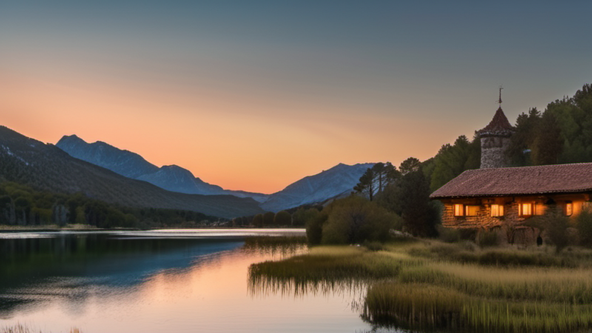
Aigüestortes i Estany de Sant Maurici National Park is in Lleida (province) of Catalonia. A wild mountain region in the Pyrenees, with peaks rising to 3017 m (Besiberri Sud) and with nearly 200 lakes, many of them of gla
Aigüestortes i Estany de Sant Maurici National Park is in Lleida (province) of Catalonia. A wild mountain region in the Pyrenees, with peaks rising to 3017 m (Besiberri Sud) and with nearly 200 lakes, many of them of glacial origin, the park comprises a core area of 141 km2 and a buffer zone of 267 km2 surrounding the park. It had over 580,000 visitors in 2024.
The national park comprises 40,852 hectares (100,950 acres), divided into two different levels of protection: the core area and the buffer zone surrounding the park. This buffer zone creates a gradation from the inner side, more strictly protected than the external parts of the park.
The core area is located in the comarques of Pallars Sobirà and Alta Ribagorça, and includes the main entrances of the park:
On the west side, from the village of Boí, is the Aigüestortes plain. Aigüestortes means "winding waters" and is largely flat which allows the river to meander and flow slowly. This area indicates the existence of an old lake, today covered by sediment.
To the east, near the village of Espot, is Sant Maurici lake, one of the most famous of the region, from where one can see the spectacular twin peaks of the Encantats.
To the south, Estany Gento, and a cable railway runs in the higher valley of Torre de Cabdella.
This area also includes part of the municipalities of Vielha e Mijaran and Naut Aran in the Val d'Aran; Vilaller and Vall de Boí in the Alta Ribagorça; La Torre de Cabdella in the Pallars Jussà; and Espot, Alt Àneu, Esterri d'Àneu, La Guingueta d'Àneu and Sort in the Pallars Sobirà.
The buffer zone also contains the forest of la Mata de Valencia, Gerber and Cabanes valleys, Colomers and Saboredo valleys, the Besiberri valley, the lakes of Cabdella and Montardo peak.

The park’s altitudinal spread creates a calendar of contrasting experiences. Late spring brings a burst of alpine wildflowers in the subalpine zone, while higher passes still wear snow—a reminder that the high paths demand crampons or sturdy boots until early July. Summer is the narrow window when the network of stone‑built refuges opens fully, allowing multi‑day treks without carrying a tent. Autumn, though quieter, offers crisp air and the chance to photograph lakes turning turquoise to amber under low‑sunlight, plus fewer crowds on the classic Carriera de les Barres. Winter transforms the landscape into a ski‑tourist’s playground, but only experienced alpinists should attempt the higher glacier routes, as avalanche risk spikes after fresh snowfall.
While the park is a sanctuary of wilderness, the surrounding Vall de Boí villages preserve a distinct Catalan mountain culture. Taste the rustic fare of escudella, a hearty stew simmered with local beans and cured pork, best enjoyed in a modest farmhouse restaurant where the cook still kneads the paella pan by hand. Artisan workshops in Boí produce woolen blankets using centuries‑old looms; a quick stop lets you feel the texture of a product made from sheep that graze the same high pastures you’ll cross later. The area’s Romanesque churches, some UNESCO‑listed, host modest organ recitals on summer evenings—an unexpected sonic complement to the rustle of pine needles.
1 Park Information Center, Carrer Graieres 2, Boí, ☏ +34 973 69 61 89, pnaiguestortes@gencat.cat. 09:30-14:00 15:30-17:45. (updated Feb 2024)
2 Centre d'informació d'Estany Gento, Estació superior del telefèric, 25515 Torre de Cabdella, ☏ +34 973696189, info.aiguestortes@oapn.mma.es. Jul to Sep 09:30-14:00 15:30-17:45. (updated Feb 2024)
3 Casa del Parc Espot, CR Sant Maurici 5, 25597 Espot, ☏ +34 973624036. 09:30-14:00 15:30-17:45. (updated Feb 2024)
4 Centre d’informació de Llessui (Ecomuseu dels Pastors de la Vall d’Àssua), Antigues escoles, s/n · 25567 Llessui, ☏ +34 973 62 17 98. 09:30-14:00 15:30-17:45. (updated Feb 2024)
5 Banhs de Tredòs tourist office. (updated Feb 2024)
Human settlement of the Pyrenees dates back at least to the period of glacial melting. Inside the borders of the national park, there is no record of stable human habitation during this time, but recent archeological studies have found evidence of temporary settlements from 8,500 years ago in the Neolithic Age.
During the 19th century, the high Pyrenees became more populated, fueled by strong demand for natural resources with intense forestry, farming, and fishing. At the beginning of the 20th century, hydroelectric electrical power plants were built, resulting in a great transformation of the landscape.
On 21 October 1955 the national park was created, becoming the fifth Spanish national park. On 30 March 1988, the Catalan government took ownership of the park, together with an additional buffer zone, according to the Catalan laws. From that date, management of the wild protected areas has been managed by the autonomous government, which has introduced increases to the budget and staffing, along with stricter rules.
Since then, forestry exploitation, fishing, camping and any exploitation of natural resources has been forbidden. However, an allowance is made for cattle breeding and the operative hydroelectric generation. Traditional uses of natural resources which are compatible with the protection of the wilderness are only allowed in the buffer zone.
In 1996 the national park was enlarged, to a total area of 14,119 hectares.
Aigüestortes National Park is an important item in the Pyrenean geology. The predominant rocks are granite and slate, both very old Paleozoic rocks. These emerged from the sea in the Paleogene, during the Alpine orogeny, giving rise to the Pyrenees.
Successive quaternary glaciations covered these mountains with huge glaciers. The lakes, the waterfalls, the sharpened peaks, the vertiginous ridges and the U-shaped valleys are the footprints of the erosive action of those ancient glaciers. Today, they have virtually disappeared, except for small glaciers in the central Pyrenees.
Today, lakes are the most important contribution of these glaciers, which are fed by rivers and waterfalls.
The Park exhibits a rich alpine vegetation tapestry across varying altitudes. In lower valleys at 1500m, European deciduous forests thrive, hosting oak, ash, beech, and hazel. Human-exploited meadows transition to grasslands, shrubs, and secondary forests dominated by common box and Scots pine. Beyond 1500m, mountain pine forests dominate up to 2000m, adapting to the High Pyrenees' harsh winters. Alpine meadows above 2300m showcase diverse flora, including alpenrose and blueberry. A significant portion aligns with the Eurosiberian group, representing central European flora.
The park shelters a discreet yet diverse array of wildlife, particularly with approximately 200 species, dominated by two-thirds being birds. Notable avian residents include the capercaillie, rock ptarmigan, golden eagle, griffon vulture, and bearded vulture. Other sightings may include the black woodpecker, red-billed chough, wallcreeper, white-throated dipper, and citril finch. Mammalian representatives encompass the Pyrenean chamois, brown bear, stoat, alpine marmot, fallow deer, and roe deer, introduced in the latter half of the 20th century. Amphibians feature the elusive Pyrenean brook salamander and the common frog. Caution is advised for the venomous vipera aspis, while lakes and rivers host the local brown trout alongside introduced species.
The climate in the park is predominantly cold. The mean temperature is around 0 to 5 °C. In the upper parts, temperatures hardly reach above 0 °C during winter. Mean annual precipitation ranges from 900 to 1300 mm – Mostly as snow in the mountains.
The park is far from airports, being the closer ones Barcelona El Prat Airport BCN IATA in Spain 300 km (190 mi) and Toulouse–Blagnac Airport TLS IATA in France 220 km (140 mi)
Alsa bus lines, ☏ 902 42 22 42 (domestic)Country code missing. The company has several lines that link main cities around the park with Barcelona, Lleida and Puigcerdà (updated Jan 2026)
N-230 runs along the west side of the park from El Pont de Suert coming from Lleida until Vielha. Then it continues until the French border
L-500 starts in N-230 north of El Pont de Suert and runs the Boi Valley (Vall de Boí)
N-260 runs along the South of the park from El Pont de Suert to C-13
L-503 enter south of the park to Vall Fosca valley.
C-13 runs along the East side of the Park passing Sort and Esterri d'Aneu
C-28 runs Val d'Aran along the north side from Esterri d'Aneu until Vielha.
It is free to enter; however, the 4x4 taxis approaching you to the park entrances from parking areas are not free.
The circulation of vehicles and bicycles inside the park is restricted. Access to the interior is only permitted on foot, by bicycle (up to the information points in Sant Maurici and Aigüestortes) or with duly authorised public transport vehicles from the area of influence of the national park.
No hunting, fishing or trapping of any animals is allowed. Do not damage the natural elements. Stones and trees, flowers, fruits, mushrooms and all kinds of animals are part of nature. Respect them and enjoy their observation.
Don't let anyone know you've been to the park. Don't litter the mountain with your rubbish. Take it out of the national park and deposit it in the appropriate containers for this purpose.
It is forbidden to light a fire. If necessary, packaged gas can be used.
Free and uncontrolled camping favours the proliferation of waste and the degradation of natural ecosystems. That is why it is prohibited within the scope of the national park. There are mountain shelters with guards and hospitality and camping services in the villages of the area of influence.
Do not leave the marked paths. They are a guarantee for your safety, while you will collaborate in the preservation of this natural space.
Do not disturb the tranquility of the place. It is not allowed to use machines or instruments that produce strange noises in nature or perform actions that disturb or frighten animals.
Try not to bring pets inside the park. If necessary, they must be held by the person carrying them.
Respect rivers, ravines and ponds. Bathing, water activities or any other activity that could represent an alteration or pollution of the waters are not allowed.
Cars are restricted in the national park. They must be left in one of the car parks near the entrances to the Park and visitors must then proceed on foot.
If you would like to start your walk from higher up, you can take a 4x4 taxi.
In Boí and Espot, the 4x4 taxis run a shuttle service all year round up to Aiguestortes and Lake Sant Maurici.Taxis vall de boi Taxis espot
Once up there, you can hike further up if you want, check the times of return journeys. Espot taxis also take you along tracks in the eastern sector of the Park (see taxi website: for more information).
In the Val d'Aran, in the summer, a discretional transport service in Ribera d’Aiguamòg and Ribera de Valarties makes it easier to walk to the shelters at Colomèrs and Era Restanca, respectively.
In the Fosca Valley, a cable car operates from July to September from the Sallente reservoir to Lake Gento, the starting point for a number of interesting hikes. Vallfosca Cablecar
The Park Bus (Bus line around the park) offers seasonal public transport from June through September, linking the National Park's primary access points twice daily: Boí (Alta Ribagorça) and Espot (Pallars Sobirà), via Val d'Aran. It serves surrounding villages in the park's influence zone, ideal for hikers tackling long routes before returning to their start, or reaching trailheads without a car. Schedules align with taxis, park maps, and refuge availability for planning multi-day treks.Fares vary by boarding and alighting points, with discounts for return journeys. Bicycles and pets prohibited. Groups should pre-contact the operator.
Bus around the park (Circumval·lacio del parc nacional), ☏ 902 42 22 42 (domestic)Country code missing. Bus that goes around Aigüestortes i Estany de Sant Maurici National Park (updated Mar 2025)
Taxis de la Vall de Boí, Plaça del treio, s/n,Boí, ☏ +34 629 205 489, info@taxisvalldeboi.com. The Vall de Boí taxi service, managed by an association made up of 18 vehicles, provides regular service to the Aigüestortes and Estany de Sant Maurici National Park. The vehicles are 4x4 and have a capacity of 9 seats. In the event that there are not enough passengers to fill the vehicle, there may be a maximum wait of one hour. from €5.75 per adult. (updated Mar 2026)
In many of the car parks located at the entrances to the Park, visitors will find an information panel where, at the very least, they can consult a map of the Park with the possible itineraries and the protection regulations: Specifically, the car parks that have this type signs are located in the towns and valleys:
1 Son, C/Sant Pere s/n, Son. Itineraries (updated Feb 2024)
2 Parking Refugi pla de la Font. Access through an unpaved road. (updated Feb 2024)
3 Parking in Jou, Carretera de Jou a Son. (updated Feb 2024)
4 Parking el Callau (Vall de Cabanes), road C-142z. (updated Feb 2024)
5 Prat de Pierró, Carretera d'Espot a Sant Maurici. Main access to Sant Maurici lake. (updated Feb 2024)
6 Espot parking. access to 4x4 taxis to Sant Maurici lake (updated Feb 2024)
7 Peülla parking. Ski resort parking, Gerber valley access (updated Feb 2024)
8 Mare de Déu de les Ares Parking, Carretera del Port de la Bonaigua. Gerber valley access (updated Feb 2024)
9 Banhs de Tredos. hotel, restaurant, 4x4 taxis, itineraries, snow activities (updated Feb 2024)
10 Valarties. 4x4 taxis to pontet de rius (updated Feb 2024)
11 Locampo-Saboredo (Val de Ruda). (updated Feb 2024)
12 Boca Sud del tunnel de Vielha (Espitau de Vielha). (updated Feb 2024)
13 Conangles (La vall de Barravés), N230 (1km before Vielha Tunnel). (updated Feb 2024)
14 La Farga, L-500 road. Main access to Aigüestortes area. in L-500 road (updated Feb 2024)
15 Cavallers part baixa, Carretera de Caldes al Pantà de Cavallers. access Cavallers Dam & itineraries (updated Feb 2024)
16 Llubriqueto (Just after Caldes de Boí going north). access to Caldes de Boí, itineraries (updated Feb 2024)
17 la ribera de Sant Martí, Cami de les pistes (Past pla de l'ermita). (updated Feb 2024)
18 the Sallente reservoir. restaurant, itineraries, Cable car (updated Feb 2024)
19 Capdella. viewpoint, picnic area , itineraries, WC. (updated Feb 2024)
20 Parking Bordes de Llessuí. See picnic areas (updated Feb 2024)
21 pas de la Mainera. (updated Feb 2024)
It should be borne in mind that in winter (but also in late autumn and all spring), access to these points can be tricky because of snow and ice. Ask for information in advance at the Park Houses.
In the parc the main visits are sightseeing places and itineraries.
Visit AIgüestortes plain. Go to parking La farga. see #Vall de Boí zone (W of Park)
Visit Sant Maurici Lake. Go to parkin Prat de Pierró. See parking #Esterri zone
Visit the Villages in Vall de Boí
Visit the Vall Fosca and Estany Gento. Go to parkings in #Vall fosca zone (S of park)
6 Mirador de la Cascada de Gerber.
7 Mirador Colomers.
8 Guardar dera Val de Ruda.
9 Mirador del Portarró.
10 Mirador de l'Estany.
11 Mirador de Fogueruix.
12 Mirador de la Vinyeta.
13 Mirador de Sant Jaume.
14 Mirador de Canasso.
15 Mirador de Sant Vicenç.
16 Mirador de Capdella.
17 Mirador Refugi de Colomina.
18 Mirador de la Vall Fosca.
19 Mirador de l'Escaleta.
20 Mirador de la Santeta.
21 Mirador de les Cuirilles.
22 Mirador del Ventosa i Calvell.
23 Mirador de Sant Esperit.
24 Saut de Molières.
1 Castell de Llort. It is believed that the castle of Llort is already mentioned in the 10th century. Its remains, few but visible, are on a rocky hill surrounded by forest. It was a large castle, occupying a space of more than 2,500 m². It was surrounded by a wall, which in some sections took advantage of the natural rock, and was reinforced with towers, of which an entire force is preserved. At the southern end there are remains of a building that could correspond to the main dwelling of the castle. Everything makes you think of a feudal castle, with all the elements found in these castles that were also the residence of their lords. (updated Feb 2024)
2 Castell de Berrós. To reach the site, take the path that crosses the Costalada or Berrós stream from the town of Berrós Jussà, then continue west until you reach the foot of a group of hills where you can see the castle. The remains make up a fortified complex sitting on two hills. In the first of them, more to the east of the town, you can see the remains of a square tower, defended to the east by a moat with a face of well-cut and small limestone. On the same hill you can also see several sections of a walled enclosure that descends in a westerly direction towards the second enclosure. On the second hill, which is much more fortified than the first, a perimeter wall from which several bastions protrude, as well as a large inner courtyard, is documented. In the highest part there is a square tower with the same invoice as the one previously described. Around it you can see a series of cuts in the rock that indicate the existence of a complex of buildings related to the activity of the castle, but of which it is not possible to establish its layout or its functionality.This castle is located on the strait called la Torrassa, and together with the castle of LLort (Espot) defended the entrance to the Àneu valleys. (updated Feb 2024)
3 Torre dels Moros. It is above the town of Espot, to its southwest, on the obac side of the Pui de Linya, below and to the east of the Bosc de la Torre. Despite the fact that the domain of the Espot valley is widely documented since 1066, the tower it is not mentioned in any document, possibly because it was a watchtower depending on a castle, possibly that of Llort. (updated Feb 2024)
4 Sant Jaume de Jou church. It is an old Romanesque chapel in the old town of Bogarri, now gone, in the municipality of Guingueta d'Àneu, in the region of Pallars Sobirà. It belongs to the territory of the old district of Jou. It is located to the east of the town of Jou, at a distance of about 550 meters. Its scanty remains remain to the north of the road. (updated Feb 2024)
5 Ecomuseu de les Valls d'Àneu, Carrer del Camp 22-24, Esterri d'Aneu. The Ecomuseum of the Àneu Valleys is a museum dedicated to the ethnography of the Àneu Valleys and the rest of Pallars County (updated Feb 2024)
6 Castell de València d'Àneu. The Castle of Valencia d'Àneu, or Castle of Pallars, is a medieval castle in the old district of Valencia d'Àneu, in the current municipal district of Alt Àneu, in the region of Pallars Sobirà. It is located between the courses of the Noguera Pallaresa and Riu de la Bonaigua rivers, at 1,085 meters above sea level, on a hill that dominates the entire Esterri d'Àneu valley. It is, and was, a strategic place of which today only the ruins as witnesses of the greatness of the County of Pallars. It was the last fortress where the flag of Pallares flew as an independent country. (updated Feb 2024)
7 Sant Joan Baptista de Guiró church. Sant Joan Baptista de Guiró is in the municipality of Torre de Cabdella. It is apparently documented since 986. The current church, which presents transformations with respect to the original, Romanesque, is a nave with a small square bell tower in the north-eastern corner. The current temple appears upside down: the entrance is to the east, where the apse should have been, and the altar, to the west, where the feet of the nave should have been (updated Feb 2024)
8 Vall de Boí Romanic museum (Centre del Romànic de la Vall de Boí), Camí del Batalló 5,Erill la Vall. (updated Feb 2024)
9 Santa Eulàlia d'Erill la Vall church. Like the rest of the church in Vall de Boí, that of Santa Eulàlia d'Erill la Vall was sold and exchanged in 1064 by the counts of Pallars Sobirà, Artau I and his wife Llúcia de la Marca, to the counts of Pallars Jussà, Ramon V and his wife Valença de Tost, together with the castle of Erill and other possessions. In 1266 Santa Eulàlia d'Erill la Vall was given to the monastery of Santa Maria de Lavaix, and it became a monastic parish, a characteristic that it retained until the extinction of the monastery of Lavaix, in the middle of the 19th century. However, he did not lose the special regime that the churches of the Vall de Boí had within the bishopric of Urgell. (updated Feb 2024)
10 Sant Joan de Boí church. The town of Boí was a small walled town that had grown up next to what was the most important castle in the valley, although only a few vestiges remain today. Boí Castle gave its name to the town and the entire valley. The town belonged to the jurisdiction of Mr. d'Erill, who distinguished himself in various feats of arms in the service of the counts of Pallars. This created favourable conditions to start the renovation and construction of many churches in its territory. The construction and interior paintings date from the 11th century. With the form ipsa illa de Bogin, the town of Boí is already mentioned in 1064, when, together with the rest of the churches and places in the valley, it was the subject of sale and exchange (updated Feb 2024)
11 Santa Maria de Taüll. Santa Maria de Taüll is a Romanesque church in the town of Taüll in the municipality of Vall de Boí. It is located in the village square of Taüll, and a few meters to the south-west (right at the entrance to the village) there is the church of Sant Climent which belongs to the same period. Both were erected and consecrated at the same time: that of Santa Maria was consecrated a day later than that of Sant Climent, in 1123. From the 18th century it was the only parish in the municipality of Taüll, while that of Sant Climent served as the chapel of the modern cemetery of Taüll, but in previous centuries, the two churches had shared a parish. (updated Feb 2024)
12 Sant Climent de Taüll. Sant Climent de Taüll is a Romanesque-style church greatly influenced by the Lombard style, which can be seen through its exterior decoration. The bell tower is an example of Byzantine influence, because it stands out for its verticality. The church was intended as a place for Christian worship, unlike other churches of the time, which were intended as a pilgrimage. The artwork in Sant Climent de Taüll was important in bringing the art into the public atmosphere. The main work of art is the mural painting, located on the central apse of the church. The identity of the painter is unknown, but is referred to as Master Taüll. The altar-frontal was created by a native Catalan artist, possibly in a workshop in La Seo de Urgel (updated Feb 2024)
Summertime is a good time for trekking. There are a lot of possibilities, but it's necessary to be aware of the difficulty of some of the paths and be in good physical condition.
The transpyrenean path, GR-11 marked with red and white lines, crosses the park from one side to other.
At the information points, hiking brochures available (also in English) which are recommended and shows many of the easy paths with descriptions. See #Parking for starting points of routes. Some of them are:
At Boí valley, from Llebreta Lake to Llong Lake, following Sant Nicolau River. Along this path, a footbridge allows the handicapped people with wheelchairs to visit the Aigüestortes plain.
From Espot and the Sant Maurici Lake, an interesting path goes up to the waterfall and Ratera Lake. From this lake, after 15 minutes additional walking, it is possible to arrive at a viewpoint looking over the Sant Maurici Lake. A second option is to walk up to Amitges shelter which provides walkers with experience of the high mountains.
From the parking area of Clot Gran, near the Port de la Bonaigua, to Gerber valley and lakes.
From Banhs de Tredòs, at the Val d'Aran, walk to Colomers shelter – this provides a very spectacular walk with a number of lakes.
From Estany Gento, walk to Tort Lake and arrive to the Colomina shelter or Saburó Lake.
Ruta de la Llúdriga: cap a Llebreta i Aigüestortes,2h, 430m, starts in parking La Farga
El planell d'Aigüestortes, 1h, flat, starts at end of Ruta de la Lludriga. You can also take a 4x4 taxi
Camí del Llong, Redó i Portarró, 3h, 600m, starts at end of Ruta de la Lludriga. You can also take a 4x4 taxi
Ruta de la Marmota: cap a l'estany Negre, 2h15,350m, starts in Cavallers part baixa Parking
La vall de Besiberri, 500m, 2h
Ruta de l'Isard: cap a l’estany de Sant Maurici, 260m, 1h15, Starts in Prat de Pierró Parking
Cap a les Agulles d'Amitges, 480m 1h45, starts at end of Ruta de l'Isard in Sant Maurici lake. You can also take a 4x4 taxi
El mirador de l'estany de Sant Maurici, 300m, 2h30, starts at end of Ruta de l'Isard in Sant Maurici lake. You can also take a 4x4 taxi
El gran circ de Colomèrs, 500m 6h30, Starts in Parking Banhs de Tredos
Els estanys de la Mainera, 300m, 1h30, Starts in Pas de la Mainera Parking
La vall de Gerber, 230m, 1h30, Starts in Peülla parking
La vall de l'estany Tort, 220m, 2h15, Starts in Estany Gento, end of Vall fosca cable car. You can take de cable car at the Sallente reservoir Parking.
Camí del port de Rius, 810m, 2h30, Starts in Boca Sud del tunnel de Vielha (Espitau de Vielha) Parking
A very interesting tour for several days:
Camins vius (Living Paths). This route is a walk along the historic valley paths, most dating back to medieval times and some of more ancient origin, through villages surrounding the national park, passing through Alta Ribagorça, Val d'Aran, and Pallars Sobirà.
Carros de foc (Chariots of Fire). This route completes a circular tour around some of the shelters that exist in this area. The competitive option (Sky runner) must be completed in less than 24 hours but it's better to have at least four or five days in order to appreciate the experience that this route provides.
Other mountain activities as rock climbing, alpinism, snowshoeing or backcountry skiing are also allowed (with some regulations) in the national park. The mountain shelters, the only places where visitors are permitted spend a night into the park, are available to stay for allow traversing the higher peaks in the park.
Cycling is only allowed on paved routes inside the park (just to Sant Maurici Lake or Aigüestortes plain) and is strictly regulated. Some routes are available in the peripheral area, most of them with medium or hard level.
Pedals de Foc: is an organised route for riding around the park (not inside) for several days and possibility of backpacking transfer.
There are several ski resorts around the Park
Baqueira Beret
Espot
Llesui
Boi-Taüll
There are many Bar - Restaurants in the villages around the park.
1 Bar Restaurant Sallente, Carretera de Cabdella s/n. (updated Feb 2024)
2 Les Ares, Carretera Port de la Bonaigua, s/n, 25587, Lleida, ☏ +34 973 298 309. (updated Feb 2024)
3 Bordes de Llessuí picnic area. (updated Feb 2024)
4 Capdella picnic area. parking, WC, viewpoint (updated Feb 2024)
5 Planell de Remordí picnic area. it has a small parking area (updated Feb 2024)
6 Conangles. near vielha tunnel south , grill, itineraries, refuge, parking (updated Feb 2024)
The eassiest lodging is in the villages around the park. There are some options in the buffer zone, and a lot of mountain refuges for long trekking routes.
LLavorsi zone (E of park)
Llavorsí
Val d'Aran zone(N and NW of park)
Vielha
Baqueira-Beret
Vall de Boí zone (W of Park)
Vall de Boí
El Pont de Suert
Sort area (SE of park)
Sort
1 MónNatura Pirineus., Son, 25589, ☏ +34 973 626 722, info@monnaturapirineus.com. hotel, restaurant and activities (updated Feb 2024)
2 Banhs de Tredòs, Carretera Aiguamòg s/n, Salardù, ☏ +34 973 253 003, banhsdetredos@banhsdetredos.com. Hotel with hot spring and Spa, Restaurant, activities (updated Feb 2024)
Trekkers can find several refuges in the park and its periphery. These refuges are open during the four warmest months of the year. In the winter, every refuge has its own opening schedule (usually around Christmas and Easter) and must be booked in advance. The refuges are as follows:
3 Refugi del Pla de la Font, ☏ +34 619930771. (updated Feb 2024)
4 Refugi de la Restanca, ☏ +34 608 036 559. (updated Feb 2024)
5 Refugi de Colomers, ☏ +34 973253008. (updated Feb 2024)
6 Refugi de Saboredo, ☏ +34 661357716. (updated Feb 2024)
7 Refugi d'Amitges, ☏ +34 973 250 109. (updated Feb 2024)
8 Refugi Ernest Mallafré (Sant Maurici), ☏ +34 973250118. (updated Feb 2024)
9 Refugi Josep Maria Blanc, ☏ +34 973 250 108. (updated Feb 2024)
10 Refugi Joan Ventosa i Calvell. (updated Feb 2024)
11 Refugi d'Estany Llong, ☏ +34 973299545. (updated Feb 2024)
12 Refugi de Colomina, ☏ +34 973252000. (updated Feb 2024)
13 Refugi bivac de Besiberri, ☏ +34 93 412 07 77. (updated Feb 2024)
14 Refugi bivac Gerber "Mataró". (updated Feb 2024)
15 Refugi del Gerdar, ☏ +34 619044476, refugidelgerdar@gmail.com. (updated Feb 2024)
16 Refugi de la Pleta del Duc. During summer pastures, the refuge can be locked by the shepherd. Meet him. (updated Feb 2024)
17 Refugi de Conangles, +34 696 649 871. (updated Feb 2024)
18 Refugi bivac la Cabaneta. (updated Feb 2024)
19 Aigüestortes Càmping Resort, Carretera C-13 Km. 159, Esterri d'Àneu. (updated Feb 2024)
20 Càmping Nou Camping, Ctra. Valls d’Àneu, s/n, ☏ +34 973 62 62 61. (updated Feb 2024)
21 Camping Llavorsí, Cami de Riberies, nº1, 25595 Llavors, ☏ +34 609 924 927, info.campingllavorsi@gmail.com. (updated Feb 2024)
22 Rialp motorhome area (Àrea d'autocaravanes de Rialb), C-13, Rialp (Behind futbol ground). (updated Feb 2024)
Càmping Noguera Pallaresa, Carretera Sort – Rialp (KM 0,3), 25560 Sort, ☏ +34 973 620 820. (updated Feb 2024)
23 Camping Borda d'en Farreró, Ctra. N-260, Km.184, 25560 Sort, ☏ +34 973620250. (updated Feb 2024)
24 Càmping Senterada, Pista de Puigcerver, Senterada, ☏ +34 973 66 18 18. (updated Feb 2024)
25 Càmping Vall Fosca, Carretera Senterada – La Torre de Capdella, Km. 14, ☏ +34 973 66 30 80. (updated Feb 2024)
26 Càmping del Remei, Crta.Vall de Boi (L-500), km. 1’5, ☏ +34 676 45 84 12, campingdelremei@gmail.com. (updated Feb 2024)
27 Càmping Taüll, Carretera de Taüll, Km. 3, 25528 Taüll,, ☏ +34 973 69 61 74. (updated Feb 2024)
Free and uncontrolled camping favours the proliferation of waste and the degradation of natural ecosystems. That is why it is prohibited within the scope of the national park.
Be well informed before doing any tour or crossing
Wear appropriate gear (boots, warm clothes and clothes to protect yourself from the rain). In the high mountains, weather conditions can change abruptly.
Try to go out together. You will share experiences with others and you will not be alone in case of need.
Measure your strengths and those of your team. Think back.
The high mountain is not always accessible. Do not hesitate to postpone your excursion until the weather conditions are more favourable.
In winter, extreme precautions must be taken
Be especially aware of weather conditions and the risk of avalanches.
In the event of an emergency or accident, all mountain shelters have a radio set connected to the Fire Brigade of the Generalitat de Catalunya.
Vall de Boí on the west side of the park.It's famous for the Romanic art and the wilderness around the valley. In Vall de Boi you get breathtaking nature and also historic churches and traditions (the Fallas). Is the western entrance to the Park.
Val d'Aran This valley constitutes one of only two areas of Spain that are on the northern side of the Pyrenees. In 2024 UNESCO designated a Biosphere reserve in the valley. It's at the north of the park.
National parks in Spain list of 16 National parks in Spain
Nature parks in Catalonia list of 20 Nature parks in Catalonia.
Public transport to the park’s gate is limited, yet a well‑timed bus from Lleida to the town of Vielha can drop you at the trailhead of the popular Refugi de Colomina. From there, the mountain paths are clearly marked with white paint blazes, and the occasional red cairn signals a change in direction. For cyclists, the narrow, serpentine road through the Vall de Tena offers a low‑traffic descent into the park, though the gradient is steep and the weather can turn abruptly. Renting a bike with a low‑gear hub gear is advisable, and always carry a waterproof map; GPS signals are erratic once you leave the valley floor.
National park in Spain Parc Nacional d'Aigüestortes i Estany de Sant MauriciIUCN category II (national park)Lake Sant MauriciInteractive map of Parc Nacional d'Aigüestortes i Estany de Sant MauriciLocationProvince of Lleida, Catalonia, SpainNearest cityLleidaCoordinates42°35′13″N 0°58′28″E / 42.58694°N 0.97444°E / 42.58694; 0.97444Area141 km2 (54 sq mi)Established1955Governing bodySpanish Ministry of Environment. managed: Catalan Department of Agriculture, Livestock, Fisheries, Food, and the EnvironmentRamsar WetlandOfficial nameParque Nacional d'Aigüestortes i Estany de Sant MauriciDesignated19 February 2007Reference no.1678 Aigüestortes i Estany de Sant Maurici National Park (Catalan: Parc Nacional d'Aigüestortes i Estany de Sant Maurici, Spanish: Parque Nacional de Aiguas Tortas y Lago de San Mauricio), is one of the fifteen Spanish national parks, and the only one located in Catalonia. A wild mountain region in the Pyrenees, with peaks rising to 3017 m (Besiberri Sud) and with nearly 200 lakes, many of them of glacial origin, the park comprises a core area of 141 km2 and a buffer zone of 267 km2 surrounding the park. The park's name in Catalan is Aigüestortes i Estany de Sant Maurici, freely translated as "The winding streams and St. Maurice lake". The park has an elevation range of 1600 to 3000 metres and contains four major vegetation zones: lower montane, upper montane, subalpine and alpine. The fauna includes Pyrenean chamois, brown bear, marmot, ermine, roe deer, among other mammals and numerous birds (black woodpecker, common crossbill, lammergeier, golden eagle). The park was created in 1955 after Ordesa y Monte Perdido National Park, the first Spanish national park in the Pyrenees in 1918. Its administrative seats are in Espot and Boí. The park is mainly located in the comarques of Pallars Sobirà and Alta Ribagorça. Since 2007 it has been designated as a protected Ramsar site.
[edit] Boundaries of the park:-In red the core zone-In yellow the peripheral areas.-In black, boundaries of Lleida and Andorra. The national park comprises 40,852 hectares (100,950 acres), divided into two different levels of protection: the core area and the buffer zone surrounding the park. This buffer zone creates a gradation from the inner side, more strictly protected than the external parts of the park. The core area is located in the comarques of Pallars Sobirà and Alta Ribagorça, and includes the main entrances of the park: On the west side, from the village of Boí, is the Aigüestortes plain. Aigüestortes means "winding waters" and is largely flat which allows the river to meander and flow slowly. This area indicates the existence of an old lake, today covered by sediment. To the east, near the village of Espot, is Sant Maurici lake, one of the most famous of the region, from where one can see the spectacular twin peaks of the Encantats. This picture is one of the symbols of the park and is the logo of the park. This area also includes part of the municipalities of Vielha e Mijaran and Naut Aran in the Val d'Aran; Vilaller and Vall de Boí in the Alta Ribagorça; La Torre de Cabdella in the Pallars Jussà; and Espot, Alt Àneu, Esterri d'Àneu, La Guingueta d'Àneu and Sort in the Pallars Sobirà. The buffer zone also contains the forest of la Mata de Valencia, Gerber and Cabanes valleys, Colomers and Saboredo valleys, the Besiberri valley, the lakes of Cabdella and Montardo peak.
[edit] Aigüestortes National Park from Son Human settlement of the Pyrenees dates back at least to the period of glacial melting. Inside the borders of the national park, there is no record of stable human habitation during this time, but recent archeological studies have found evidence of temporary settlements from 8,500 years ago in the Neolithic Age. During the 19th century, the high Pyrenees became more populated, fueled by strong demand for natural resources with intense forestry, farming, and fishing. At the beginning of the 20th century, hydroelectric electrical power plants were built, resulting in a great transformation of the landscape. On 21 October 1955 the national park was created, becoming the fifth Spanish national park. On 30 March 1988, the Catalan government took ownership of the park, together with an additional buffer zone, according to the Catalan laws. From that date, management of the wild protected areas has been managed by the autonomous government, which has introduced increases to the budget and staffing, along with stricter rules. Since then, forestry exploitation, fishing, camping and any exploitation of natural resources has been forbidden. However, an allowance is made for cattle breeding and the operative hydroelectric generation. Traditional uses of natural resources which are compatible with the protection of the wilderness are only allowed in the buffer zone. In 1996 the national park was enlarged, to a total area of 14,119 hectares. In 1997, after litigation between Catalan and Spanish laws, it was agreed that autonomous regions can also take part in the management of the national parks.
[edit] The park has an elevation range from 1600 to 3000 metres and different orientation of the valleys. For that reason very different ecosystems can be found inside the park. Vegetation[edit] Aigüestortes vegetation The park has a great variety of alpine vegetation owing to the large range of altitudes. In the lower parts of the valleys, around 1500 m high, typical European deciduous forests with pubescens oak Quercus humilis, European ash Fraxinus excelsior, beech Fagus sylvatica or common hazel Corylus avellana can be found. However, former meadow and pastureland which have been historically exploited by humans are now typically occupied with grasslands and shrubs, dominated by common box Buxus sempervirens or secondary forests with Scots pine Pinus sylvestris. From 1500 m to beyond 2000 m, the dominant vegetation is mountain pine Pinus uncinata forest. Growing at altitudes up to 2400 m, it is the tree best adapted to survive the long, hard winters of the High Pyrenees. At this altitude, alpenrose Rhododendron ferrugineum, and blueberry Vaccinium myrtillus which prefers cooler locations, can be found. Heather Calluna vulgaris" or common juniper Juniperus communis prefers more sunny and dry areas. In the north faces at less than 2000 m, there are important silver fir Abies alba forests. La Mata de Valencia is the largest Pyrenean fir tree forest. In the alpine meadows, above 2300 m where trees cannot survive, it is possible to find various other alpine flora species, such as Gentiana alpina. Approximately 8% of the species of the park are endemic to the Pyrenees. Around 7% they are plants with boreo-alpine or artico-alpine distribution, with most of them having arrived in the Pyrenees during the last Ice Age. The most important group of the national park flora belongs to the Eurosiberian group, the typical species from central Europe. Animals[edit] Animals are not easily spotted in the national park. However, there are about 200 species from the phylum Chordata present, of which two-thirds are birds. Some of the most important ones are capercaillie (Tetrao urogallus), rock ptarmigan (Lagopus muta), golden eagle (Aquila chrysaetos), griffon vulture (Gyps fulvus) and bearded vulture (Gypaetus barbatus). Also possible to see are black woodpecker (Dryocopus martius), red-billed chough (Pyrrhocorax pyrrhocorax), wallcreeper (Tichodroma muraria), white-throated dipper (Cinclus cinclus), citril finch (Serinus citrinella) among others. Most representative mammal species are Pyrenean chamois (Rupicapra pyrenaica), brown bear (Ursus arctos), stoat (Mustela erminea), alpine marmot (Marmota marmota) (which is not native), fallow deer (Dama dama) and roe deer (Capreolus capreolus) which were also introduced in the national park during the second half of the 20th century. Among the amphibians, the Pyrenean brook salamander (Euproctus asper) is significant but not easy to spot. The common frog (Rana temporaria) is more or less common. It's necessary to be aware of vipera aspis (Vipera aspis), a viper species with a venomous bite, but they will not usually attack without provocation. In the lakes and rivers, brown trout (Salmo trutta fario), the local trout, shares the region with other introduced species.
[edit] Aigüestortes National Park is an important item in the Pyrenean geology. The predominant rocks are granite and slate, both very old Paleozoic rocks. These emerged from the sea in the Paleogene, during the Alpine orogeny, giving rise to the Pyrenees. Successive quaternary glaciations covered these mountains with huge glaciers. The lakes, the waterfalls, the sharpened peaks, the vertiginous ridges and the U-shaped valleys are the footprints of the erosive action of those ancient glaciers. Today, they have virtually disappeared, except for small glaciers in the central Pyrenees. Today, lakes are the most important contribution of these glaciers, which are fed by rivers and waterfalls. The climate in the park is predominantly cold. The mean temperature is around 0 to 5 °C. In the upper parts, temperatures hardly reach above 0 °C during winter. Mean annual precipitation ranges from 900 to 1300 mm – Mostly as snow in the mountains.
[edit] 44% of the territory is government owned. Only 6% of the land has private owners, with the village of Espot extending into the eastern part of the park. Even so, exploitation of natural resources is forbidden in the strictly national park. Public use is one of the most important objectives for national parks and people have the right to visit and walk within it. Information centres[edit] The park has information centres widely distributed in the area. Boí is one of the main centres of the park. It has also a public library and an exhibition about the settlement of the Pyrenees and the adaptations to live in the mountains. The Park Information Center at Espot also provides an exhibition about the three leading things of the park: rock, water and life. The Museum of the Shepherds is in Llessui, where the exhibition shows the traditional life and work of the shepherds from this valley. Senet has an information center explaining the evolution of the park in the relation between humans and animals: a history about competition, exploitation and good fellowship. During summer months a little information centre is open in Estany Gento, and a cable railway runs in the higher valley of Torre de Cabdella. There are some explanations about the water and the national park. From all of these centres, it is possible to participate in different organised activities. Tourism[edit] Tourist activities are regulated. Walking access is free, but it is forbidden to collect any rocks, plants, flowers or mushrooms, and hunting and fishing is prohibited. Camping is also prohibited. It is not possible to enter the park by private car. In Espot or Boí, walkers can hire 4x4 taxis which can transport them to a number of popular locations within the park, such as the Aigüestortes plain or Sant Maurici lake. At the Val d'Aran entrances during the summertime, there is also a taxi service that provides easier access to the Colomers or Restanca shelters. At the Vall Fosca, the southern entrance of the park, a cableway connects Sallente with estany Gento, where some nice day walks begin. Trekking[edit] Summertime is a good time for trekking. There are a lot of possibilities, but it's necessary to be aware of the difficulty of some of the paths and be in good physical condition. The transpyrenean path, GR-11 marked with red and white lines, crosses the park from one side to other. At the information points, hiking brochures available (also in English) which are recommended and shows many of the easy paths with descriptions. Some of them are: At Boí valley, from Llebreta Lake to Llong Lake, following Sant Nicolau River. Along this path, a footbridge allows the handicapped people with wheelchairs to visit the Aigüestortes plain. From Espot and the Sant Maurici Lake, an interesting path goes up to the waterfall and Ratera Lake. From this lake, after 15 minutes additional walking, it is possible to arrive at a viewpoint looking over the Sant Maurici Lake. A second option is to walk up to Amitges shelter which provides walkers with experience of the high mountains. From the parking area of Clot Gran, near the Port de la Bonaigua, to Gerber valley and lakes. From Banhs de Tredòs, at the Val d'Aran, walk to Colomers shelter – this provides a very spectacular walk with a number of lakes. From Estany Gento, walk to Tort Lake and arrive to the Colomina shelter or Saburó Lake. A very interesting tour for several days: Camins vius (Living Paths). This route is a walk along the historic valley paths, most dating back to medieval times and some of more ancient origin, through villages surrounding the national park, passing through Alta Ribagorça, Val d'Aran, and Pallars Sobirà. Carros de foc (Chariots of Fire). This route completes a circular tour around some of the shelters that exist in this area. The competitive option (Sky runner) must be completed in less than 24 hours but it's better to have at least four or five days in order to appreciate the experience that this route provides. Other mountain activities as rock climbing, alpinism, snowshoeing or backcountry skiing are also allowed (with some regulations) in the national park. The mountain shelters, the only places where visitors are permitted spend a night into the park, are available to stay for allow traversing the higher peaks in the park. Mountain biking[edit] Cycling is only allowed on paved routes inside the park (just to Sant Maurici Lake or Aigüestortes plain) and is strictly regulated. Some routes are available in the peripheral area, most of them with medium or hard level. Pedals de Foc: is an organized route for riding around the park (not inside) for several days and possibility of backpacking transfer.
[edit] Estany Llong refuge, at the Aigüestortes i Estany de Sant Maurici National Park Trekkers can find up to ten guarded refuges in the park and its periphery. These refuges are open during the four warmest months of the year. In the winter, every refuge has its own opening schedule (usually around Christmas and Easter) and must be booked in advance. The refuges are as follows: Amitges Colomers Colomina Ernest Mallafré Estany Llong Josep Mª Blanc Pla de la Font Restanca Saboredo Ventosa i Calvell Additionally, there are two unguarded but well-equipped refuges (Mataró and Besiberri).
[edit] There is a rich architectural heritage in the region, including the Catalan Romanesque churches of the Vall de Boí. UNESCO declared it a World Heritage Site in November 2000. A good example is the Sant Climent de Taüll church.
[edit] Refugi Colomina Sant Maurici lake Pond de Ratera